
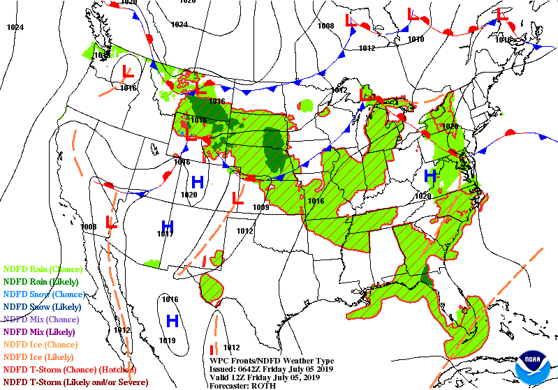
Showers and thunderstorms Northern Plains....Great Lakes...Southeast. Storms in Plains head east to affect Northeast and Mid Atlantic Saturday and then the SOutheast next week. Below - today's threat of severe weather in dark green and yellow.

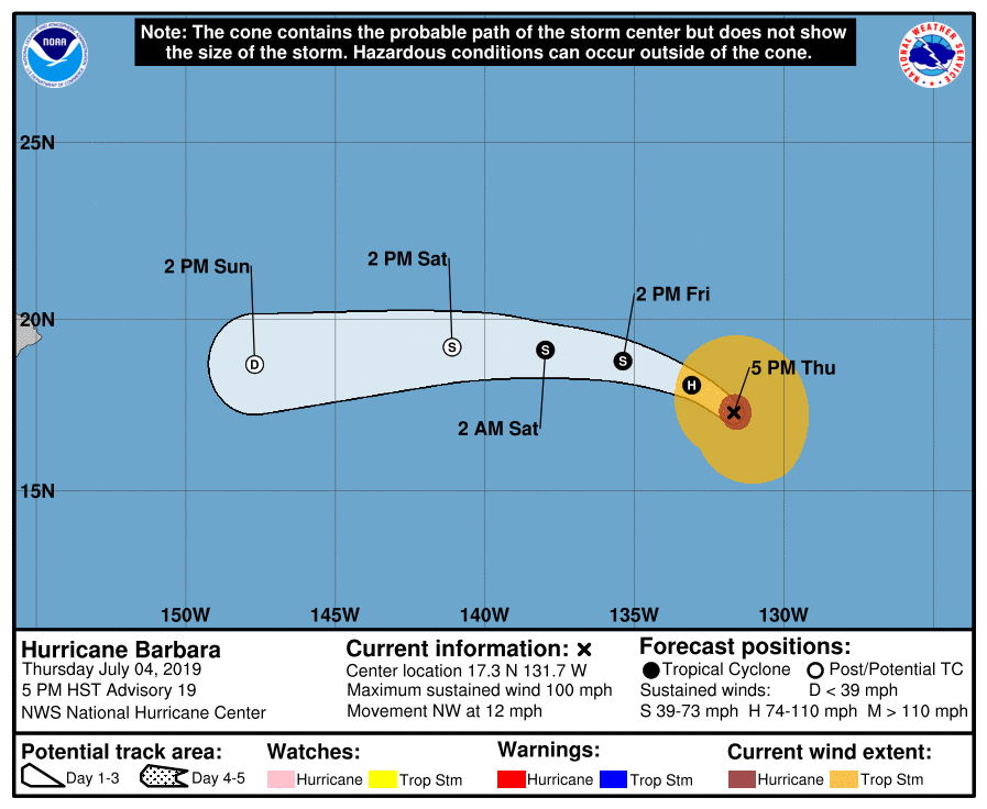
Below - track of Hurricane Barbara. She has 100 mph winds but is likely to weaken before approaching Hawaii early next week. Following that...animated maps for the next 2 days.
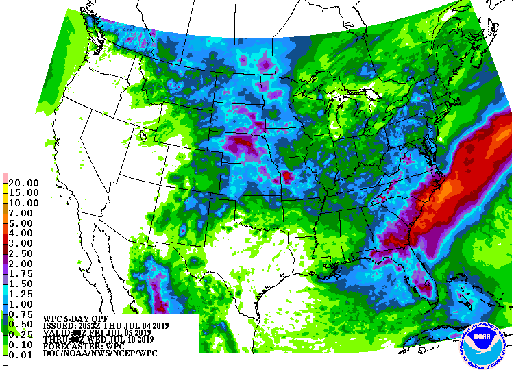
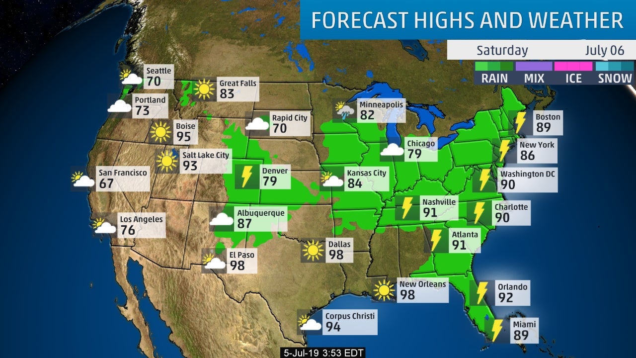
Following...rain predictions into mid next week. Heaviest expected over the southeast with a stalled front which could mean trouble down the road. After that...a snapshot of weather for your Saturday. Have a nice weekend and be safe.

 RSS Feed
