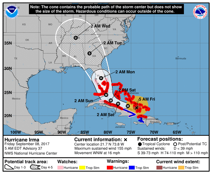
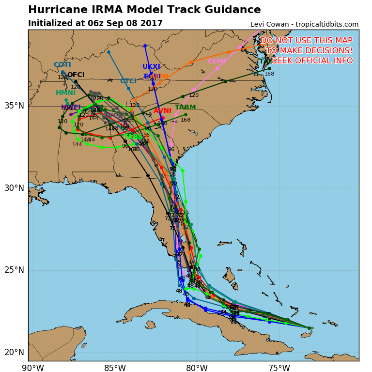
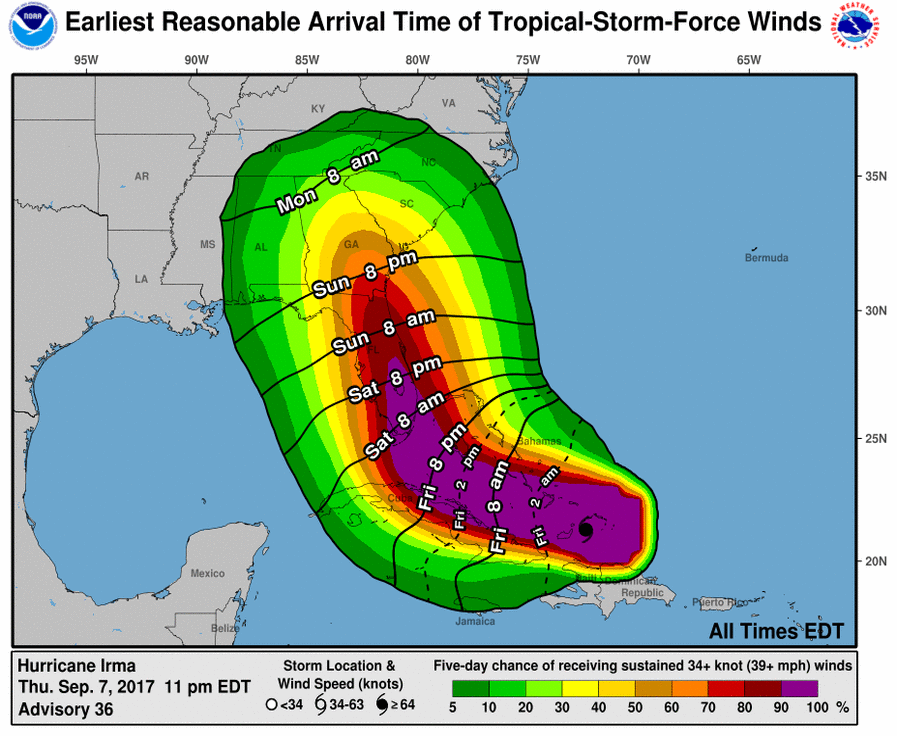
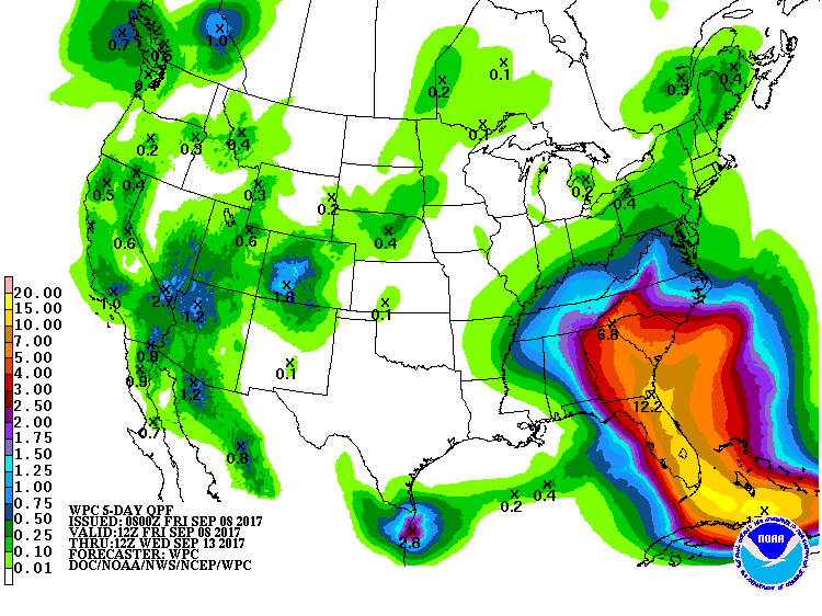
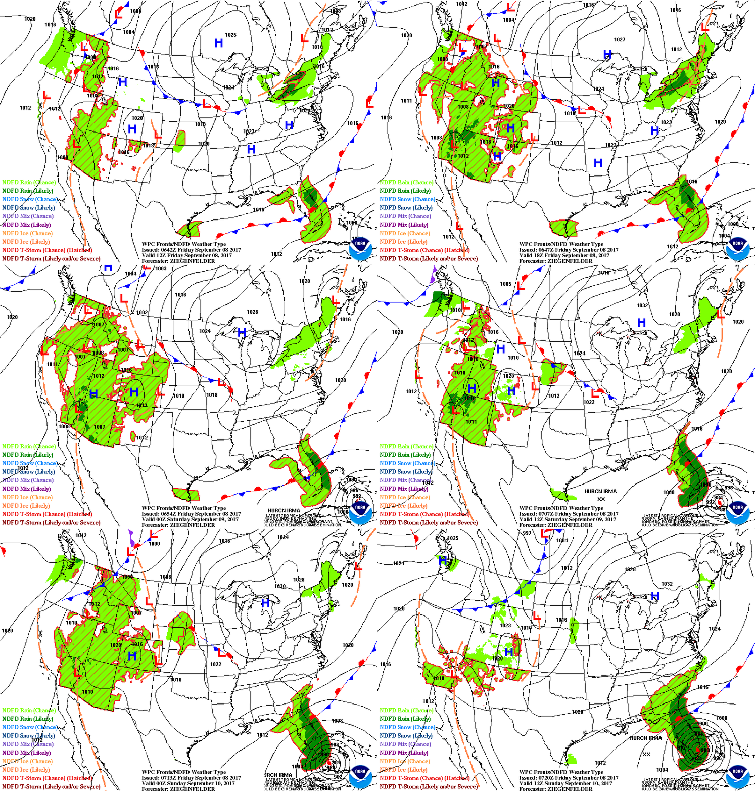
Even though Irma's sustained winds have come down a little...155mph..she is still a very destructive Cat 4 hurricane and will likely hit S.Florida at that intensity late Saturday nite into Sunday. Track shows eye going to west of Miami...Lauderdale..W.Palm & Boca Raton....which puts those populated cities in the worst part of the hurricane. Tornadoes will be likely as well as life threatening storm surge. Rainfall will exceed one foot in many places. The storm will pass into Georgia Monday...still causing many problems there. After that it should rain itself out over the Ohio Valley. Below...the usual maps....all dealing with Irma.
Below - Jose - 125 mph winds - Cat 3- hurricane - will likely hit Leeward Islands again. After that - it should turn out into Atlantic....but keep an eye on him...not to be trusted.
Above...rainfall forecast. Below - animated maps for weekend. Be safe.




 RSS Feed
