Metro Weather Inc. Services
Like us, follow us, link to us, contact us!
  • Home
    • Daily Weather Discussion
  • Weather Prepared for You
    • Film and TV Production
    • Radio & Television
    • Government and Industry
    • Forensic Services >
      • Weather Record Request Form
    • Metro Morning Monitor
  • About Metro Weather
    • Senior Staff
  • Your Weather Images
  • Contact Us

Here Comes Hermine.......

9/2/2016

0 Comments

 
Picture
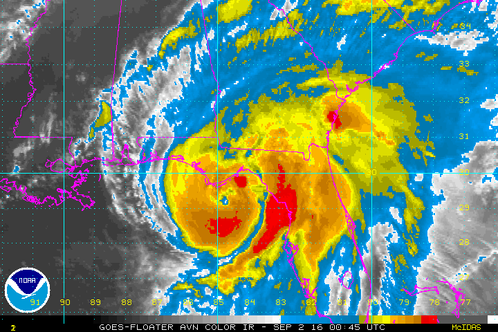
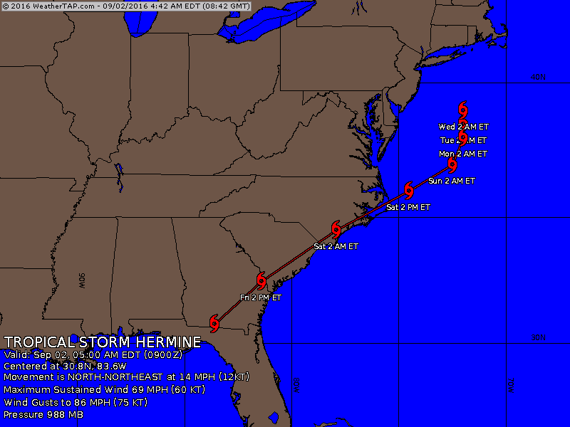
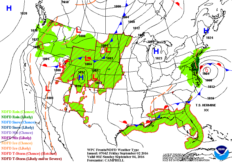
Hermine made landfall overnight over Florida Panhandle near St. Mark with 86 mph winds. She is now a tropical storm and may hold on to that status all the way up the coast. When getting to Mid Atlantic coast the storm will either stall or meander and batter that area for many days next week.
Picture
​Here is the expected track.
Picture
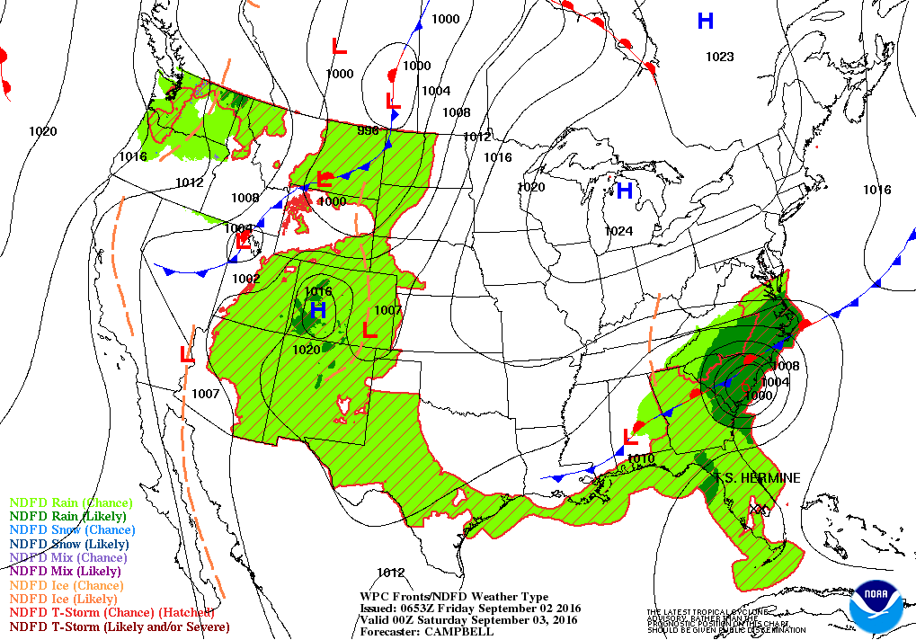
Below...today's threat for severe weather  in dark green and yellow.
Picture
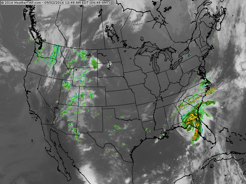
​The following maps show weather systems for tonight and Saturday night.....with emphasis on the east coast Tropical Storm.
Picture
Picture
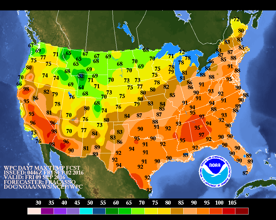
Below....expected temperatures by the end of next week....heating up east....cooling down west. Be safe..have an enjoyable holiday weekend.
Picture
0 Comments


Leave a Reply.

    Genesis of a Tornado
    We'll have daily weather discussions, talking about major systems on the horizon along with anything noteworthy that pops up on our radar.

    Pat Pagano,
    Mike Merin

    Follow us on Twitter and like us on Facebook to get updates whenever we post a new entry!

    RSS Feed

Powered by Create your own unique website with customizable templates.