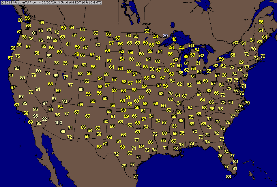
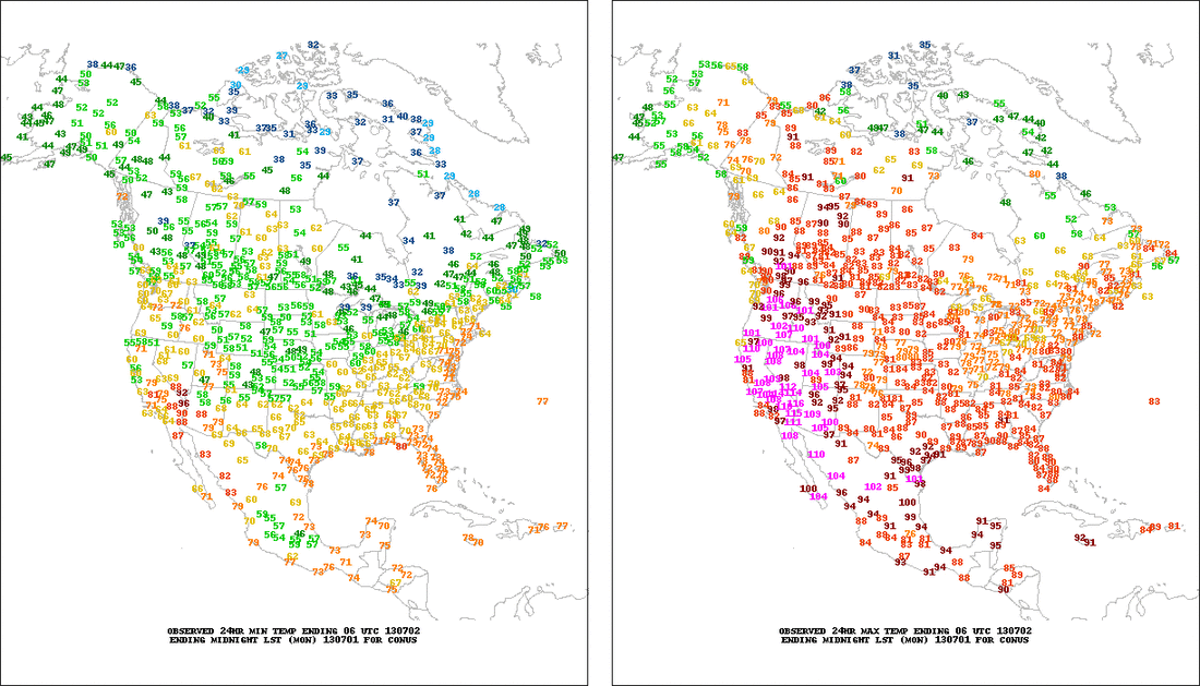
A look at temps. this a.m. tells the story.....much of the Nation above normal. The 2nd map shows lows and highs recorded yesterday. You can see the extensive heat in the West.
Next 2 pix's show a: satellite depicting pipeline of moisture direct from the tropics. All the way to the right...a tropical wave which deserves watching.
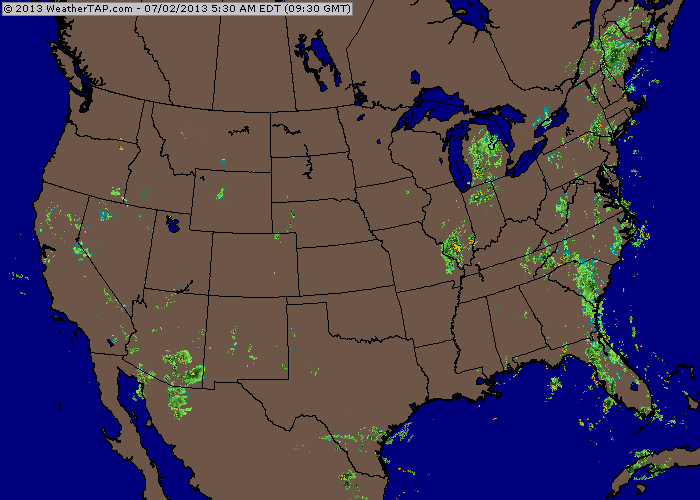
b: radar from this a.m. show the conveyor belt of moisture from south to north up The east Coast. In time...the Bermuda hi will build in and push that zone west....so coast will get hot....inland areas late weekend ...early next week could see 100.
b: radar from this a.m. show the conveyor belt of moisture from south to north up The east Coast. In time...the Bermuda hi will build in and push that zone west....so coast will get hot....inland areas late weekend ...early next week could see 100.

Finally....GFS sfc for July 4th....with superimposed temps. Don't look for any Canadian air in the near future. Meeting with NOAA yesterday wants us to emphasize the importance for outdoor worker to be extra careful in this heat. WRS........water....drink every 15 minutes......rest....and take time to be in the shade. All should know signs of heat stroke and keep an eye on fellow workers. Any signs noticed....call 911 ......heat stroke can be deadly. More people die from heatstrokes in The U.S. per year than hurricanes etc. Later.

 RSS Feed
