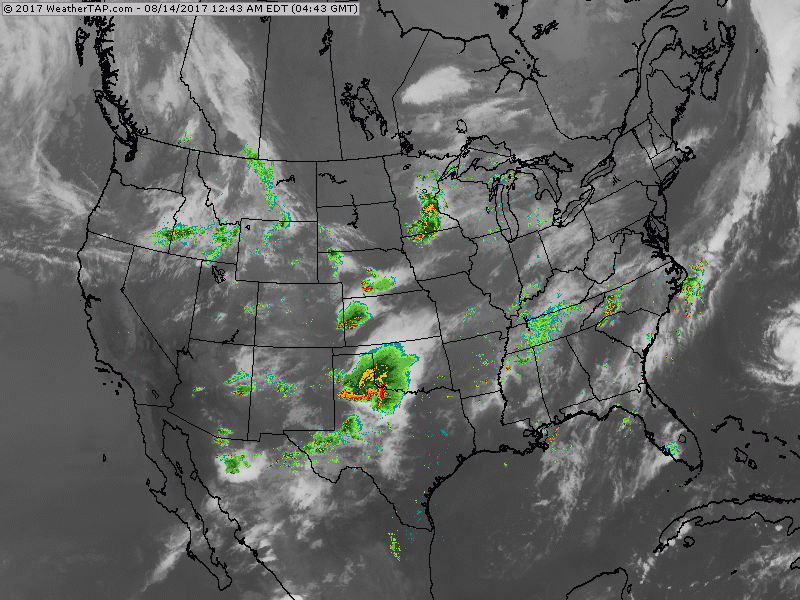
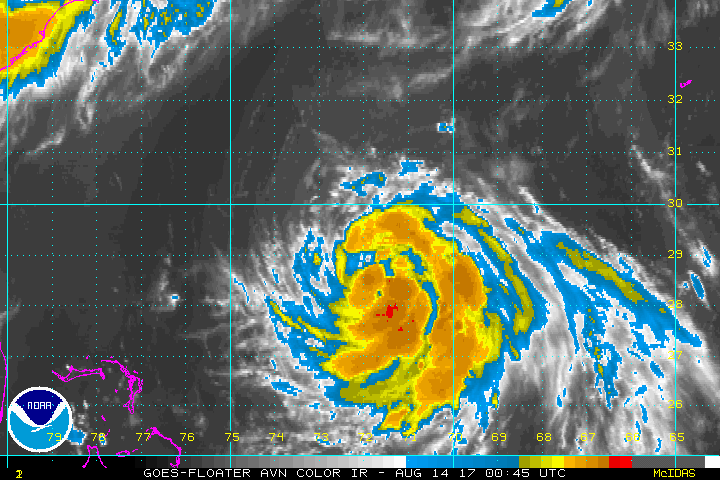
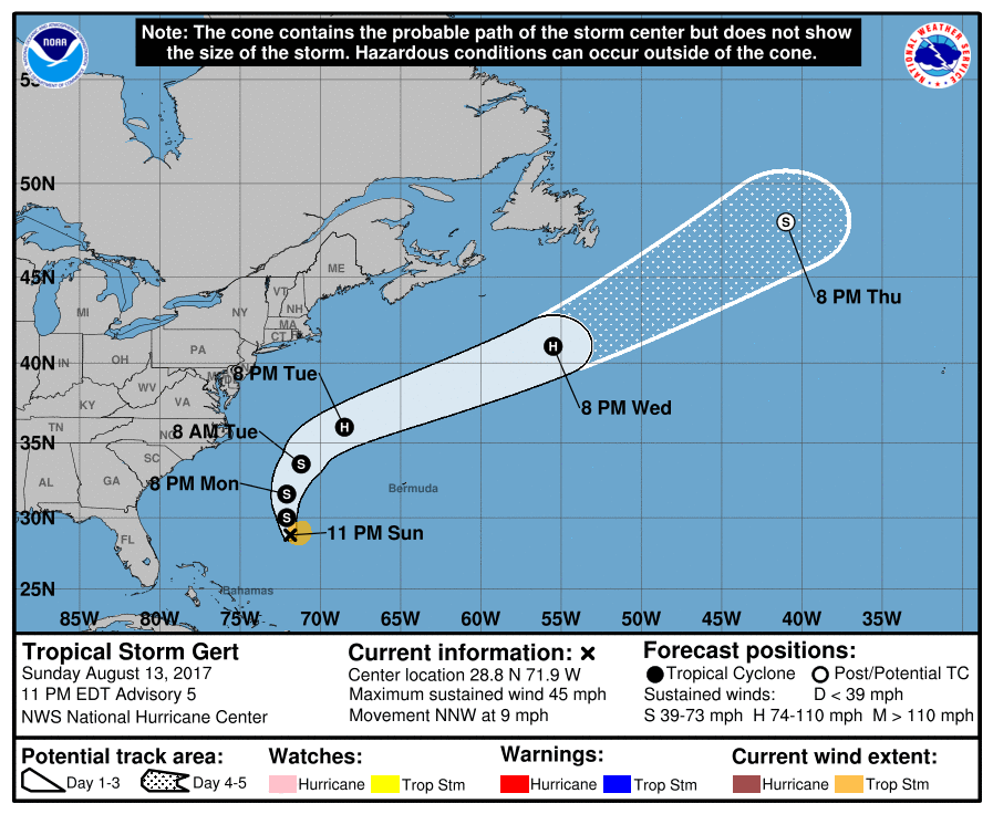
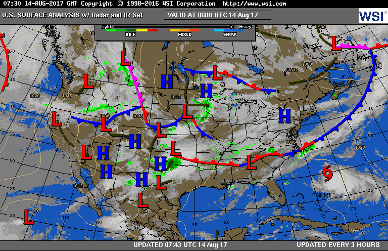
Very noisy satellite and radar map with areas of showers and thunderstorms all over the place. Lower left corner you can see Tropical Storm Gert. Below - close up view of Gert and it's expected track.
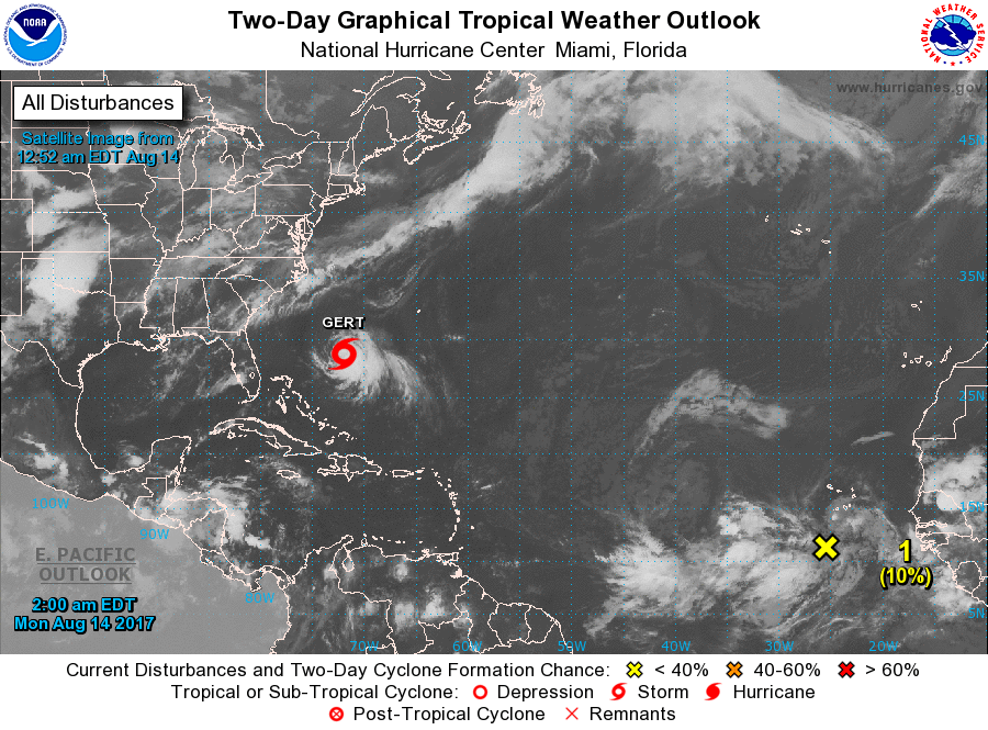
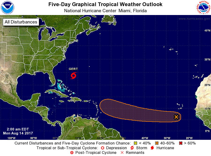
Below...broad view of Atlantic Basin with another new system off The African Coast. That system could be a threat to the U.S. but well over 1 week away. Lots of activity off Africa so things are heating up.
Current weather map below...followed by animation for next couple of days.
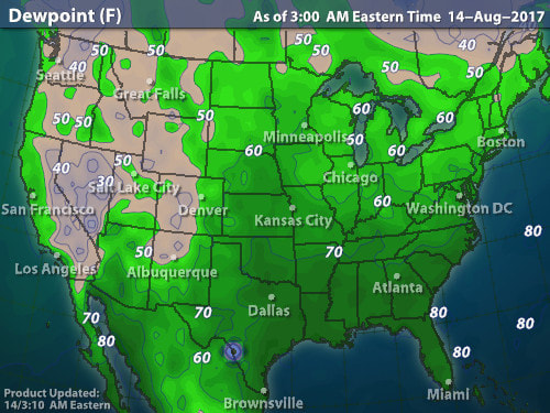
Map above shows dew points for today. The deeper the green..the more uncomfortable. This may not change much most of the week. Be safe.

 RSS Feed
