Current map shows calm conditions but a storm moving out of the Gulf States and up the East Coast Sunday will bring rain there...with a heavy wet snow and sleet combo for Northern New England. Colder weather will engulf the Plains and head east so by New Year's Day almost the entire Eastern 2/3 of The Nation will be under arctic air including Florida.
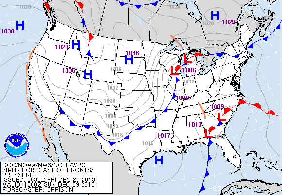
This map (above) is valid for Sunday. Southern storm to bring rain
to the East...storm near Chicago will head east and allow arctic air
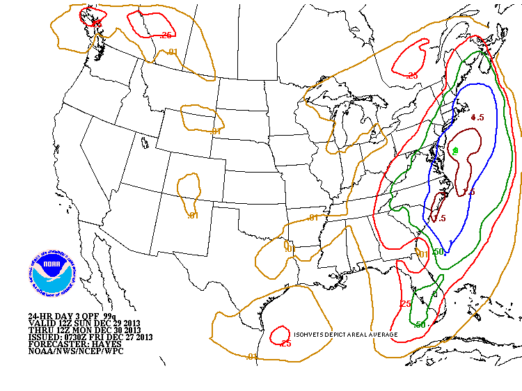
to push east. Below...chart showing rainfall amounts for the East...
1.00" of rain along the coastal areas. If that would have been snow...
a heavy 10-12" would have fallen.
to the East...storm near Chicago will head east and allow arctic air
to push east. Below...chart showing rainfall amounts for the East...
1.00" of rain along the coastal areas. If that would have been snow...
a heavy 10-12" would have fallen.
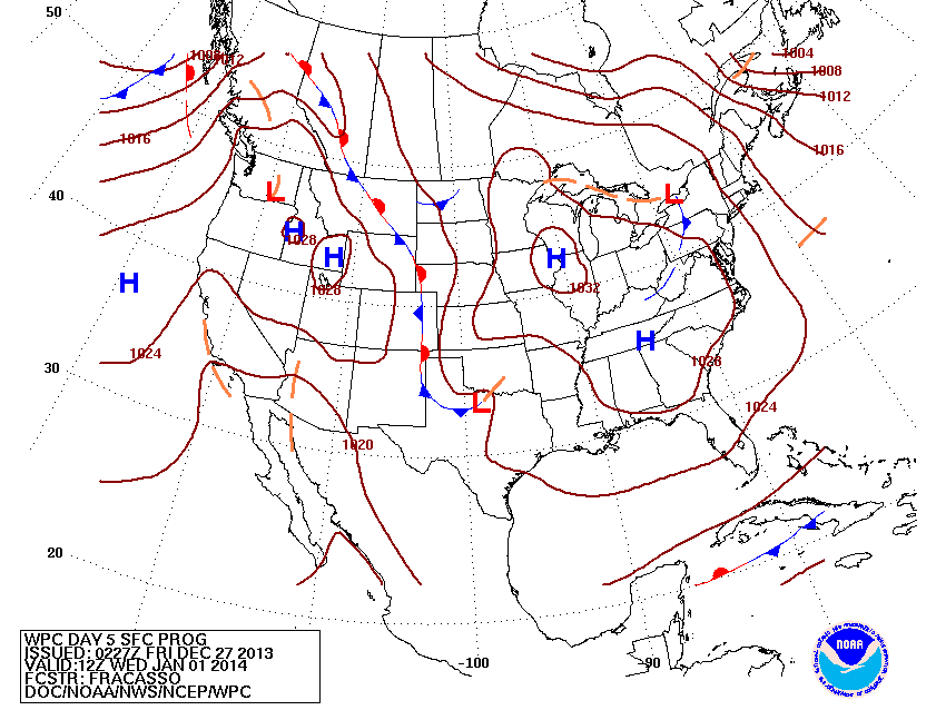
This map is valid for New Year's Day. It shows high pressure dominating...but that high is cold...and although dry...temps are going to average WELL.....below the average....so we definitely get the cold shoulder from Ms. Nature for the New Year. Have a nice and safe weekend.

 RSS Feed
