
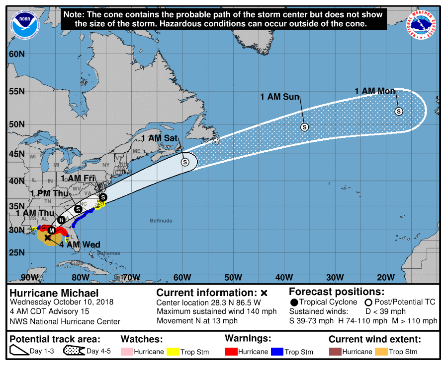
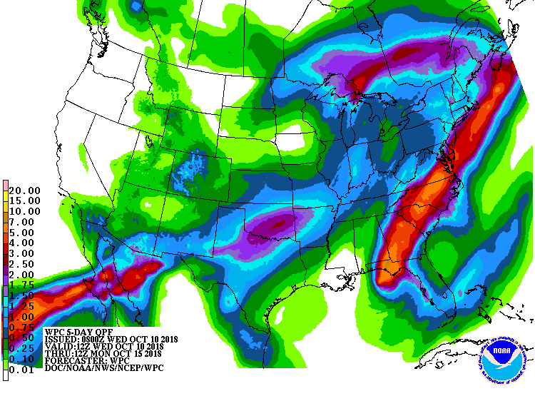
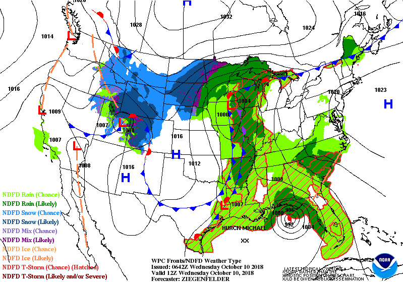
Above....radar of Michael showing a very defined eye - winds 130 mph +.Storm moving north-northeast and should make landfall between 1 and 3pm central time over Fla. Panhandle...with Appalachicola being the target. Below - track....storm surge....rainfall through next 7 days.

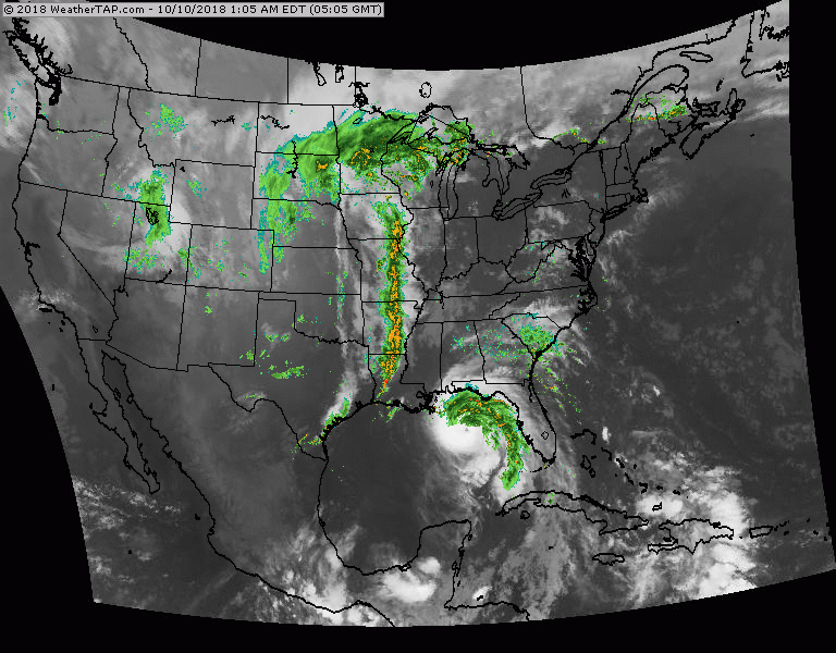
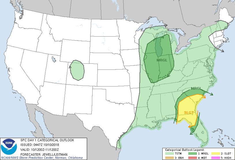
Below- satellite and radar - also showing line of rain and storms in Midwest - headed for the East on Thursday. Animated maps follow...as well as threat for severe weather today.

 RSS Feed
