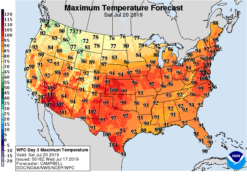
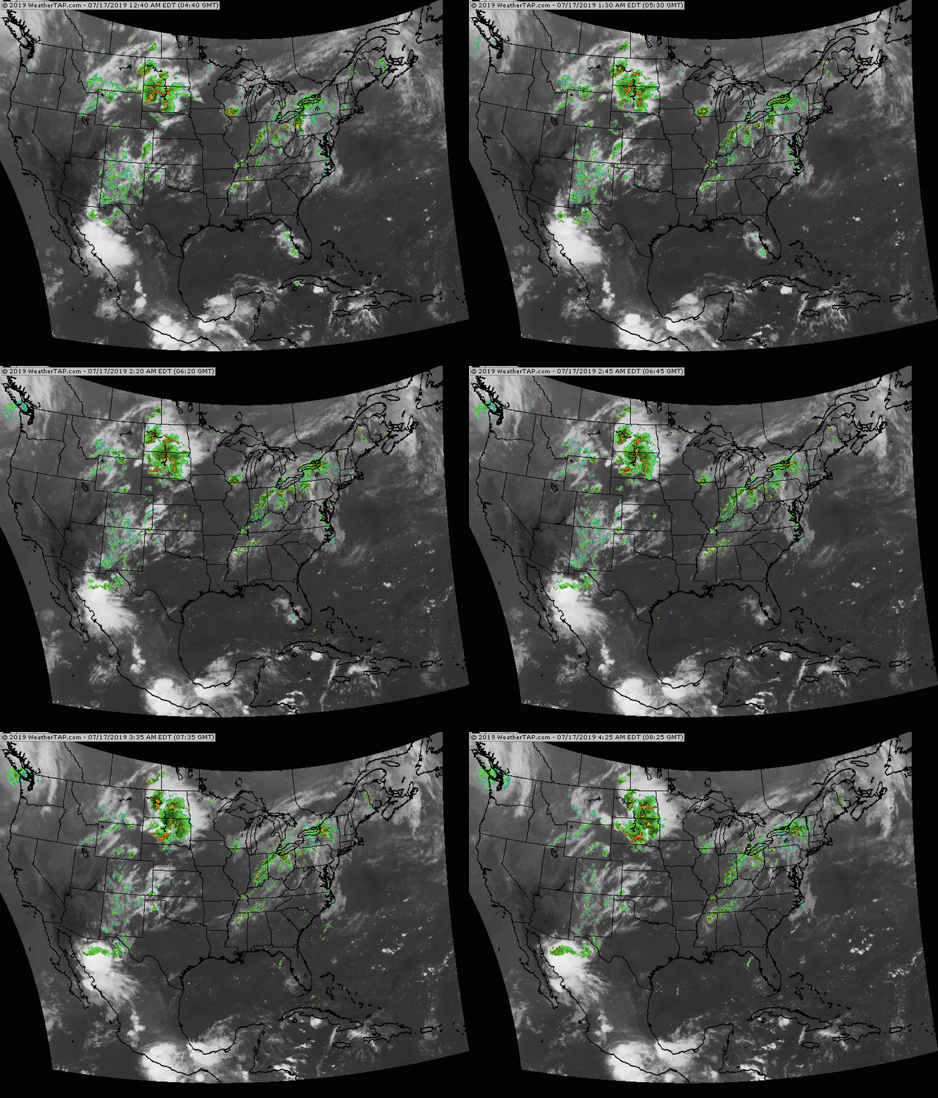
Above...projected temperatures for this Saturday. 100 + actual temperatures from Southwest to Northeast...and when combined with oppressive humidity...it will feel like 110 to 120 F. Below - satellite and radar showing showers and storms headed east from Great Lakes into Northeast today and Thursday...some of which will be severe.
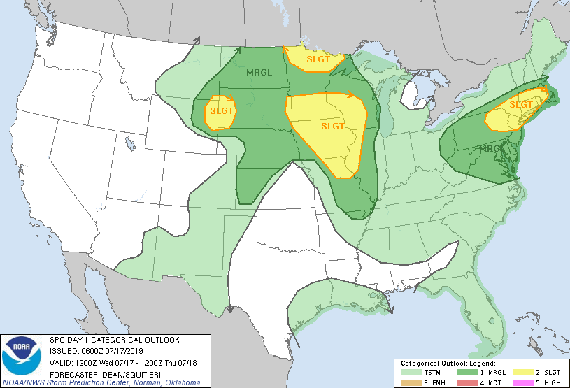
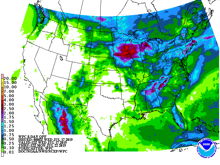
Below- today's risks of severe weather dark green and yellow.....followed by projected rainfall into Monday of next week.
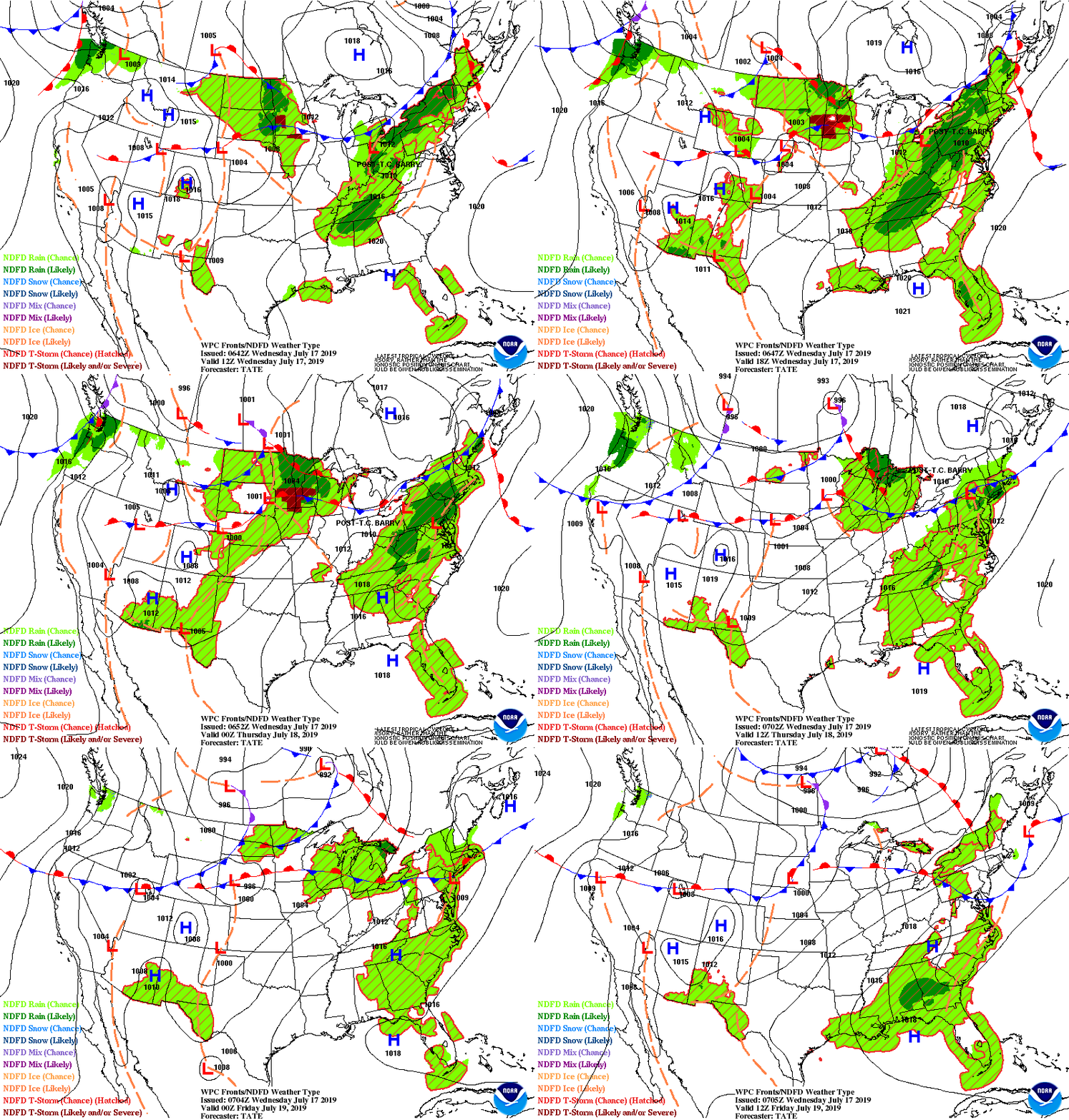
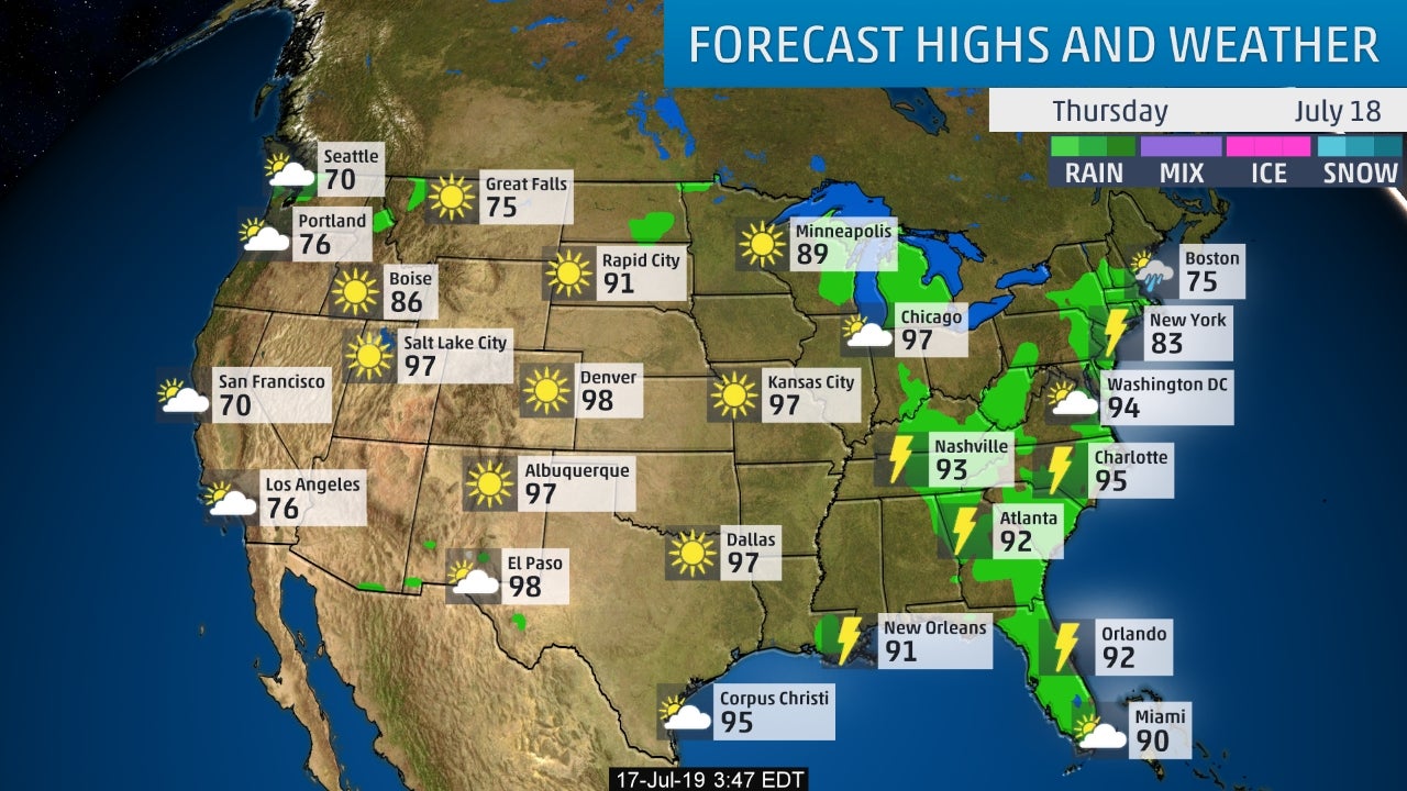
Below - animated maps for the next couple...followed by snapshot weather for Thursday. We will be posting heatwave safety rules tomorrow. Be safe.

 RSS Feed
