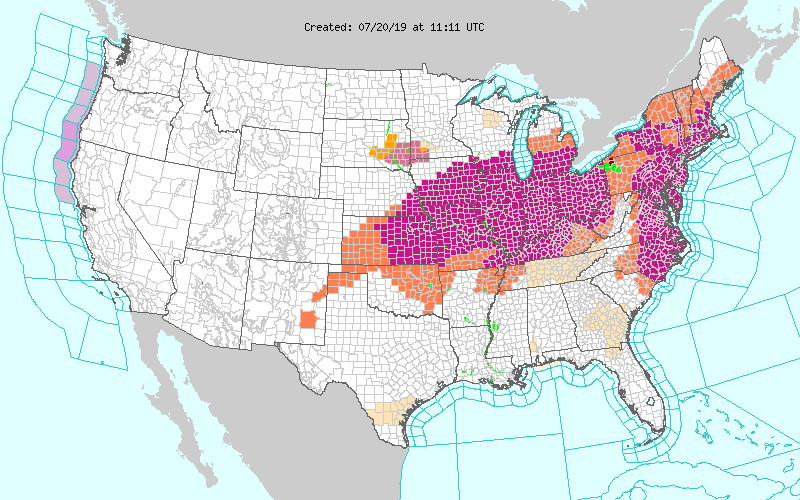
Excessive Heat Warnings and Heat Advisory extend from parts of the Texas Panhandle to the Middle Mississippi/Ohio Valleys and parts of the Great Lakes as well as into parts of the Northeast southward to the Southern Mid-Atlantic as a huge dome of high pressure extends from parts of the Southwest eastward to the Northeast/Mid-Atlantic. Daytime temperatures in the mid to upper 90s combined with high humidity will result in heat indices as high as 115 for some. Overnight low temperatures will provide little relief as temperatures struggle to get below the upper 70s or even low 80s in some parts!
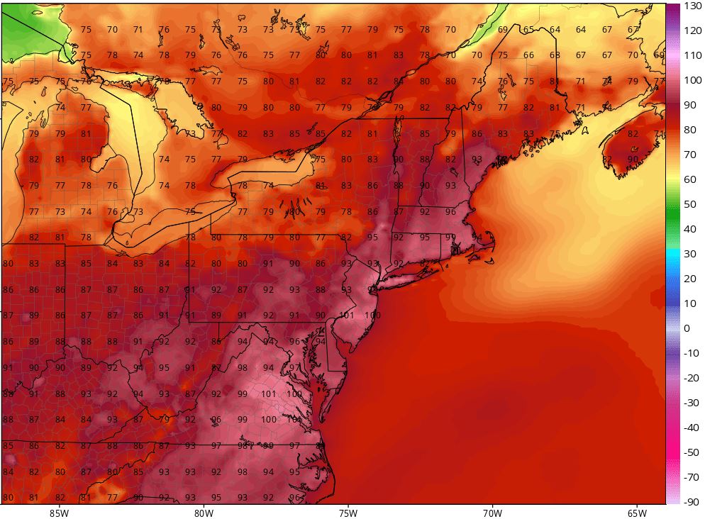
Record high temperatures are in the forecast for parts of the Great Lakes & Ohio Valley extending eastward into the Mid-Atlantic on Saturday into Sunday.
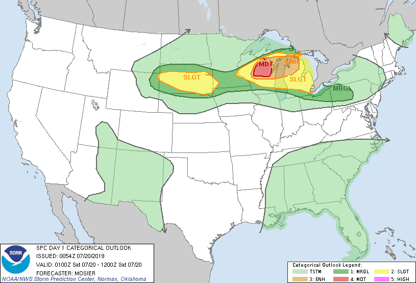
A slow moving cold front crossing the Great Lakes into the Central Plains will initiate convection over this region, highlighting a slight to moderate risk for severe thunderstorms today. The primary threat from these storms will be damaging wind gusts, heavy rainfall, and hail especially across parts of northern Wisconsin and Michigan. The chance for an isolated tornado cannot be ruled out. These showers and thunderstorms will extend from parts of the Mid-Atlantic to the Middle Mississippi Valley by Monday morning bringing much needed relief to the heat wave currently gripping much of the eastern half of the country.

 RSS Feed
