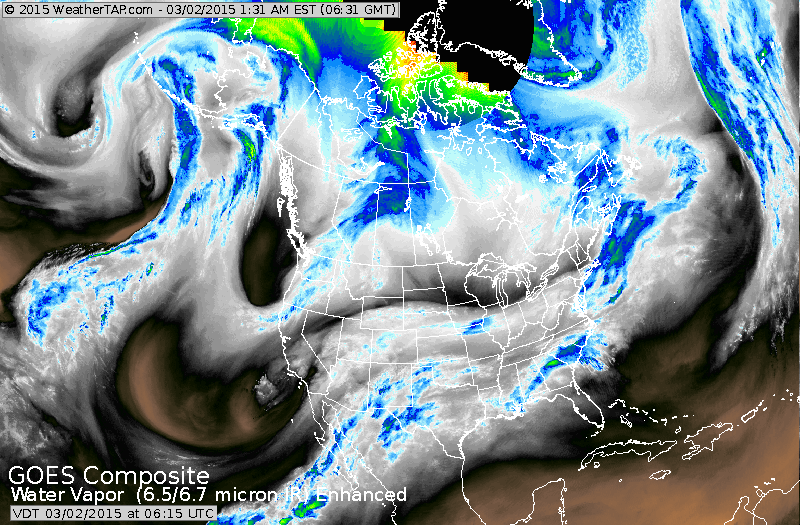
Satellite shows the latest winter storm moving out of the Northeast. Powerful upper trough over the west coast will send a belt of moisture eastward as conveyed by the blues in the southwest. This system will first bring snow changing to sleet and rain across The Nation Tuesday into Wednesday....followed by more snow from Ohio Valley to Northeast Thursday.
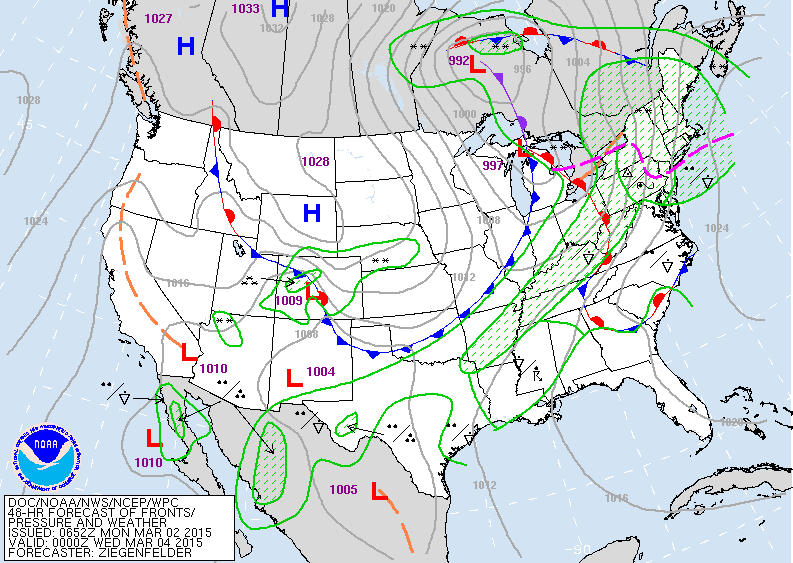
Map above is valid for early Tuesday evening. Western third of the nation...quiet. Rockies and Plains...fair - cold. Warm front over Ohio brings snow/ sleet then rain to East. Cold front over the Midwest will bring snow...to Ohio Valley on east by Thursday and it could be quite heavy.
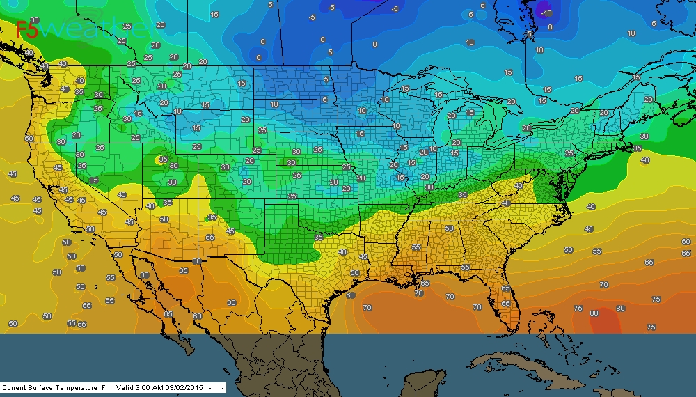
Click on image to enlarge....as above map shows temps at 4am this a.m.
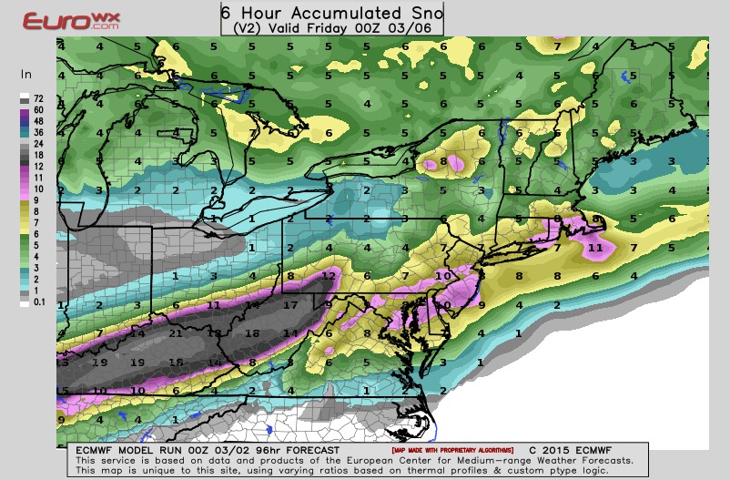
Above map is The Euro Models' forecast of snowfall from Wed. nite into Thursday. Anywhere from 1/2 to 1 foot from
Ohio Valley to Southern New England. Think it's a bit high...but this front is loaded with Gulf moisture...so it could easily wind up as a big snow.....stay tuned. Be safe.
Ohio Valley to Southern New England. Think it's a bit high...but this front is loaded with Gulf moisture...so it could easily wind up as a big snow.....stay tuned. Be safe.

 RSS Feed
