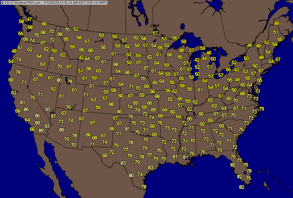
A look at this a.m. temps and if you are in the Gt.Lks or Northern New England you would think it's Sept. See how quickly things can change. Some showers will graze coast from Mid At. to New England...but any significant rainfall will be confined to The Cape - to Maine.
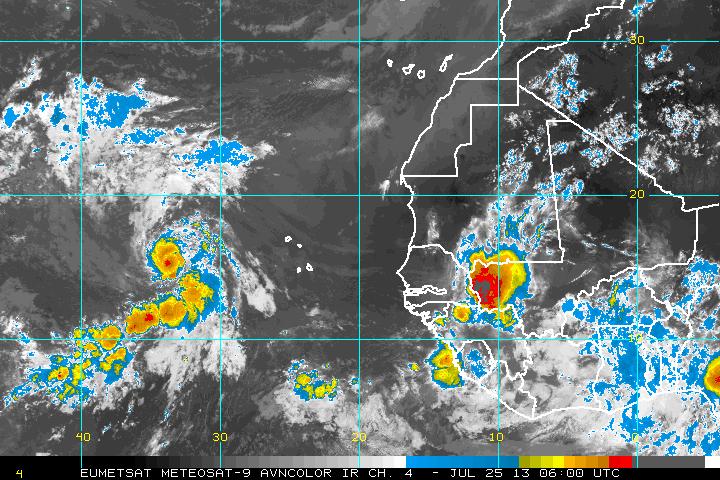
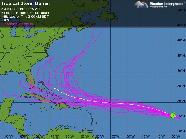
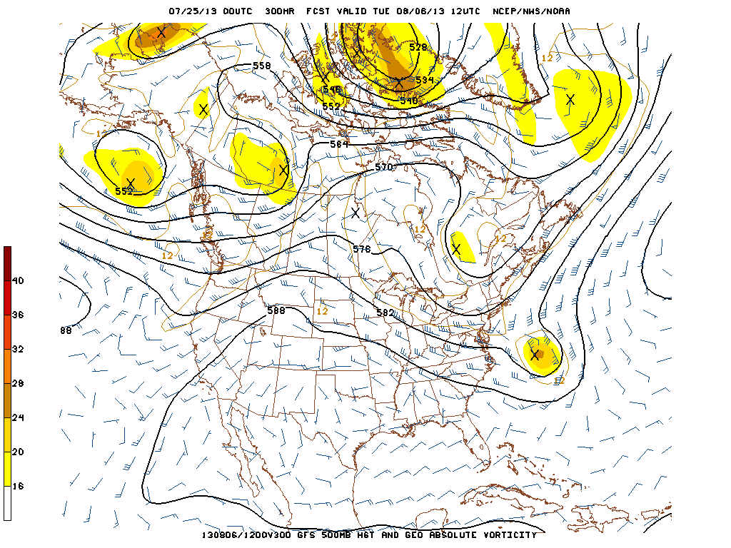
Tropical Storm Dorian intensified overnite. Hurricane center brought wind to 60 mph. Satellite pix does not show a burst of convection but structure already lends itself to minimal hurricane. You will see most of the models are in good agreement until he reaches Puerto Rico. I have included the GFS upper air 500 Mb map for early next week. That model wants to bring in another trof and scoop Dorian off the coast and out to sea. Possible. It may also slow up...and if short wave misses it...then interests along the mid Atlantic & NE would have to watch. Just cannot tell...and timing will always be an issue with tropical systems if not all weather systems. Original thinking is that Atlantic ridge holds and forces Dorian toward the SE Coast. Not out of the question yet. Question? If it can drop into the 40s in July....what can it do in August ?
Later.
Later.

 RSS Feed
