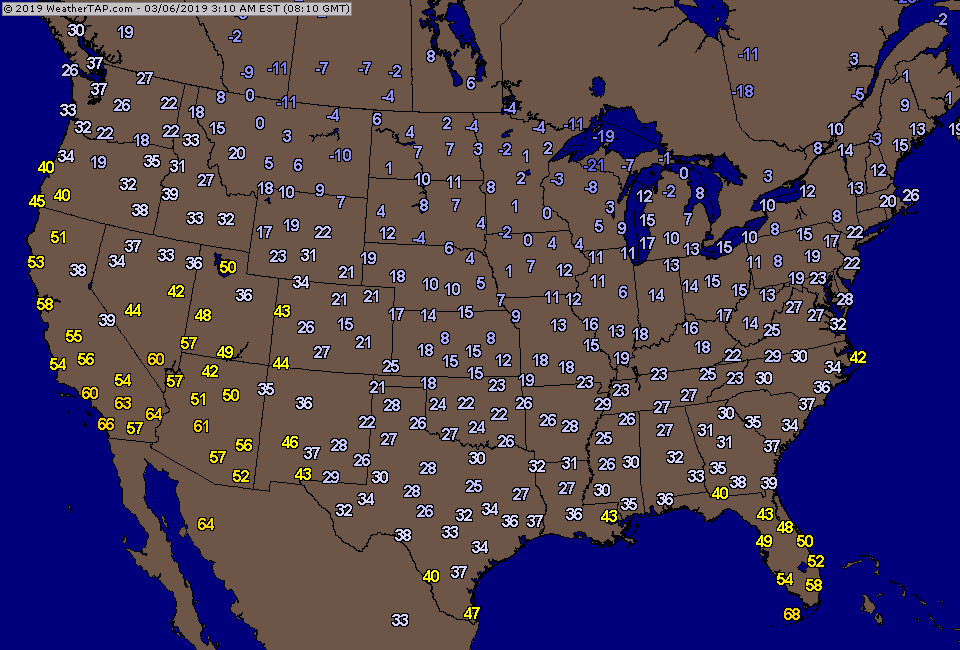
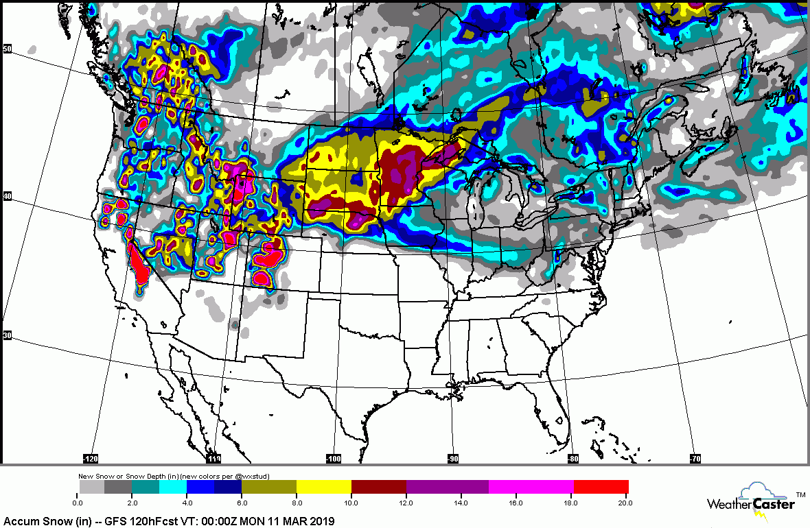
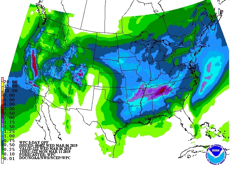
Above...4am (et) temperatures. Below - expected snowfall and rainfall through Sunday.
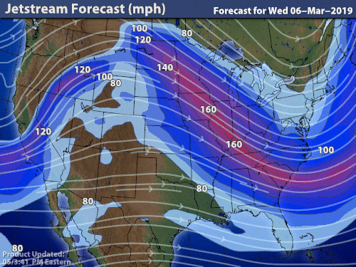
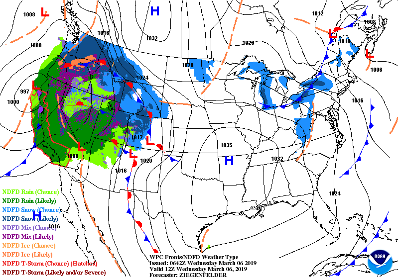
Below - jet stream......the "U" shaped form indicates a trof...and that enables cold air to be brought down from Canada. Storms form ahead of a trof..thus the reason West Coast is getting hammered now.
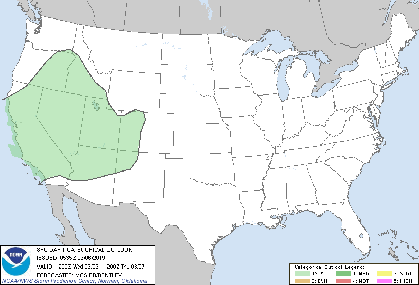
Below- chance of thunderstorms today in green...followed by animated maps for next 2 days.
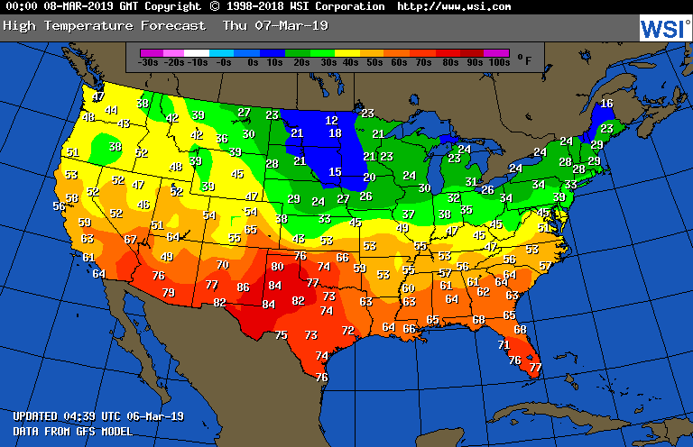
Finally - a look at high temperatures for Thursday. Be safe.

 RSS Feed
