
Satellite above...shows small band of rain moving across Northeast.
Moisture moving north from The Gulf...creating large swath of bad weather from Rockies to Plains to Gt. Lks. Lots of severe weather last night there...and that will be the case again today. Remember..black is dry..clear skies.
Moisture moving north from The Gulf...creating large swath of bad weather from Rockies to Plains to Gt. Lks. Lots of severe weather last night there...and that will be the case again today. Remember..black is dry..clear skies.
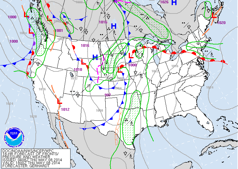
Above..today's map: Warm front (red- semi circles) goes from Gt. Lakes to Northeast. Ahead of it...wet and damp. Cold front...Minnesota to Texas...causing showers and t-storms ahead of it.
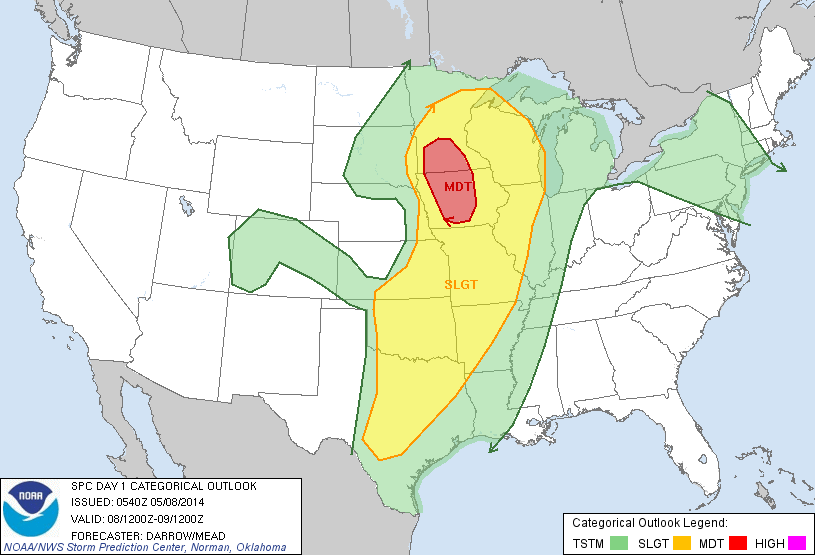
Above - severe weather threat today.....with southern Minnesota and Iowa having the best chance of severe thunderstorms and possible tornadoes.
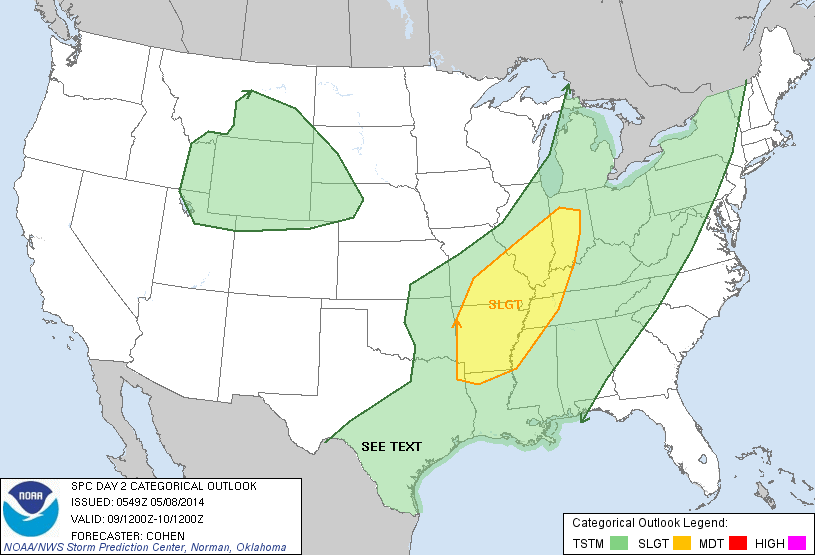
Above...severe weather threat for Friday...from Indiana to Arkansas.
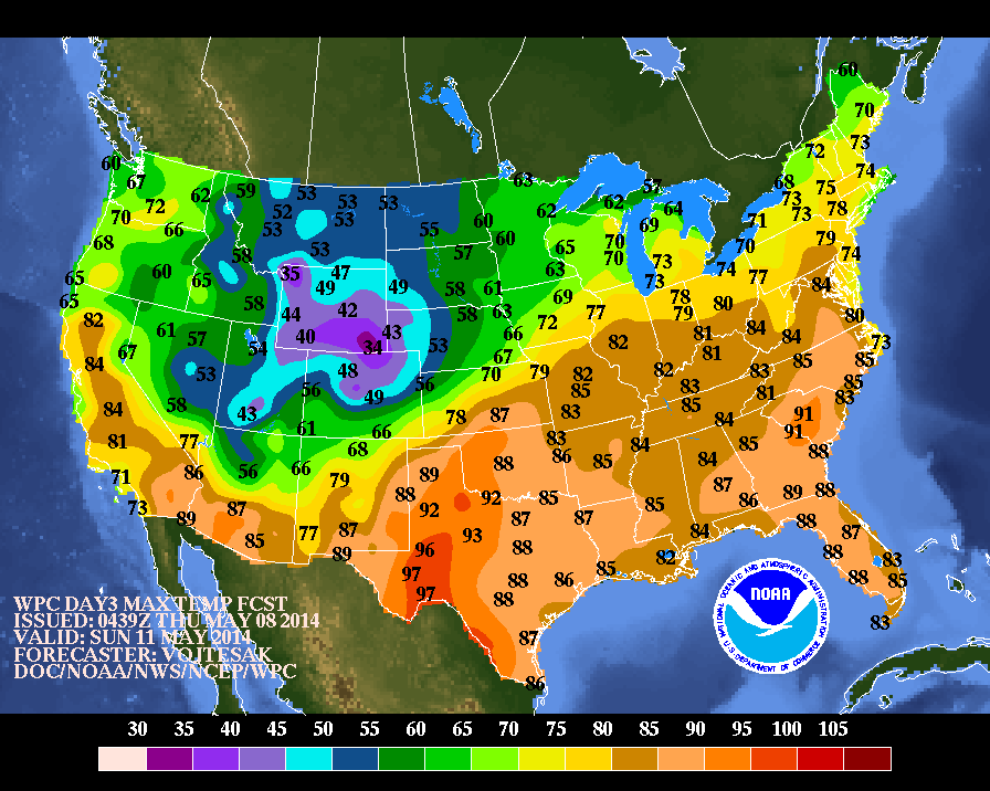
Above...maps shows high temperatures for Sunday, Mom's Day. Most will see warm weather with the exception of The Rockies....where places like Colorado will get snow.....yes...in May. Be safe today...pay attention to warnings where weather may be severe.

 RSS Feed
