Metro Weather Inc. Services
Like us, follow us, link to us, contact us!
  • Home
    • Daily Weather Discussion
  • Weather Prepared for You
    • Film and TV Production
    • Radio & Television
    • Government and Industry
    • Forensic Services >
      • Weather Record Request Form
    • Metro Morning Monitor
  • About Metro Weather
    • Senior Staff
  • Your Weather Images
  • Contact Us

Changeable !

8/4/2017

0 Comments

 
Picture
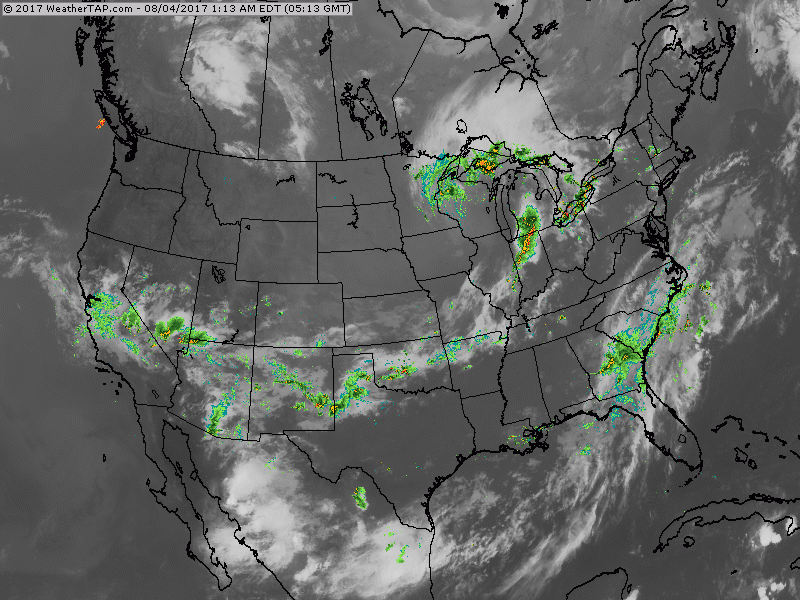
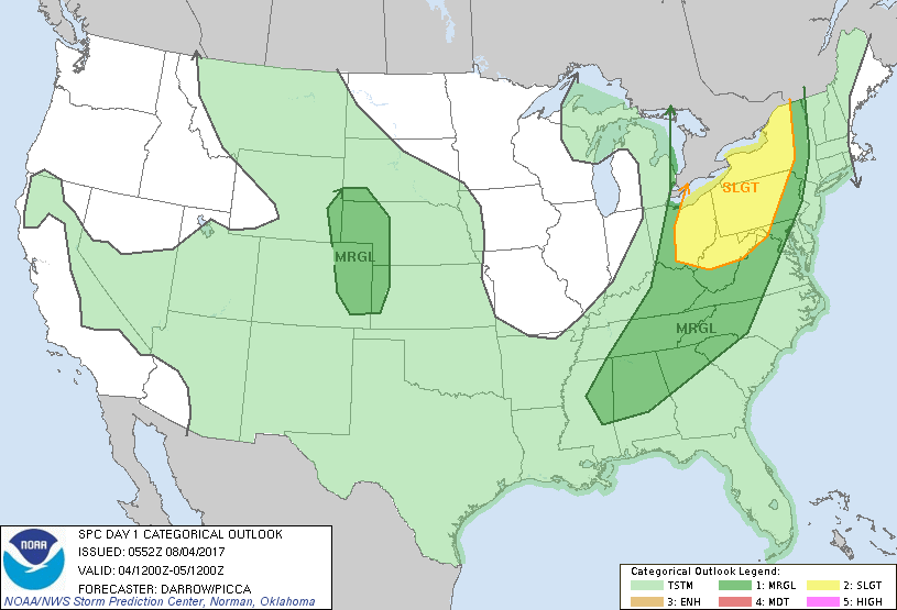
​You can see the cold front on satellite from Michigan to Oklahoma. It will swing off East Coast by Saturday night and stall in southeast. Below..threat of severe weather today in dark green and yellow...all associated with cold front.
Picture
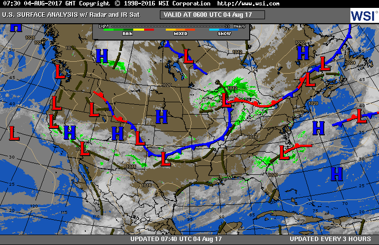
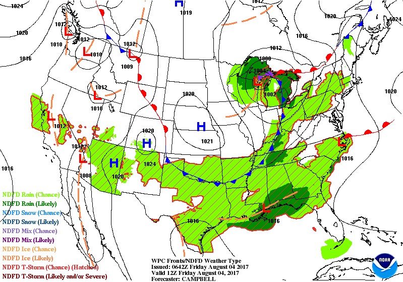
​Below...today's current map followed by animation for the next couple. 
Picture
Picture
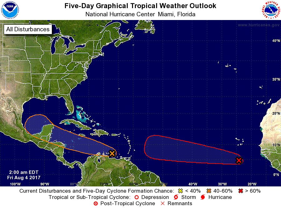
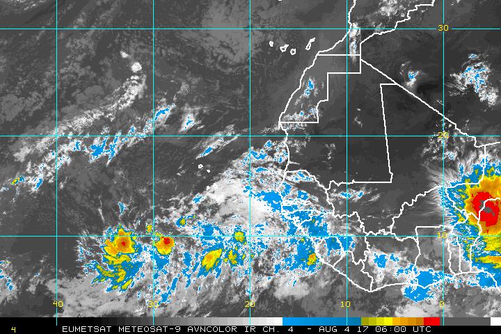
Below...tropical Atlantic.  Two waves of interest...one near SOuth America which will likely move toward Central America....other off Africa which is a concern to the U.S.  
Picture
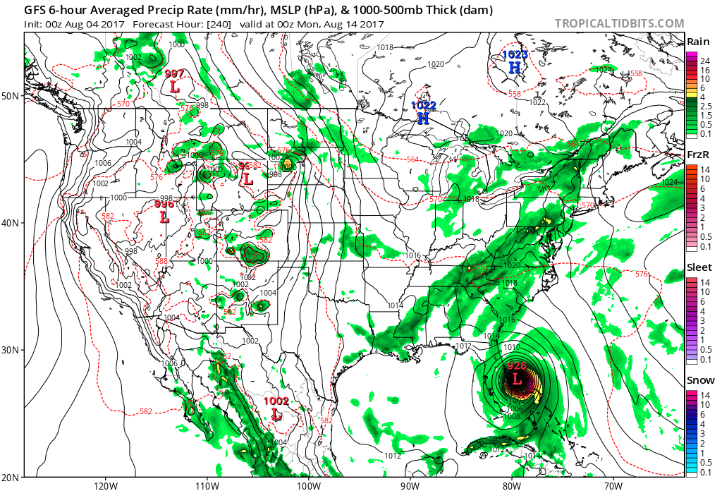
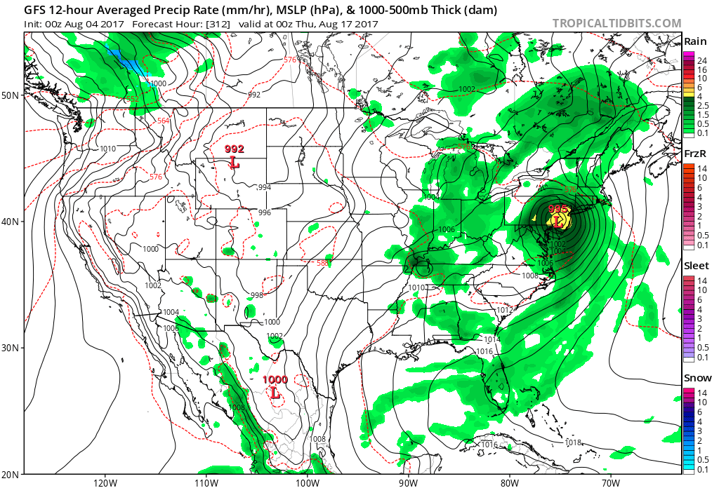
​Below is the GFS Model take on system off AFrica. All week long this model has been bringing to the U.S.  but doesn't really know where to track it....too far away. By mid August....the GFS bring this storm to Florida coast ...and then up the coast. That may not be the case....but it needs to be watched. Be safe.
Picture
Picture
Picture
0 Comments


Leave a Reply.

    Genesis of a Tornado
    We'll have daily weather discussions, talking about major systems on the horizon along with anything noteworthy that pops up on our radar.

    Pat Pagano,
    Mike Merin

    Follow us on Twitter and like us on Facebook to get updates whenever we post a new entry!

    RSS Feed

Powered by Create your own unique website with customizable templates.