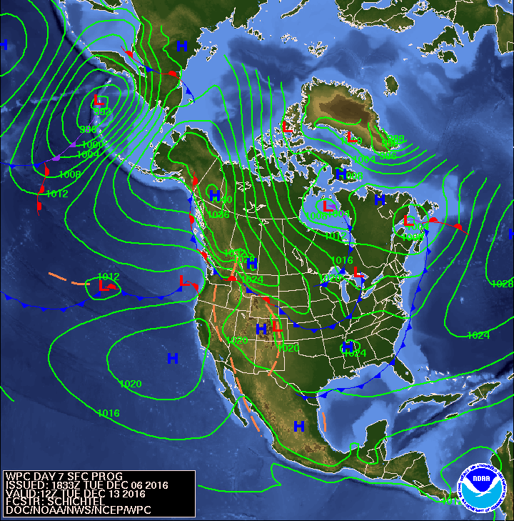
Map above is for next Tuesday. Notice the "H" in NW Territory of Canada. It's moving southbound...so plenty of cold air down the pike for the U.S.

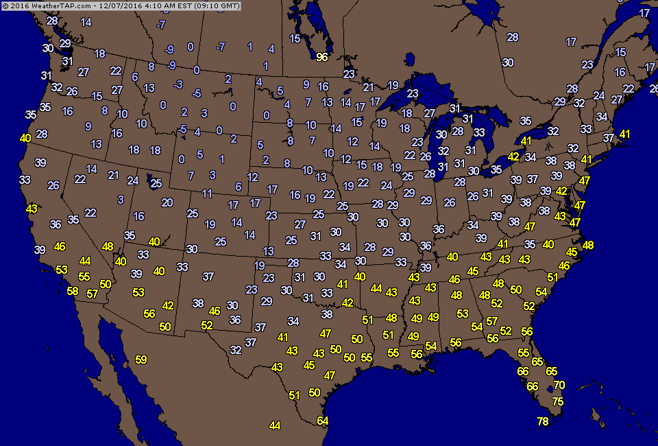
Satellite shows large low spinning in upper Midwest - just serving to pull down bitter air from Canada. Below...temperatures taken early this a.m.

Today's weather map shows that storm north of Great Lakes and cold air just dropping south and east. Snow across the southern Plains...Upper Midwest and Great Lakes. Stay warm and safe.

 RSS Feed
