Metro Weather Inc. Services
Like us, follow us, link to us, contact us!
  • Home
    • Daily Weather Discussion
  • Weather Prepared for You
    • Film and TV Production
    • Radio & Television
    • Government and Industry
    • Forensic Services >
      • Weather Record Request Form
    • Metro Morning Monitor
  • About Metro Weather
    • Senior Staff
  • Your Weather Images
  • Contact Us

Big Time Changes To Our Winter......

1/17/2019

0 Comments

 
Picture
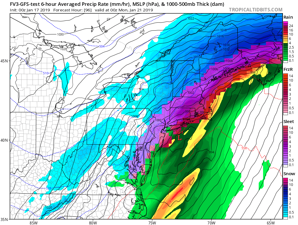
Above - New GFS Model for Sunday afternoon in Northeast. Blue is snow..purple & red = ice ....green and yellow - rain. Flash freezing Sunday will make travel a NIGHTMARE !  If you do not have to travel...by all means do not. Below- satellite and radar
Picture
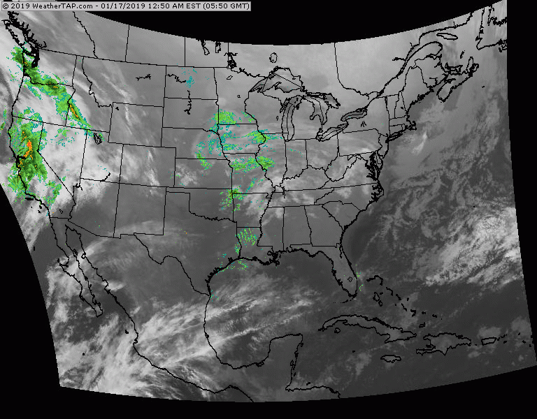
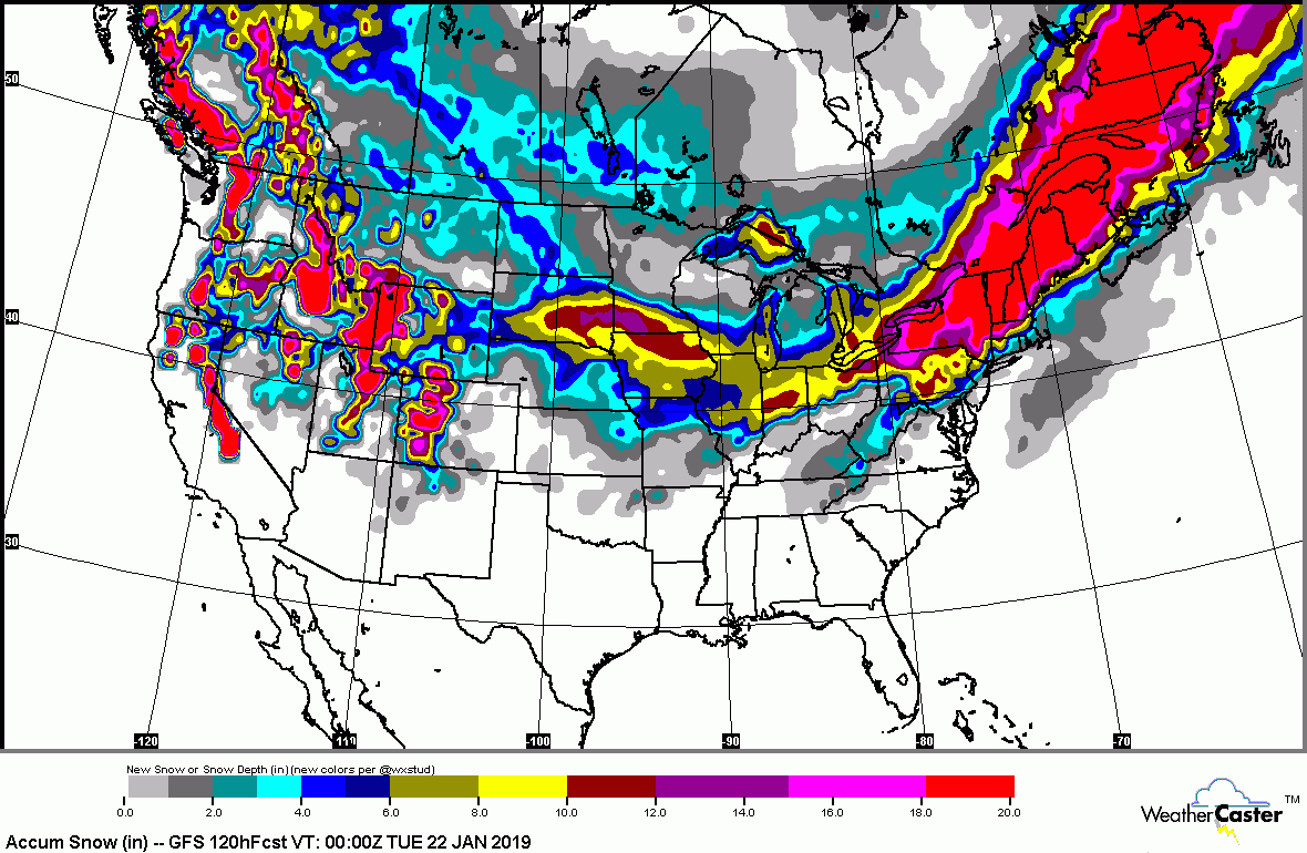
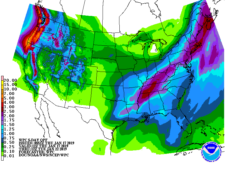
Above - satellite , radar shows storm no. 1 moving into Mississippi Valley. It will bring 1-3" of snow from Ohio Valley into Northeast. Rain further south. Storm no. 2- west coast - will be the monster storm that will head east this weekend to bring snow to Midwest only to intensify and bring even more snow and ice to Northeast Sunday. Parts of Northeast will be measuring in feet.  Below - animated maps for the next couple...followed by snowfall and rainfall into Tuesday of next week.
Picture
Picture
Picture
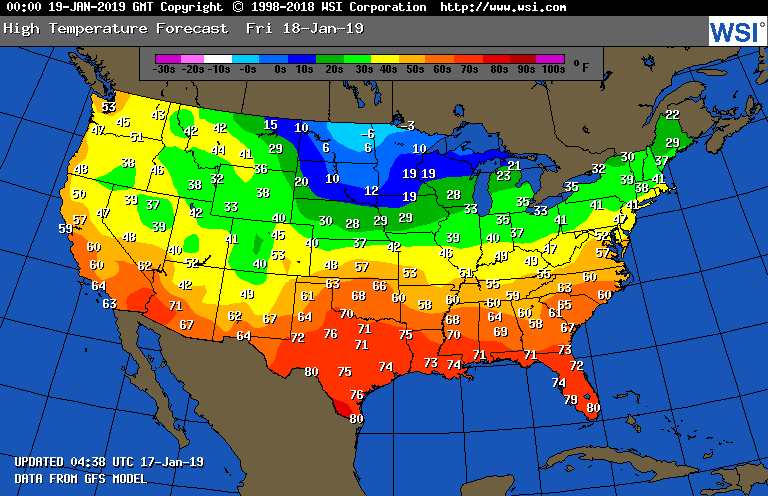
​Below - high temperatures for Friday. Be safe.
Picture
0 Comments


Leave a Reply.

    Genesis of a Tornado
    We'll have daily weather discussions, talking about major systems on the horizon along with anything noteworthy that pops up on our radar.

    Pat Pagano,
    Mike Merin

    Follow us on Twitter and like us on Facebook to get updates whenever we post a new entry!

    RSS Feed

Powered by Create your own unique website with customizable templates.