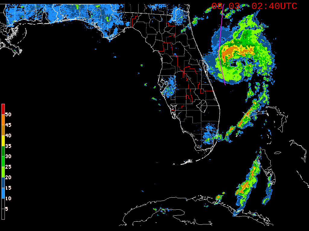
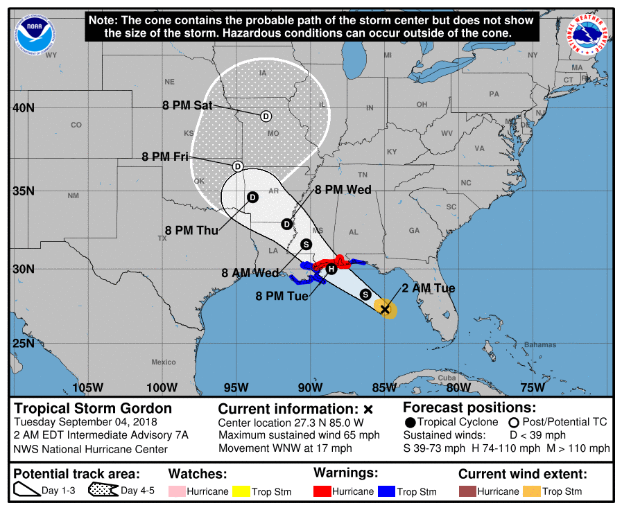
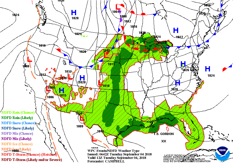
Tropical Storm Gordon radar above.....with purple line showing it's expected track to to east of New Orleans tonight. Currently 60 mph winds..could become a minimal hurricane before landfall. Below- track of Gordon.....and today's threat of severe weather in dark green and yellow.

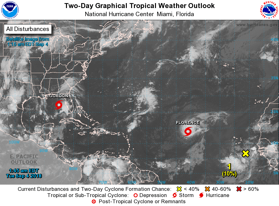
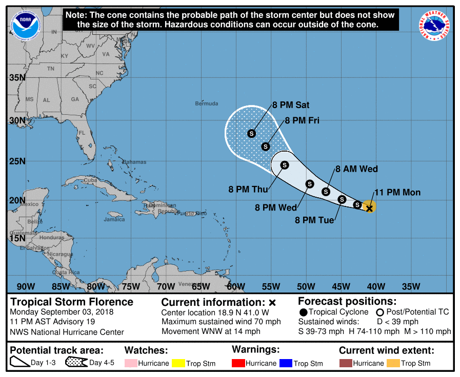
Below- satellite picture of Atlantic hurricane basin. Florence - almost a hurricane will head toward Bermuda....track after that should stay just offshore of the East Coast...but time will tell. ANother disturbance is being watched off Africa..it could become Helene. Below- track of Florence.
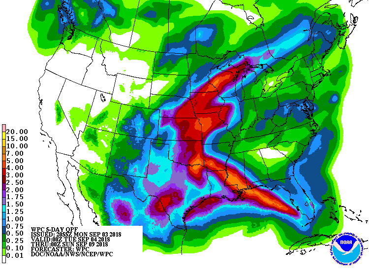
Below- animated maps for the next 2 days followed by current satellite and radar. Front over the Great Lakes won't reach the Northeast until Friday. AFter that...will it stall and produce a crumby weekend ? Maybe for the Mid Atlantic..but New England should do o.k. Lastly - rainfall for the next 5-7 days. Heaviest rain along path of Gordon.
Be safe.
Be safe.


 RSS Feed
