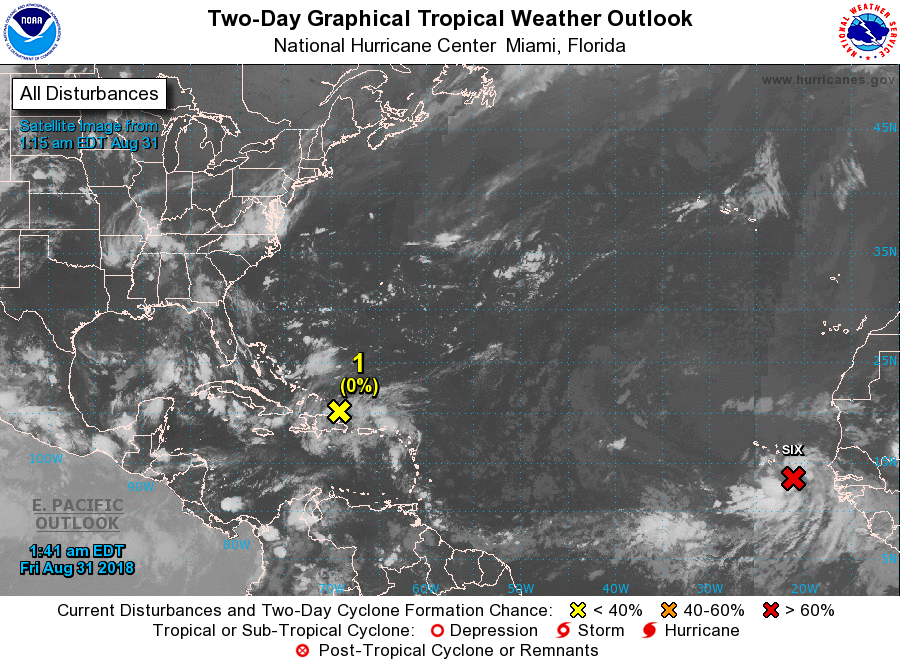
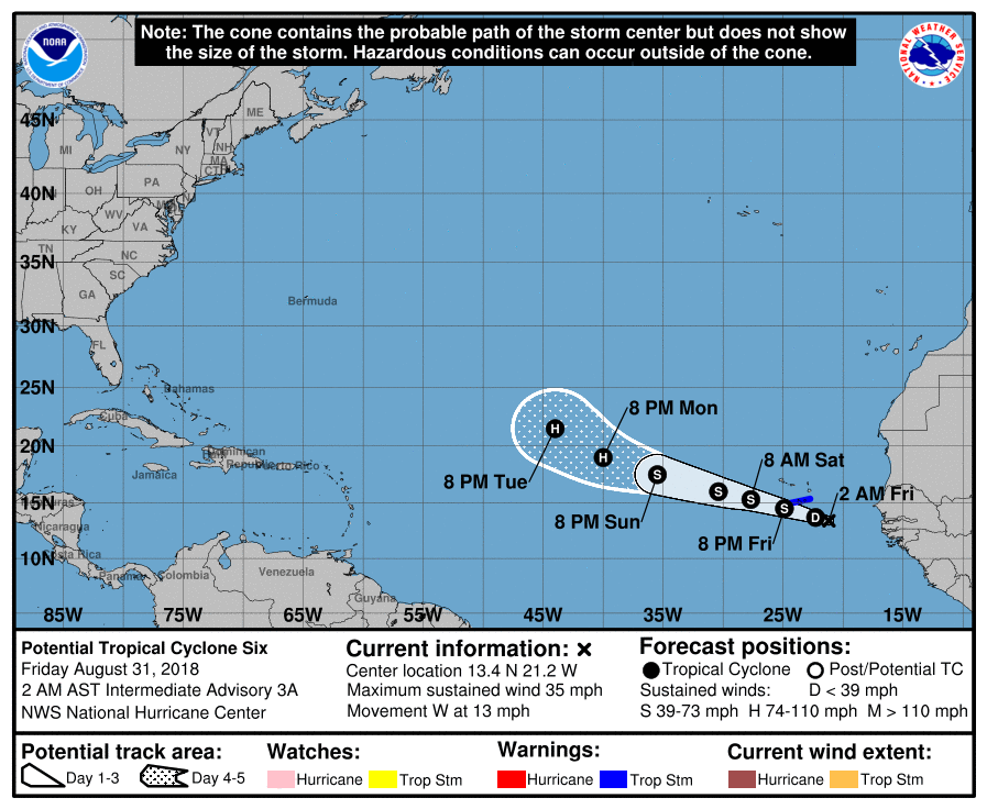
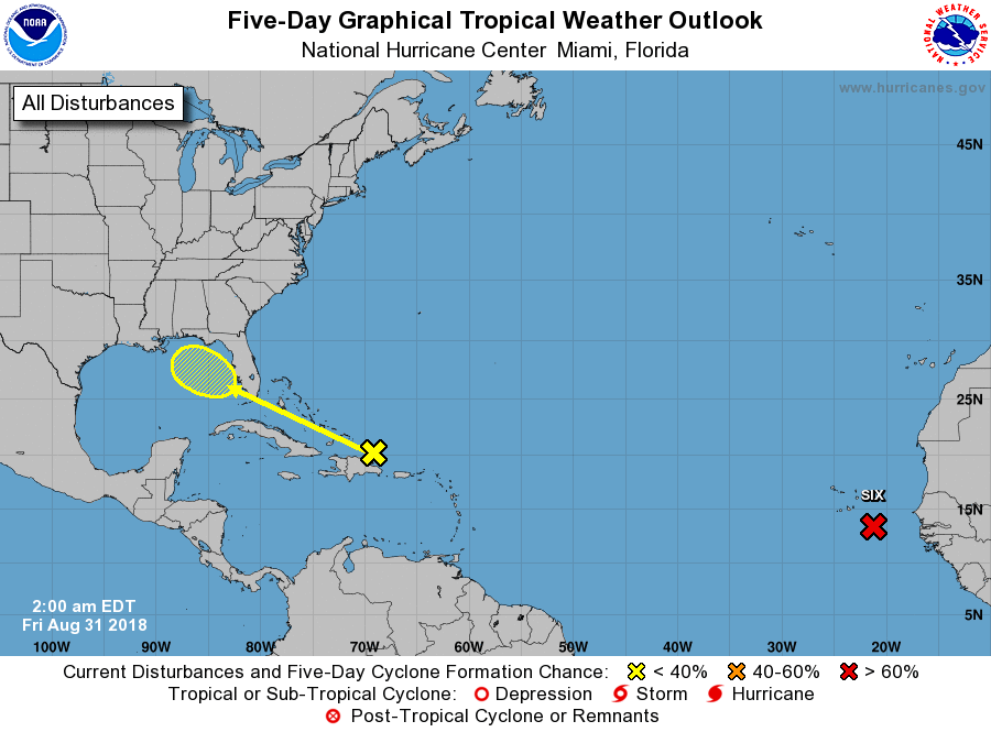
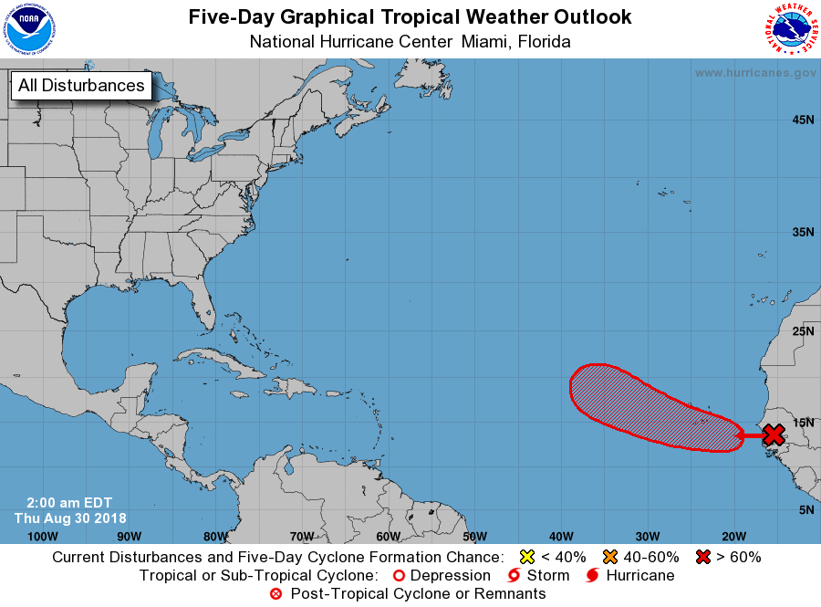
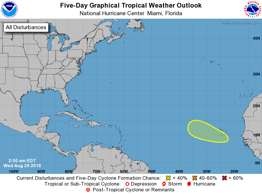
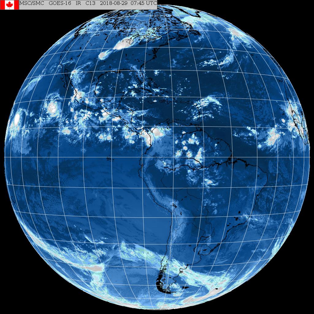
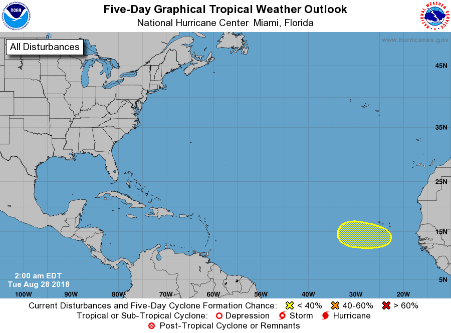
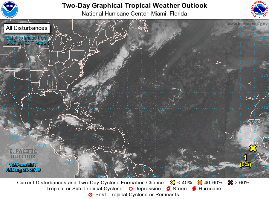
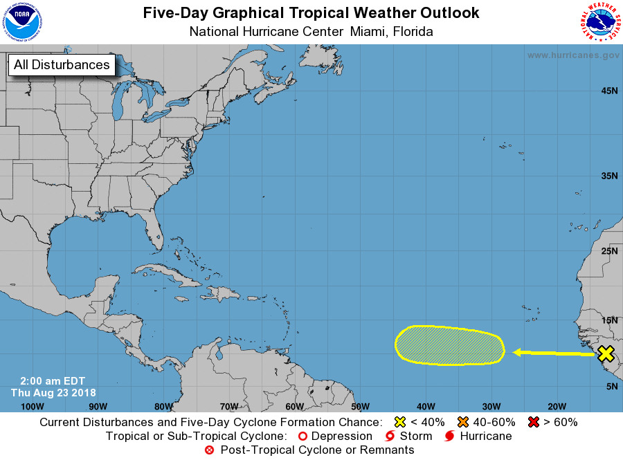
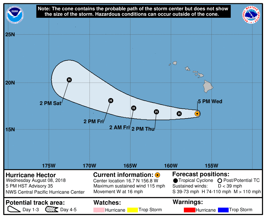
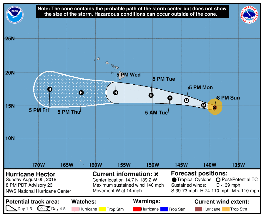
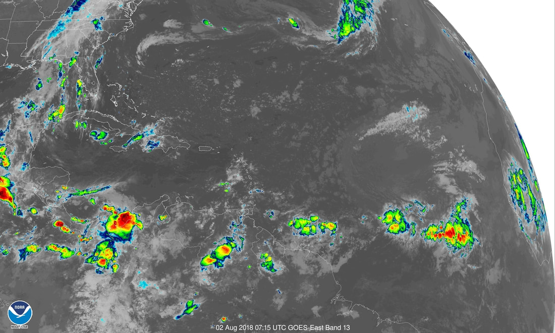
Looks like the Atlantic is coming alive now as a disturbance off Africa will likely become Debby. System over Bahamas will bring rain to Florida and may develop further once in the Gulf of Mexico this holiday weekend.
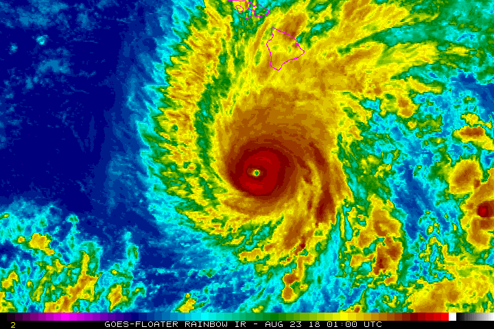
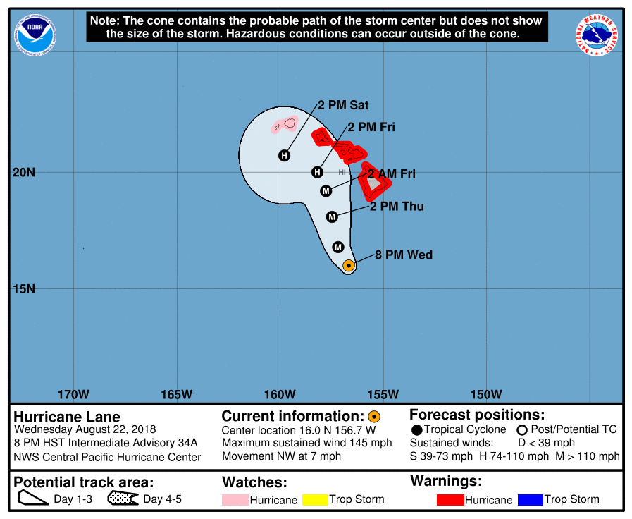
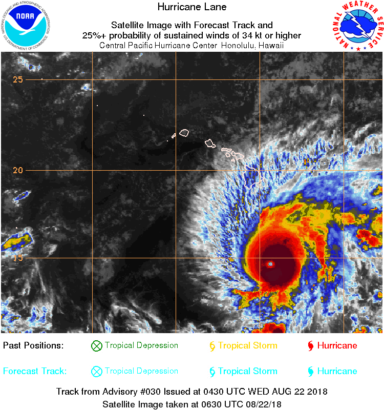
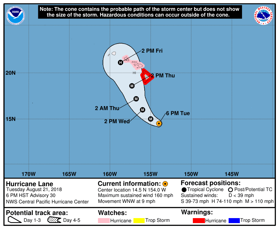
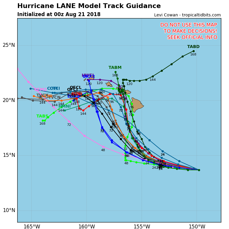
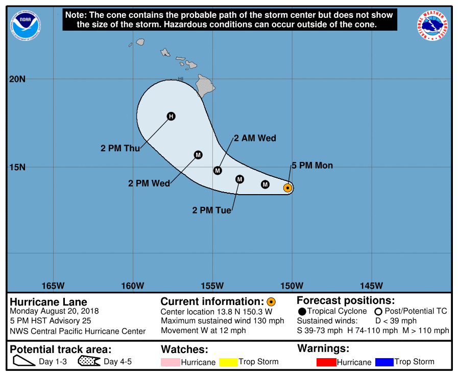
Below- tracks on both of these systems.
Below- tracks on both of these systems.
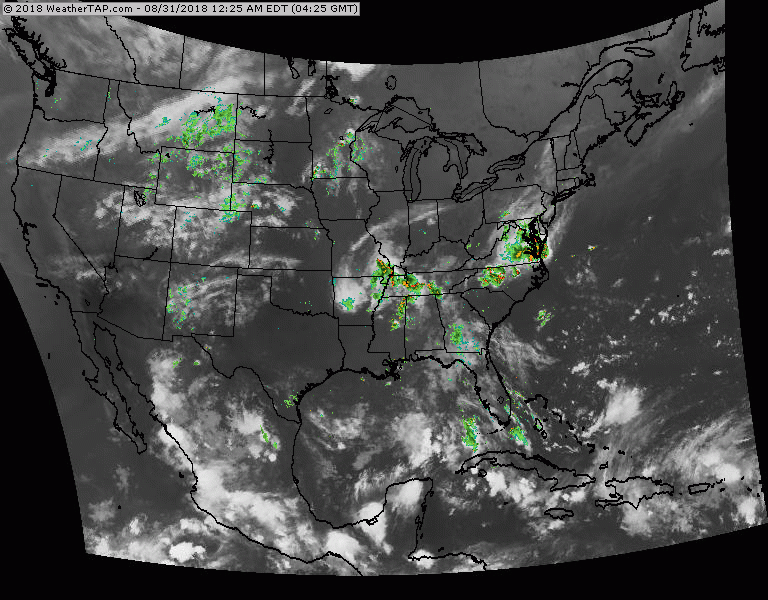
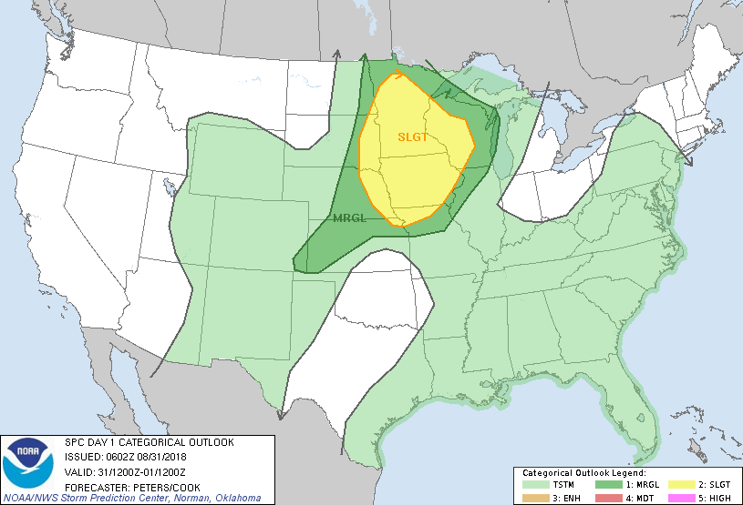
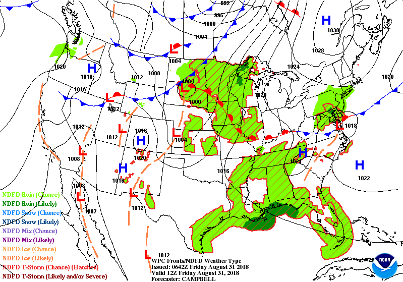
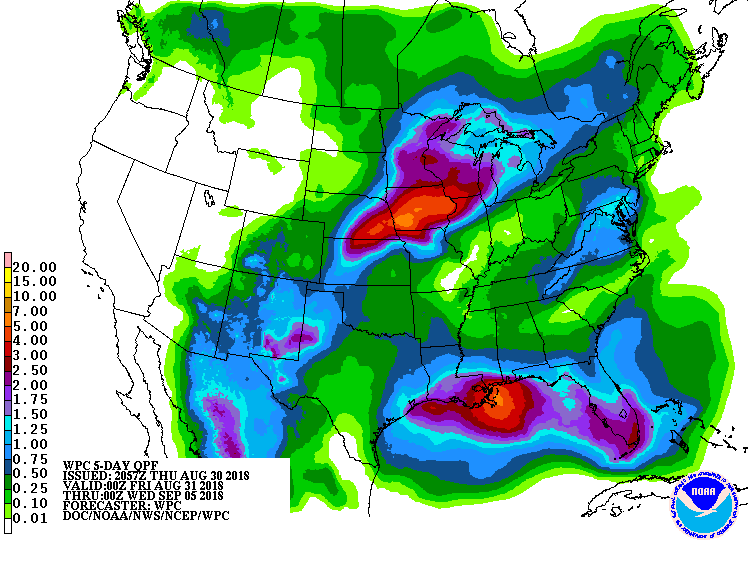
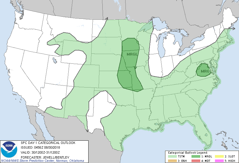
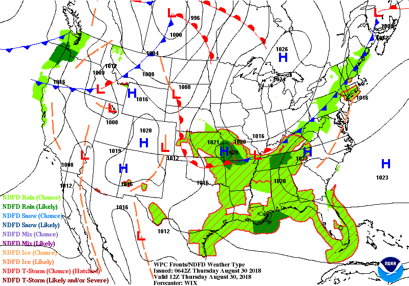
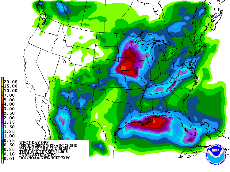
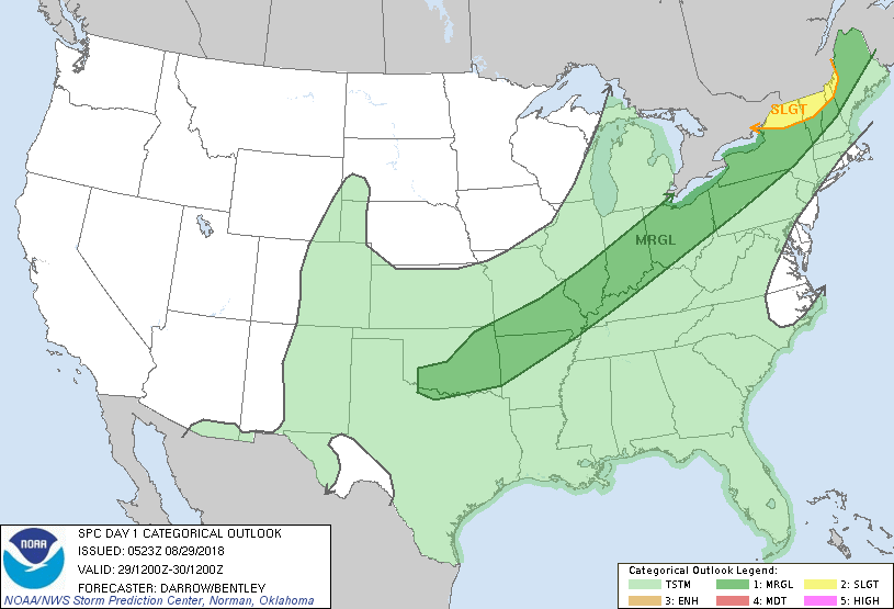
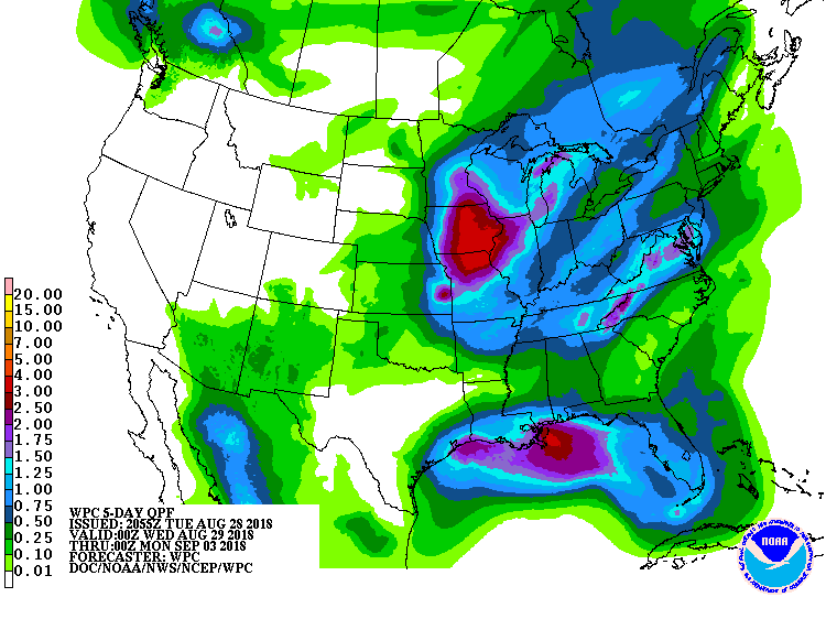
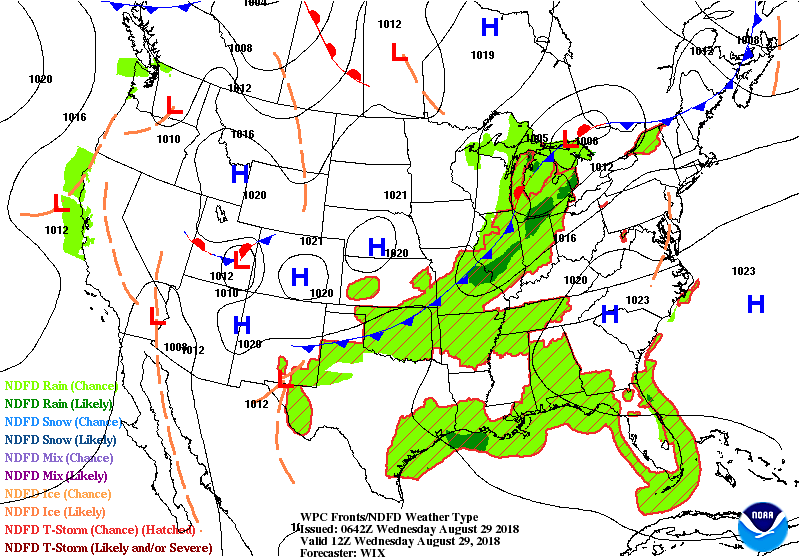
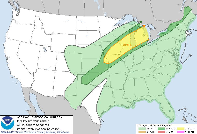
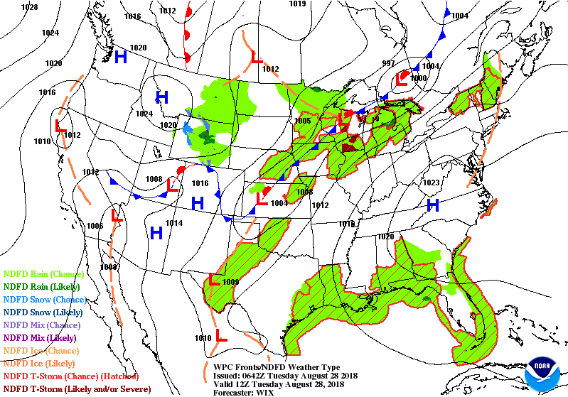
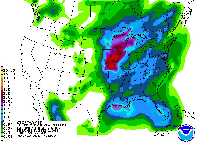
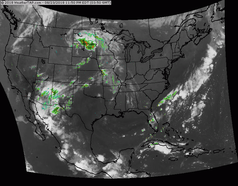
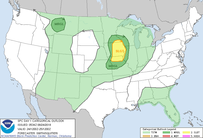
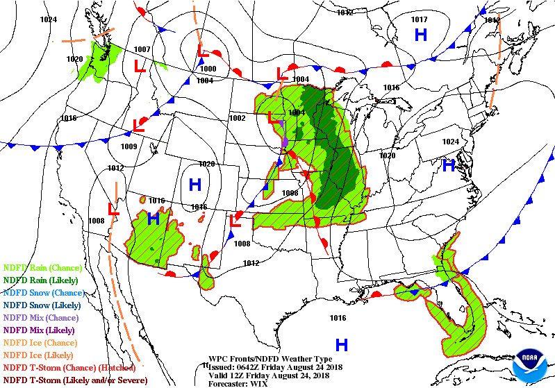
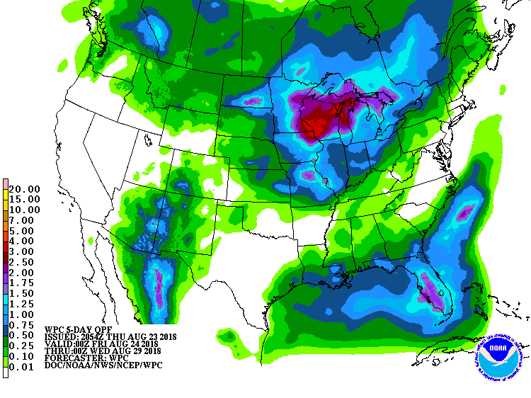
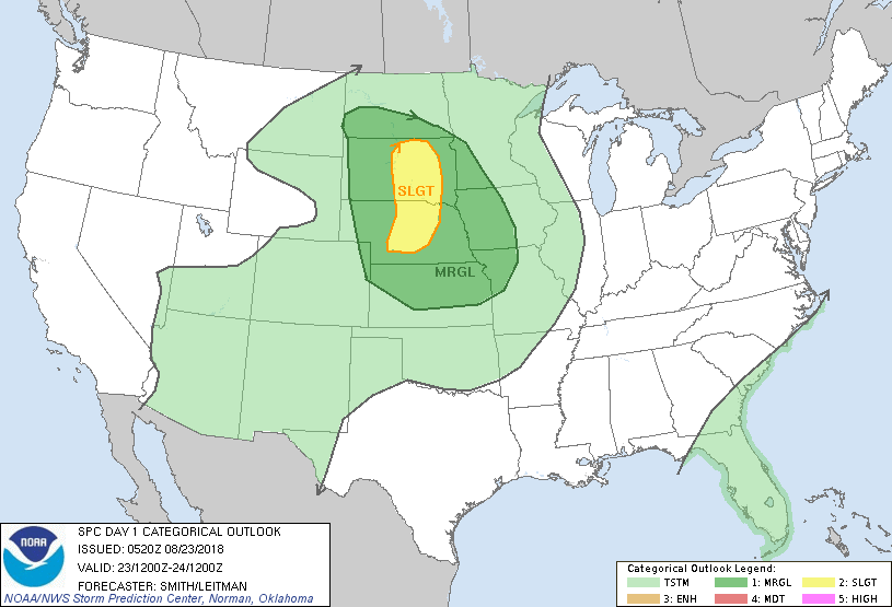
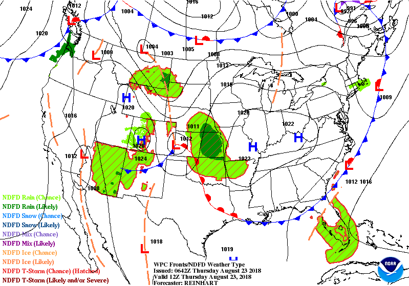
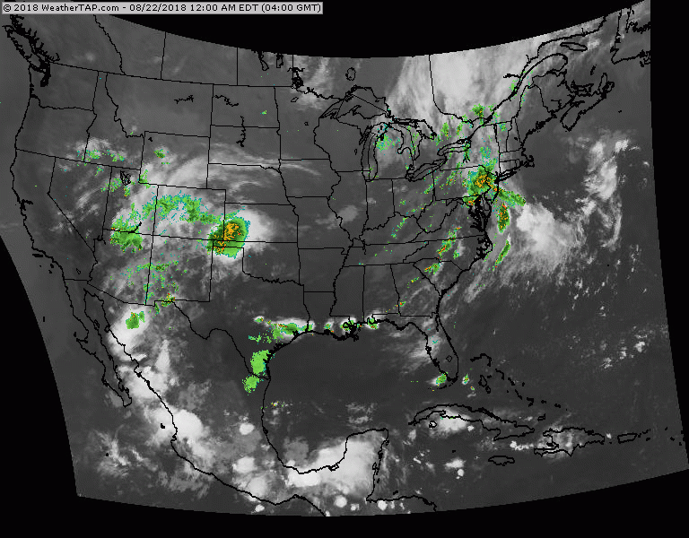
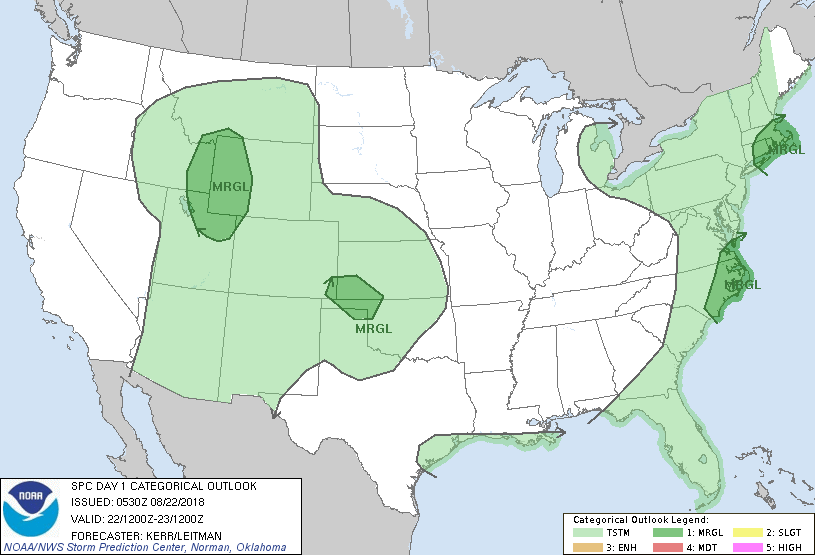
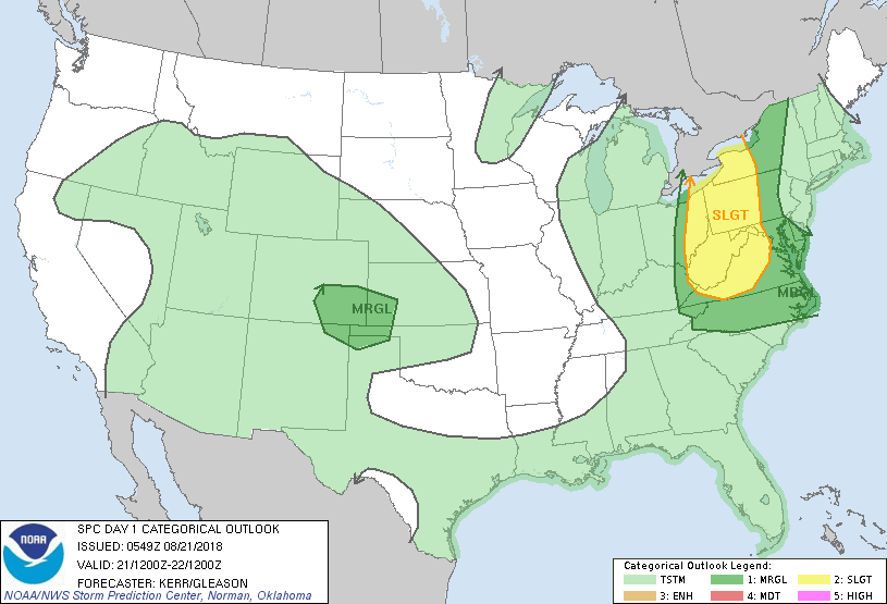
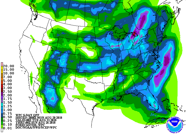
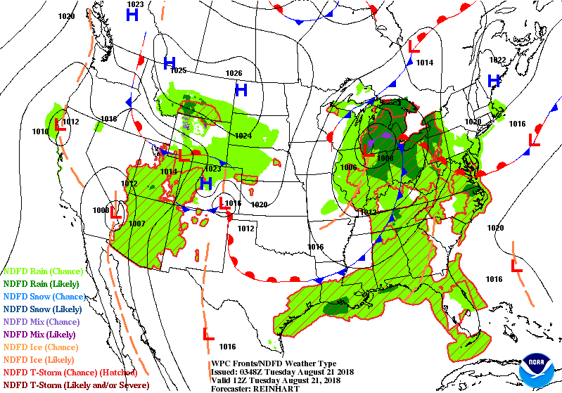
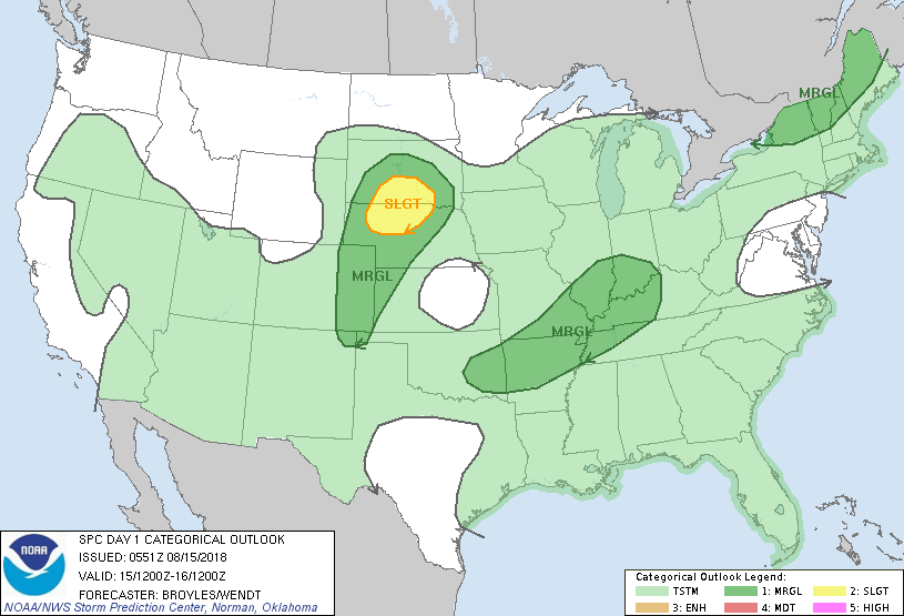
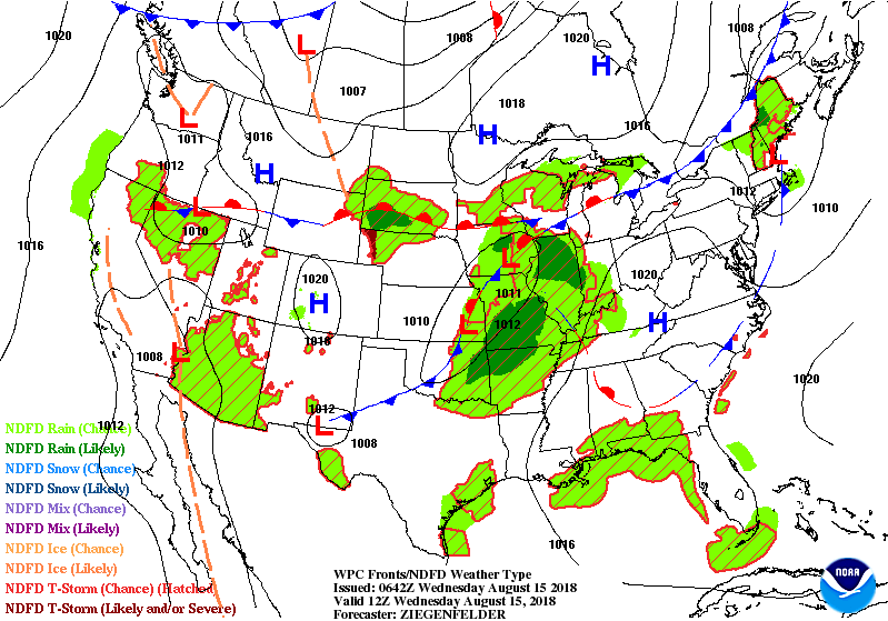
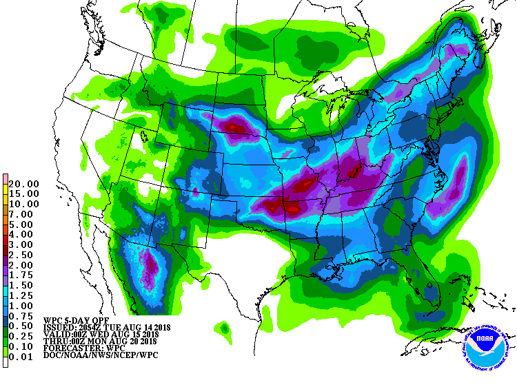
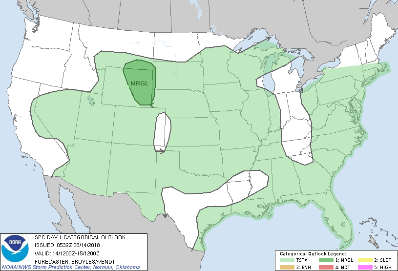
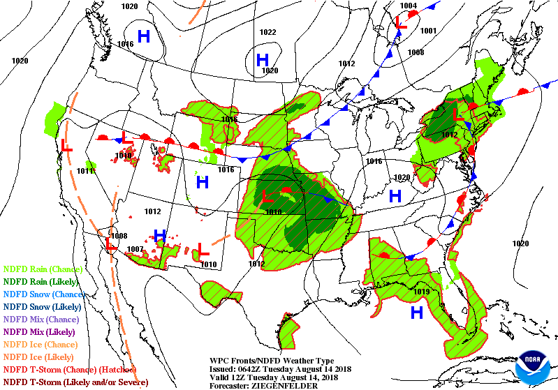
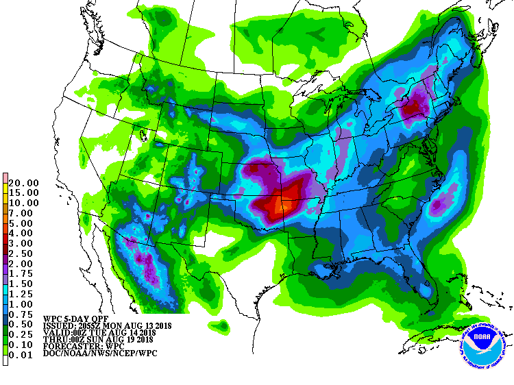
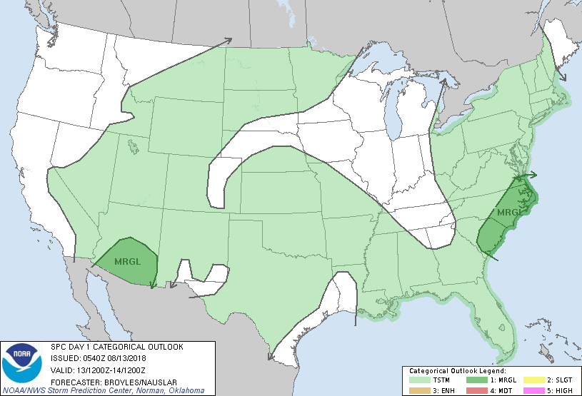
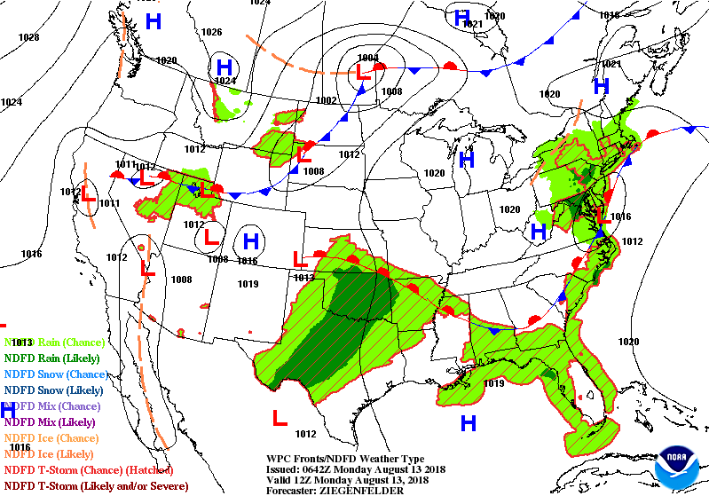
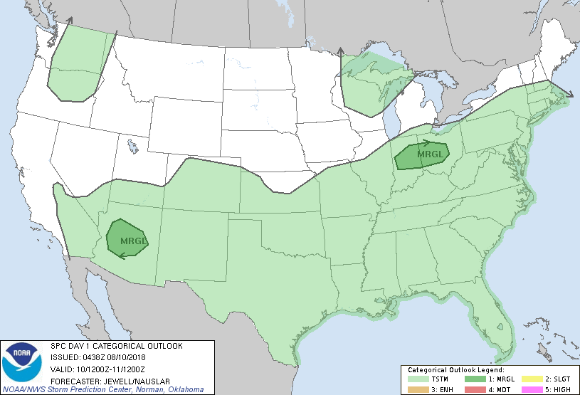
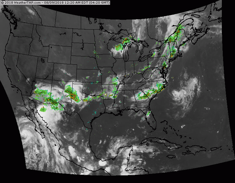
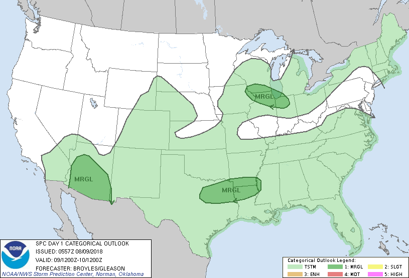
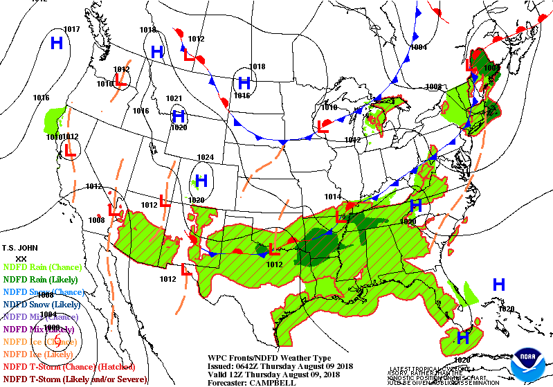
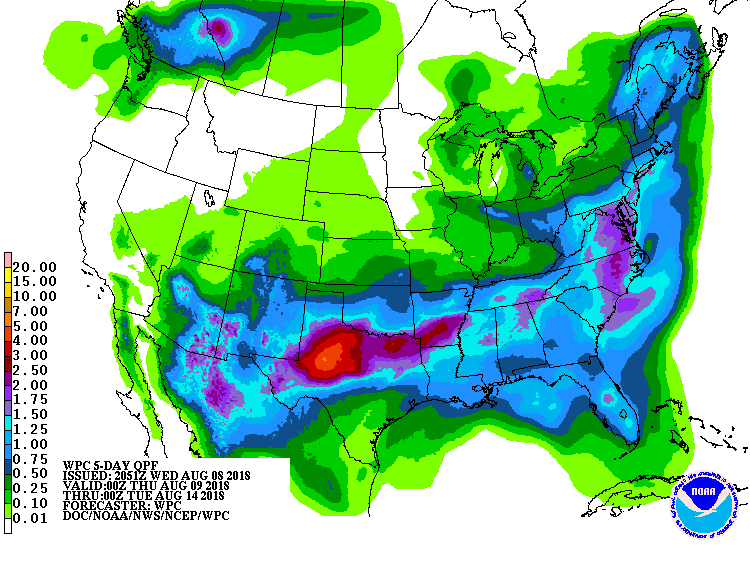
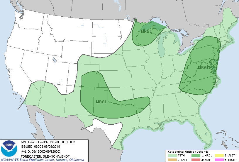
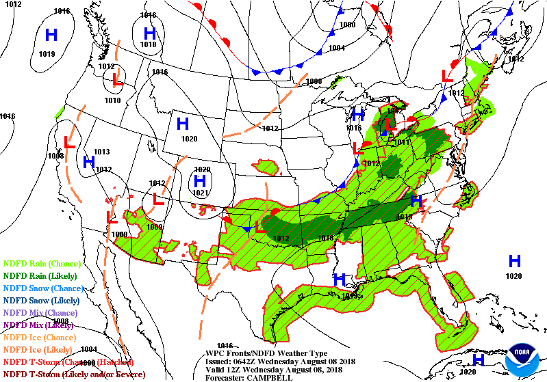
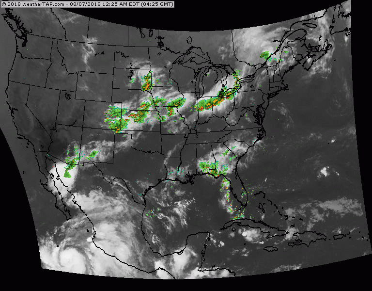
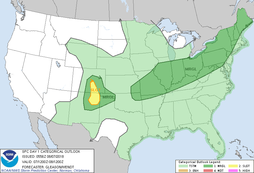
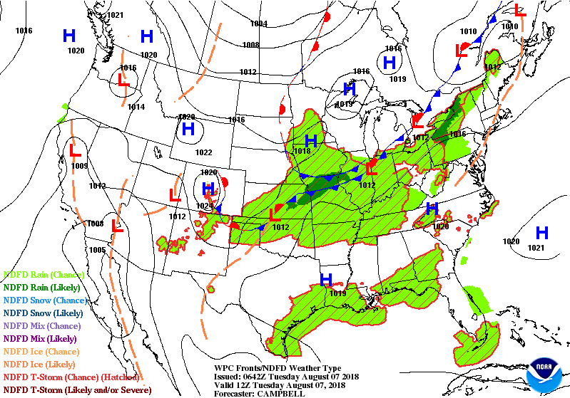
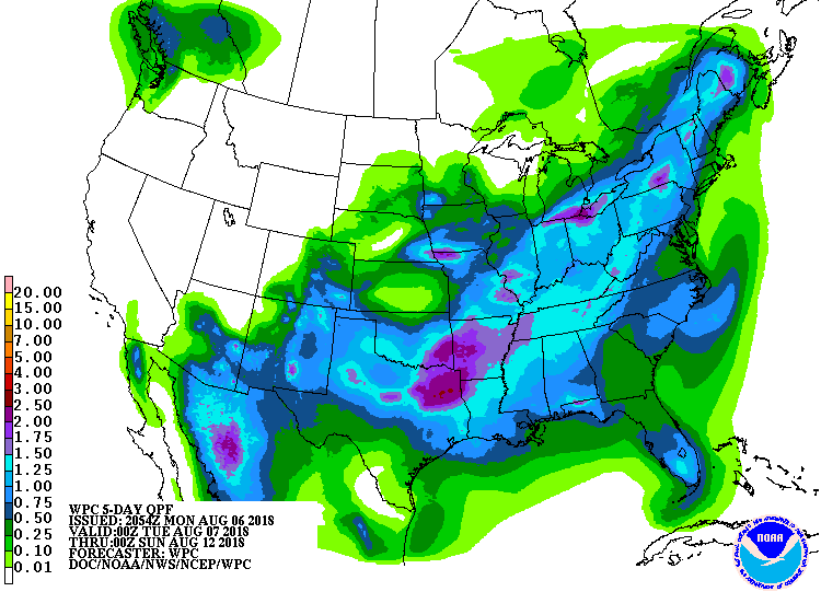
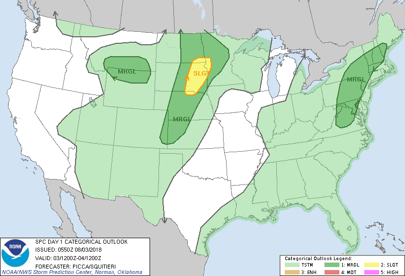
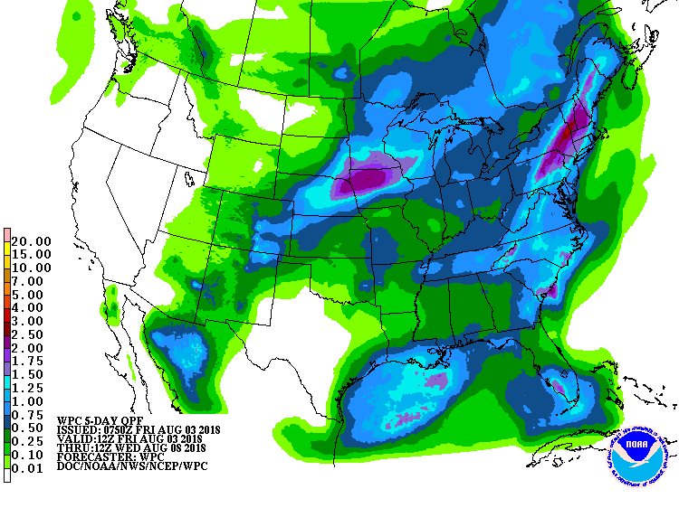
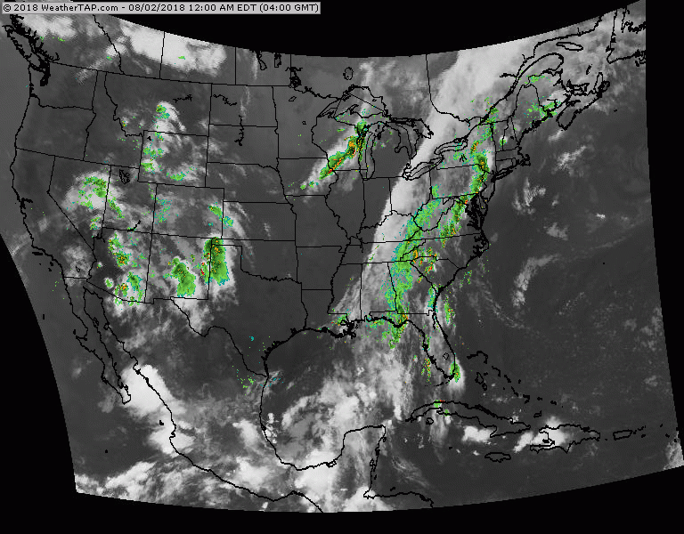
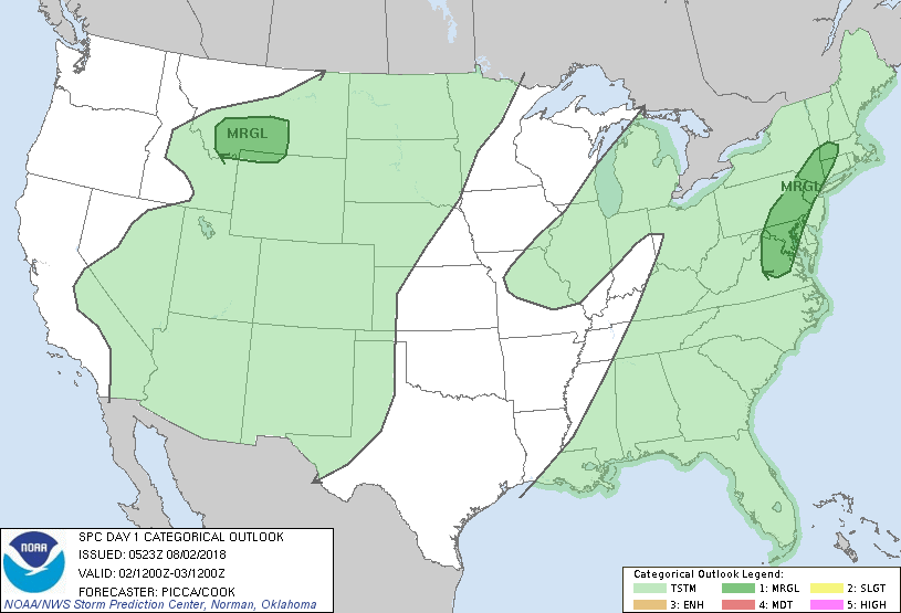
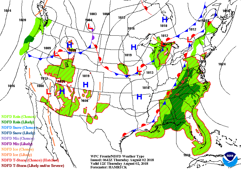
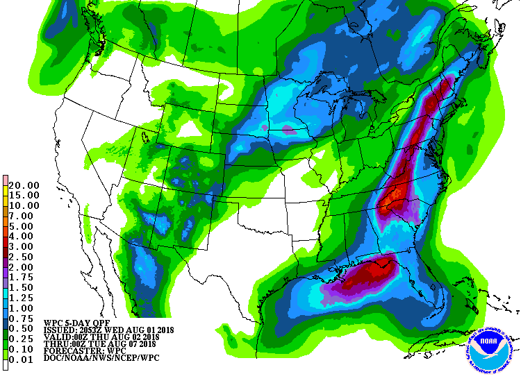
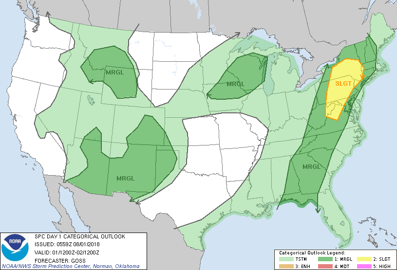
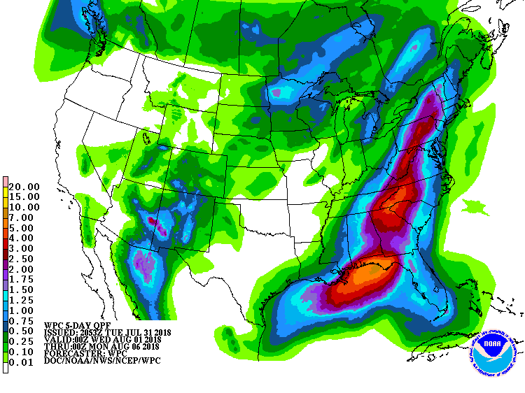
Satellite-radar shows showers over Mid Atlantic spreading into Northeast. Showers and storms in Midwest reach the East by late weekend and early next week. Below- today's severe outlook in dark green and yellow followed by animated maps and rainfall predictions for next 5 days.
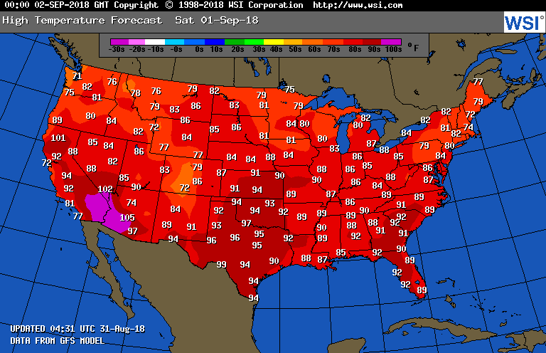
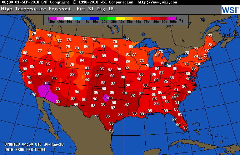
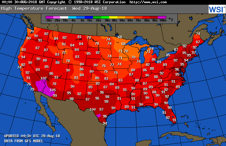
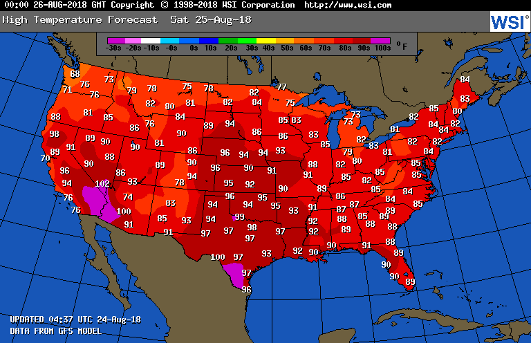
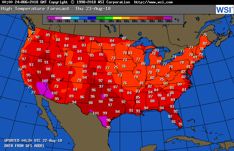
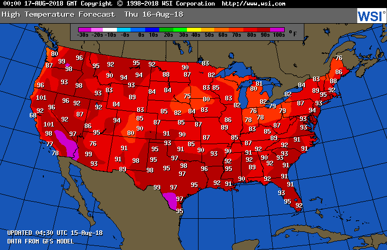
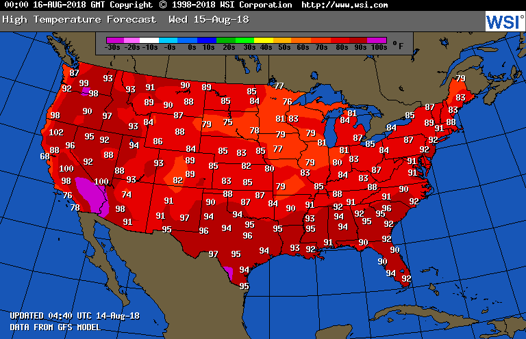
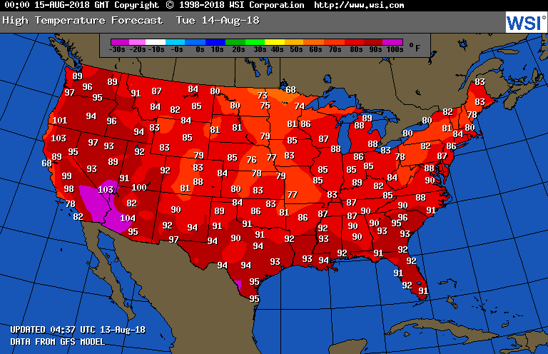
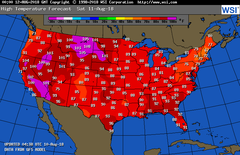
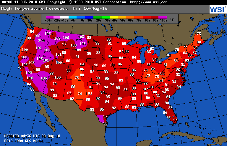
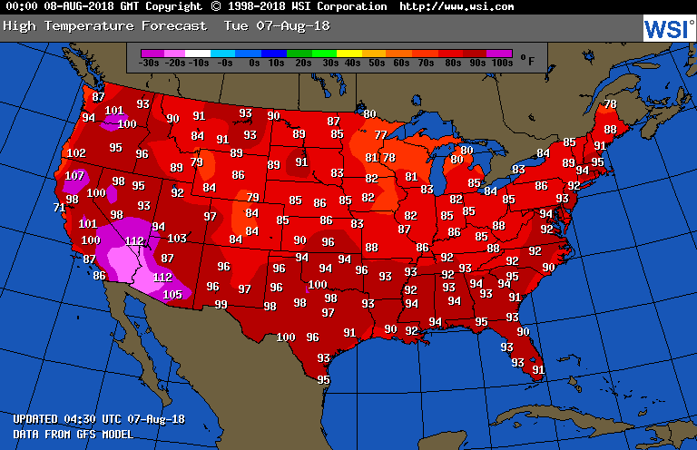
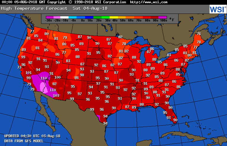
Lastly - high temperatures tomorrow. Have a nice and safe holiday weekend.


 RSS Feed
