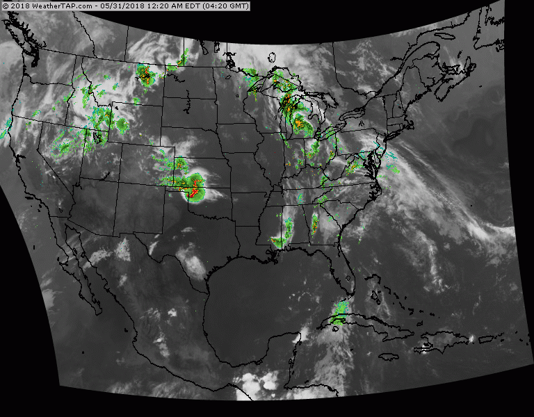
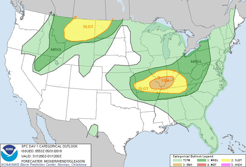
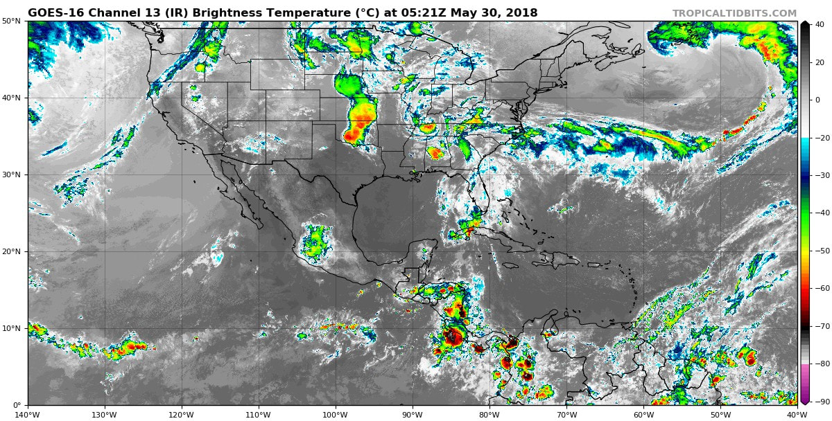
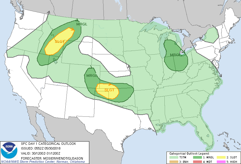
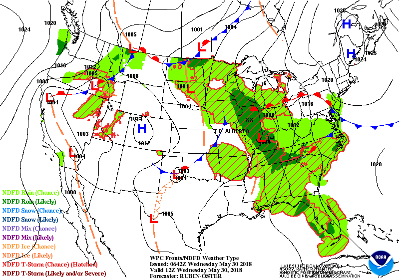
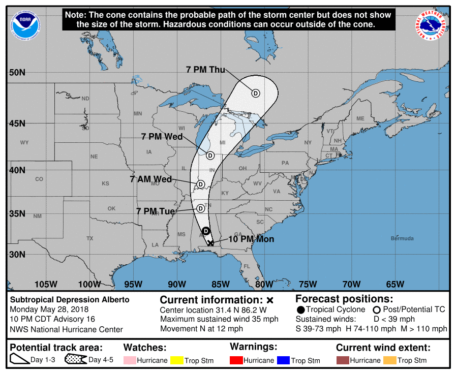
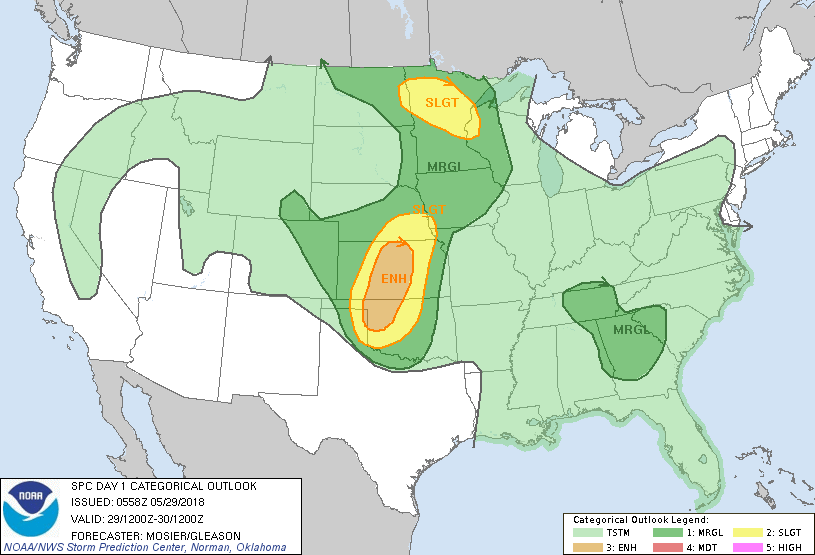
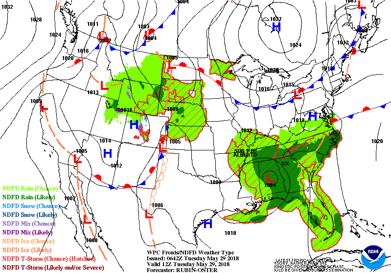
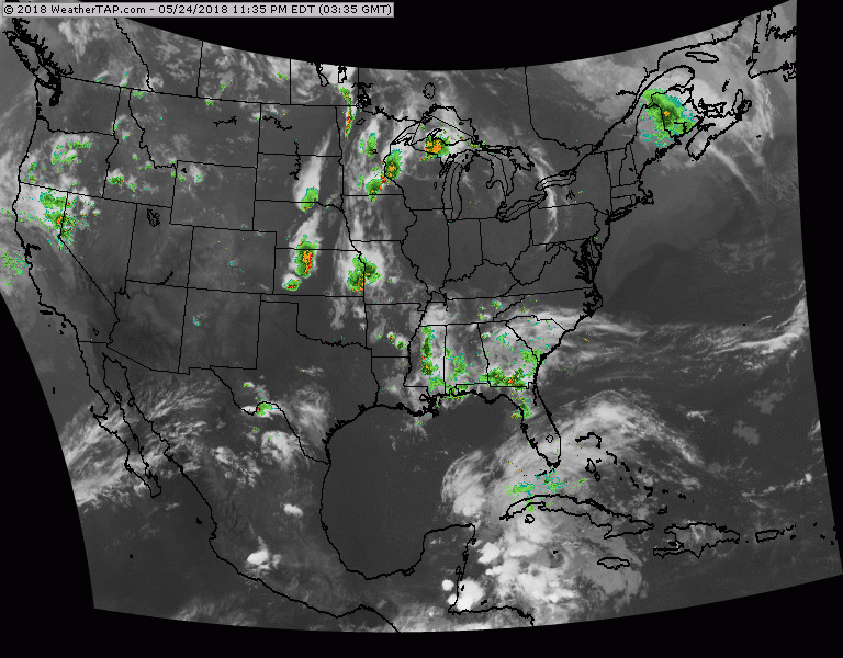
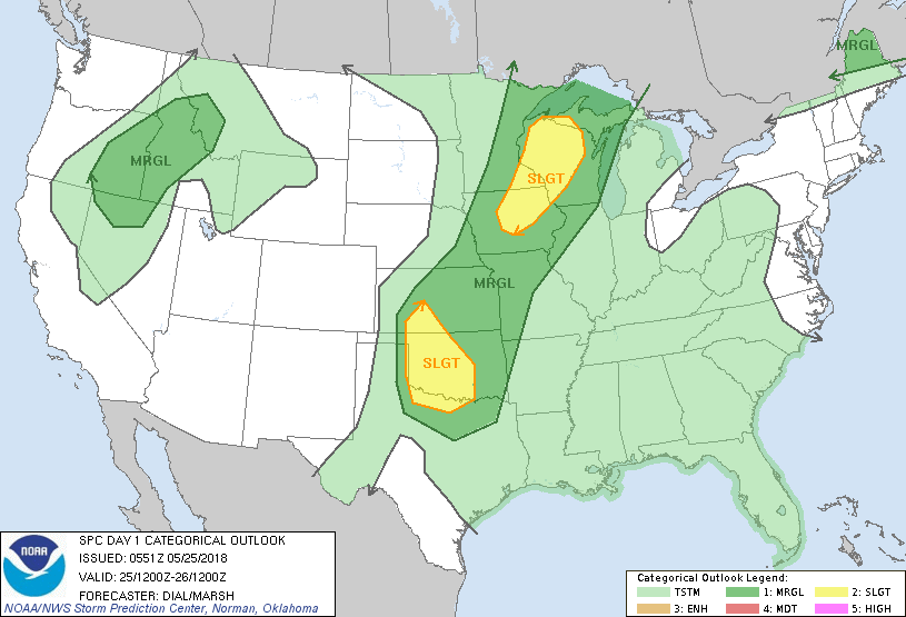
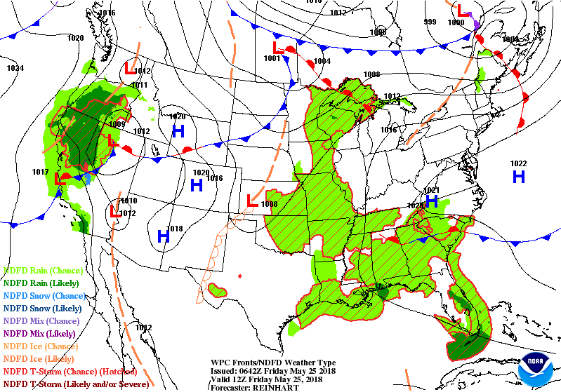
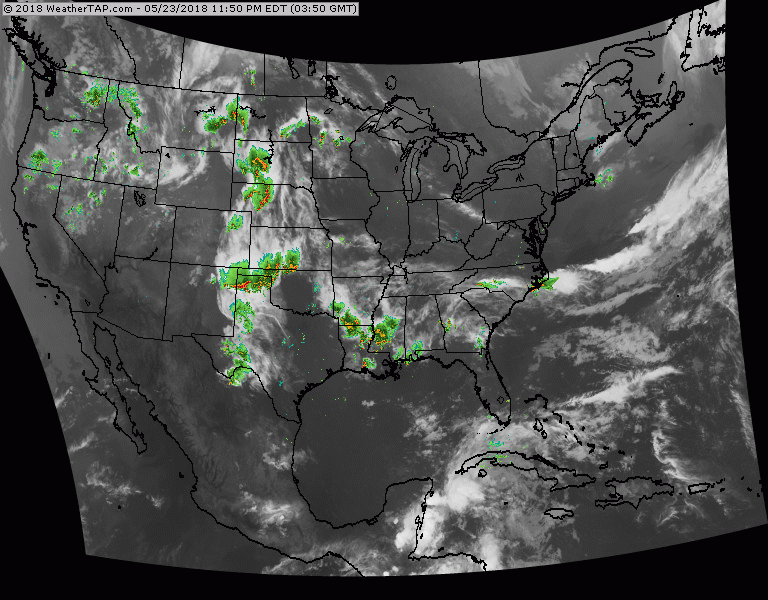
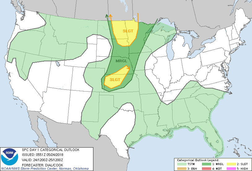
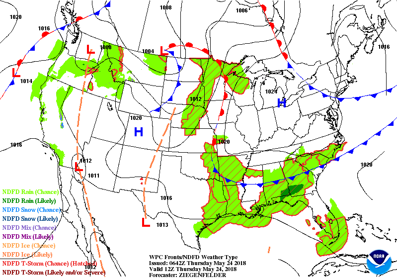
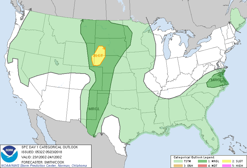
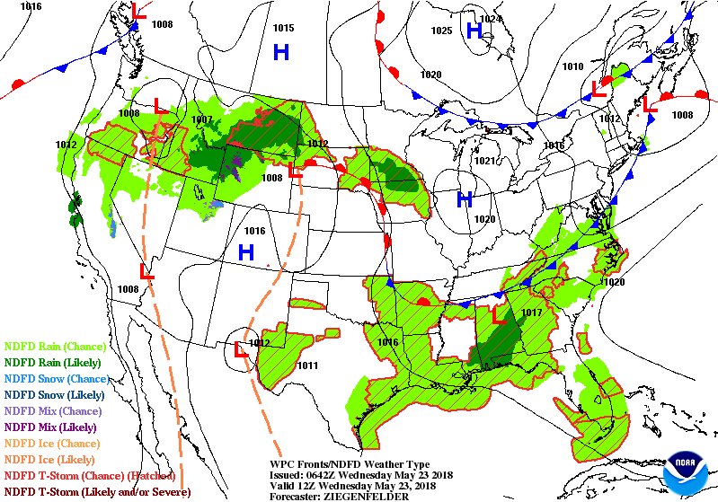
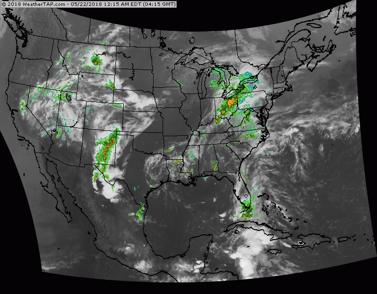
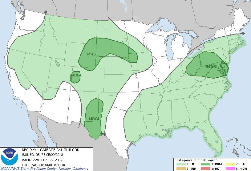
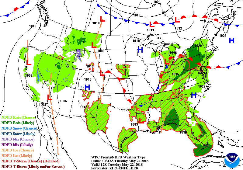
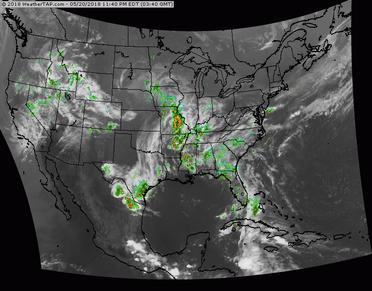
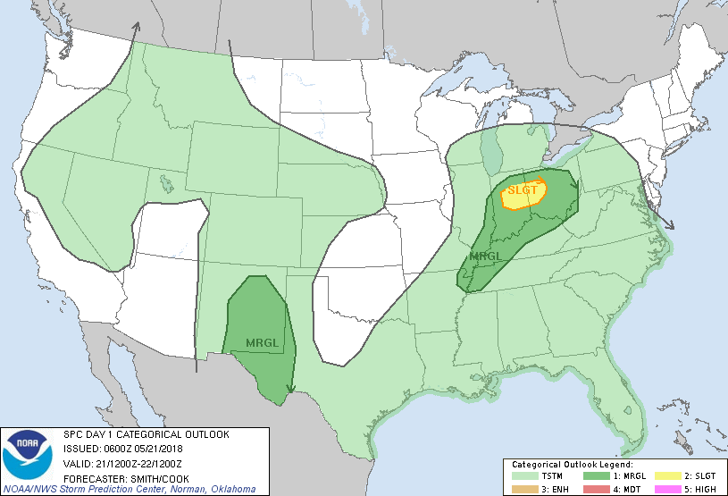
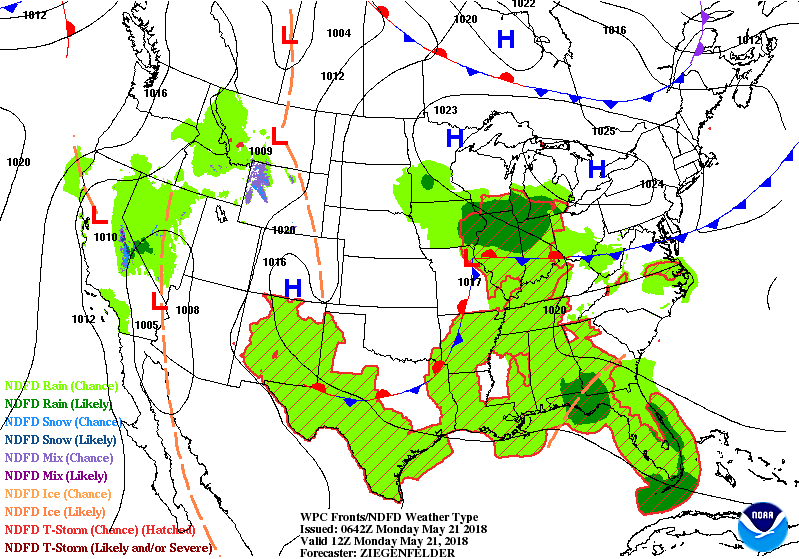
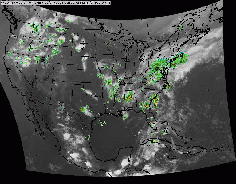
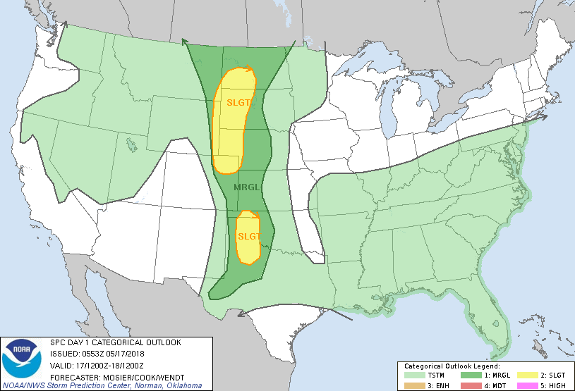
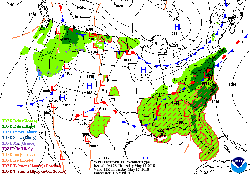
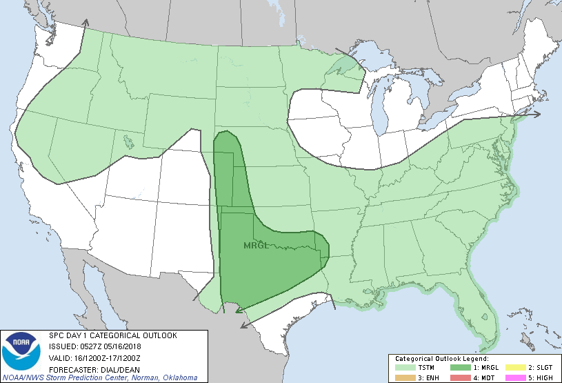
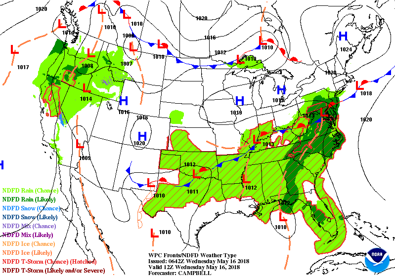
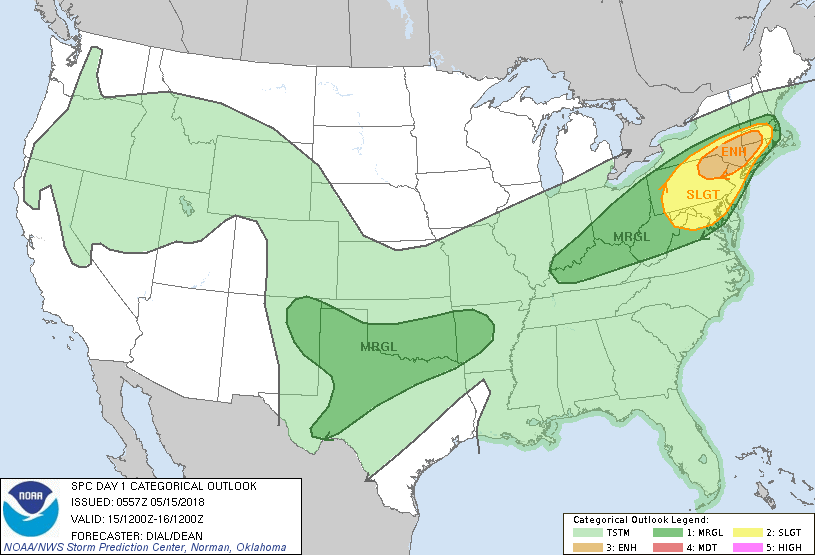
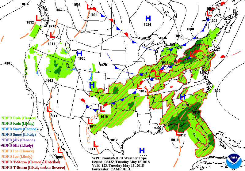
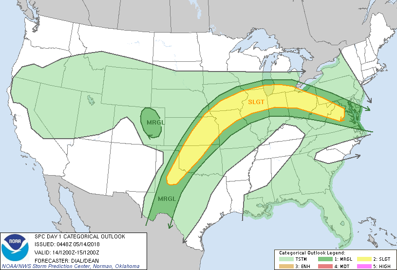
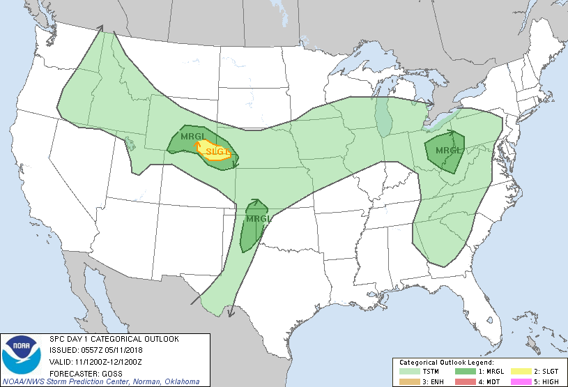
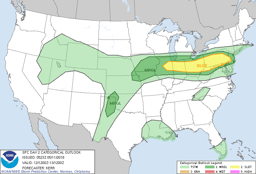
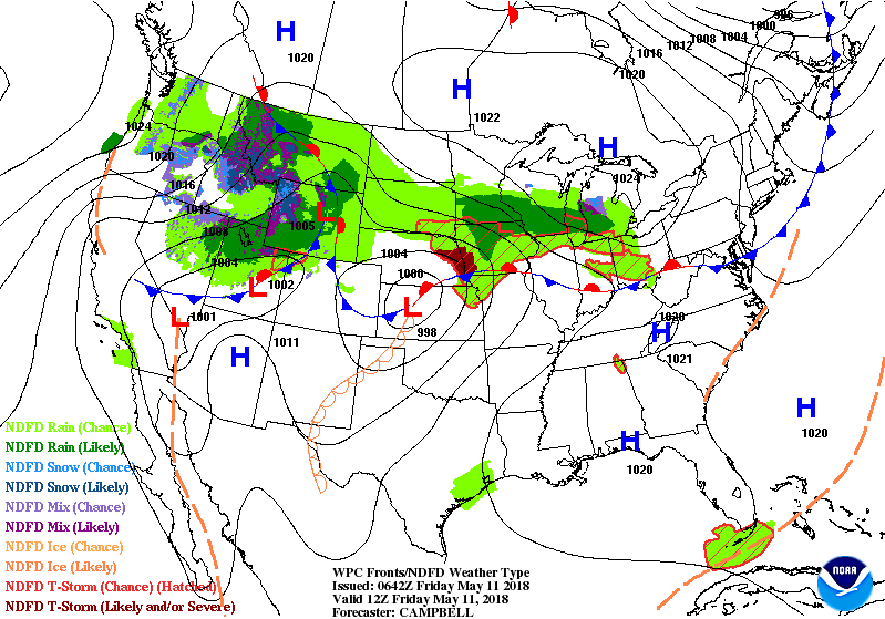
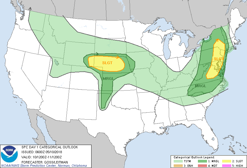
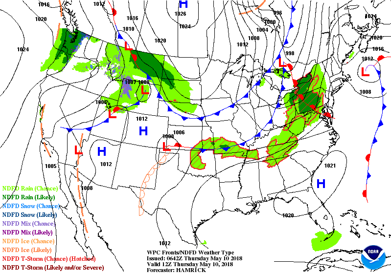
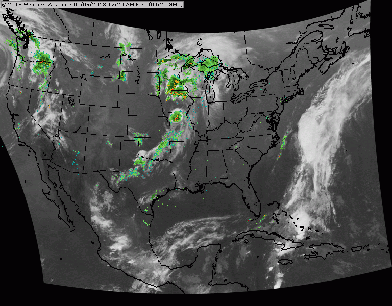
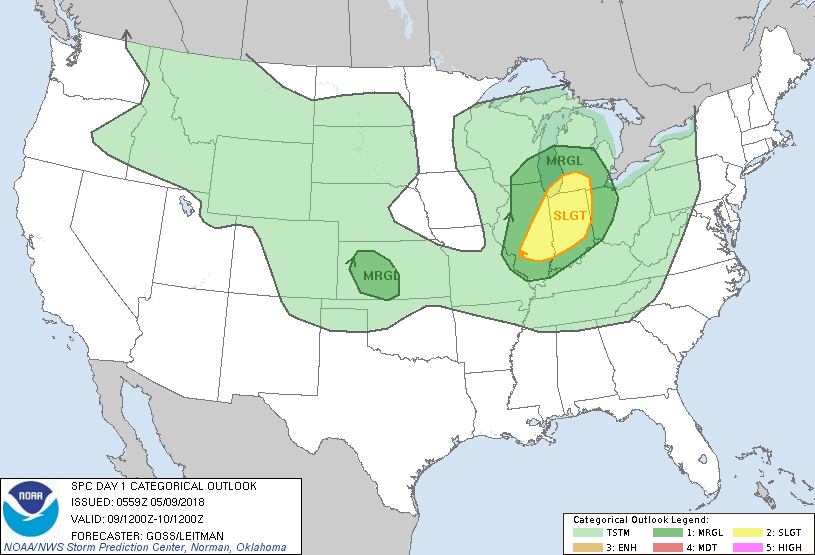
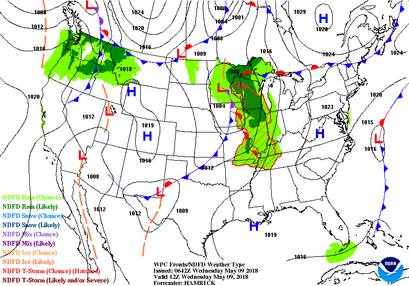
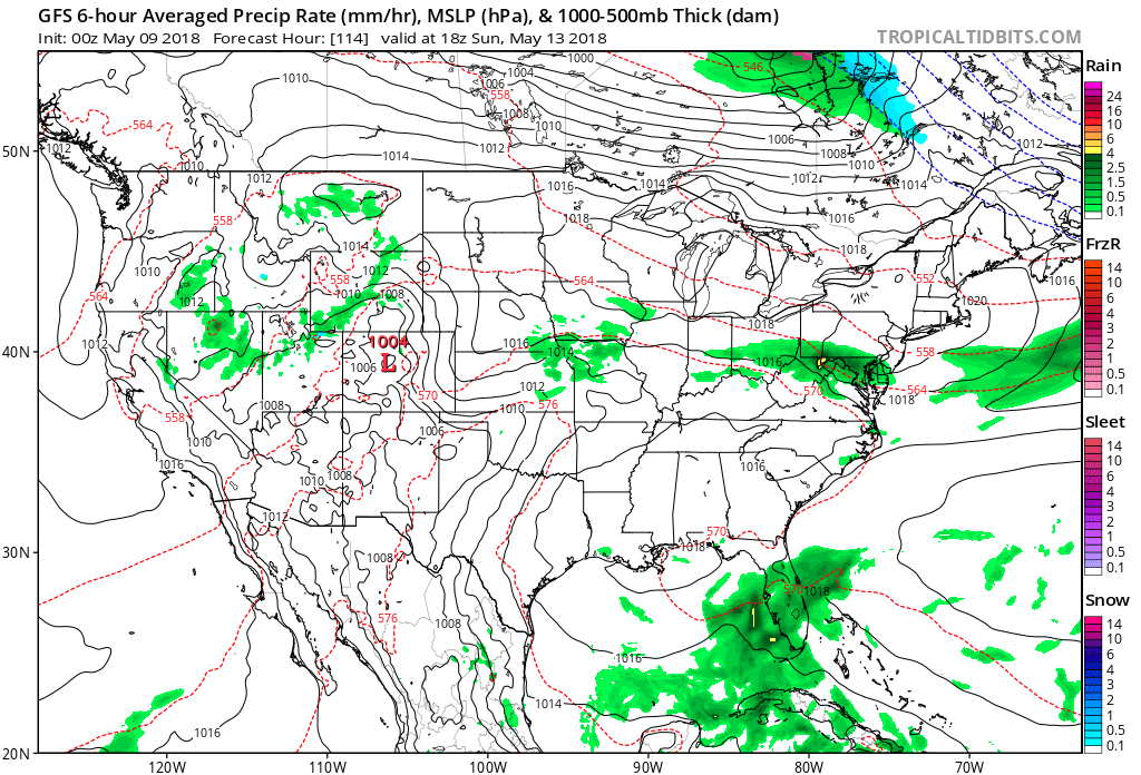
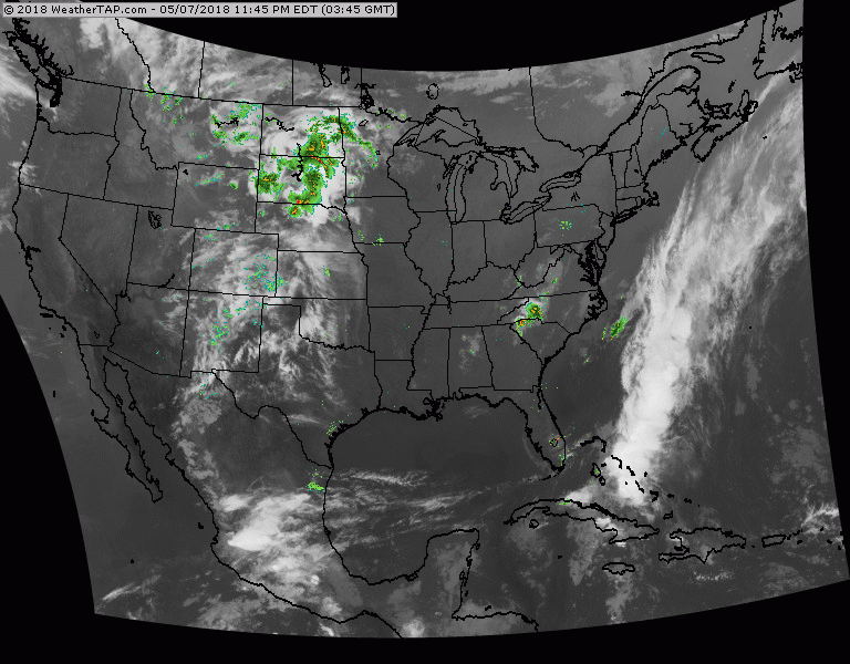
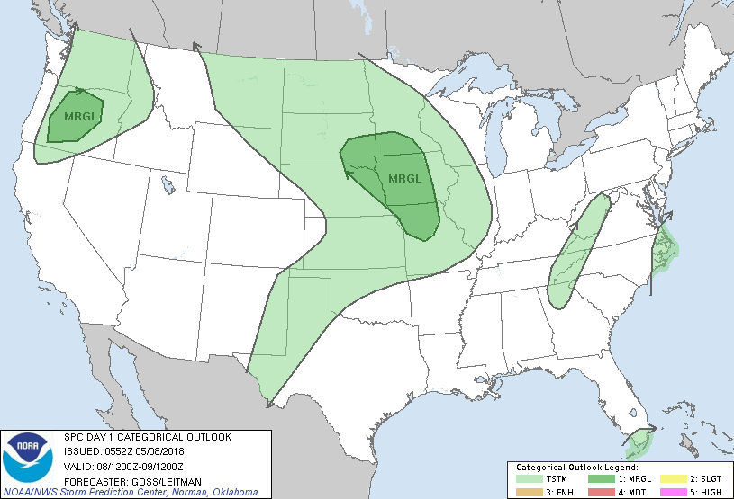
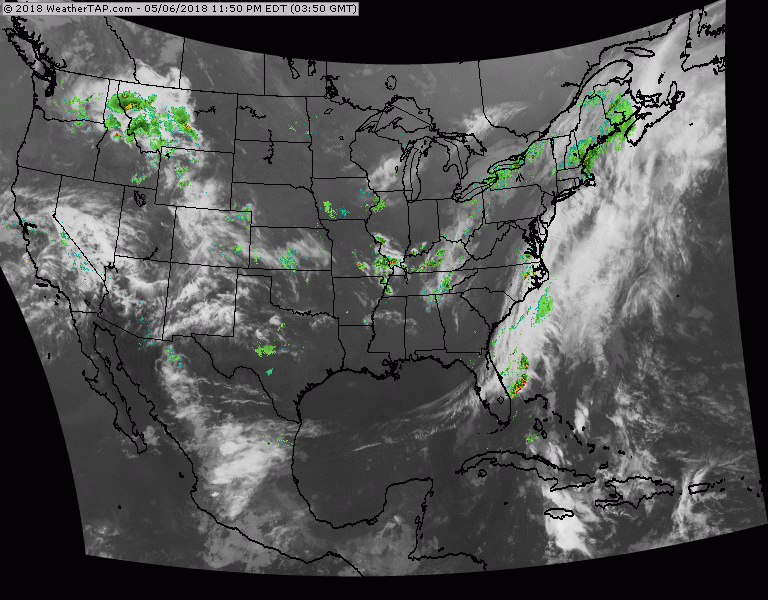
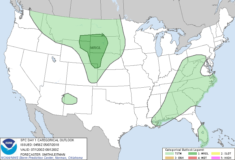
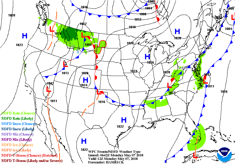
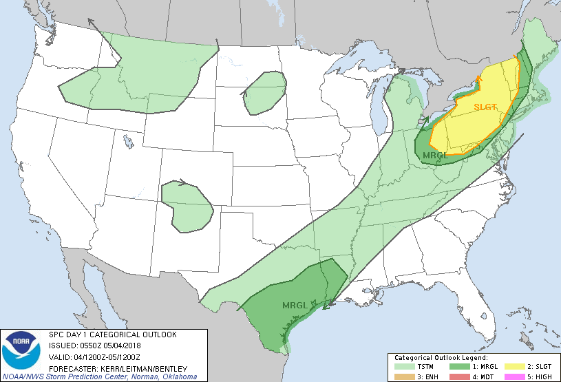
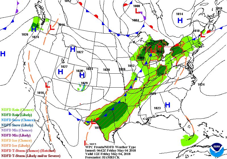
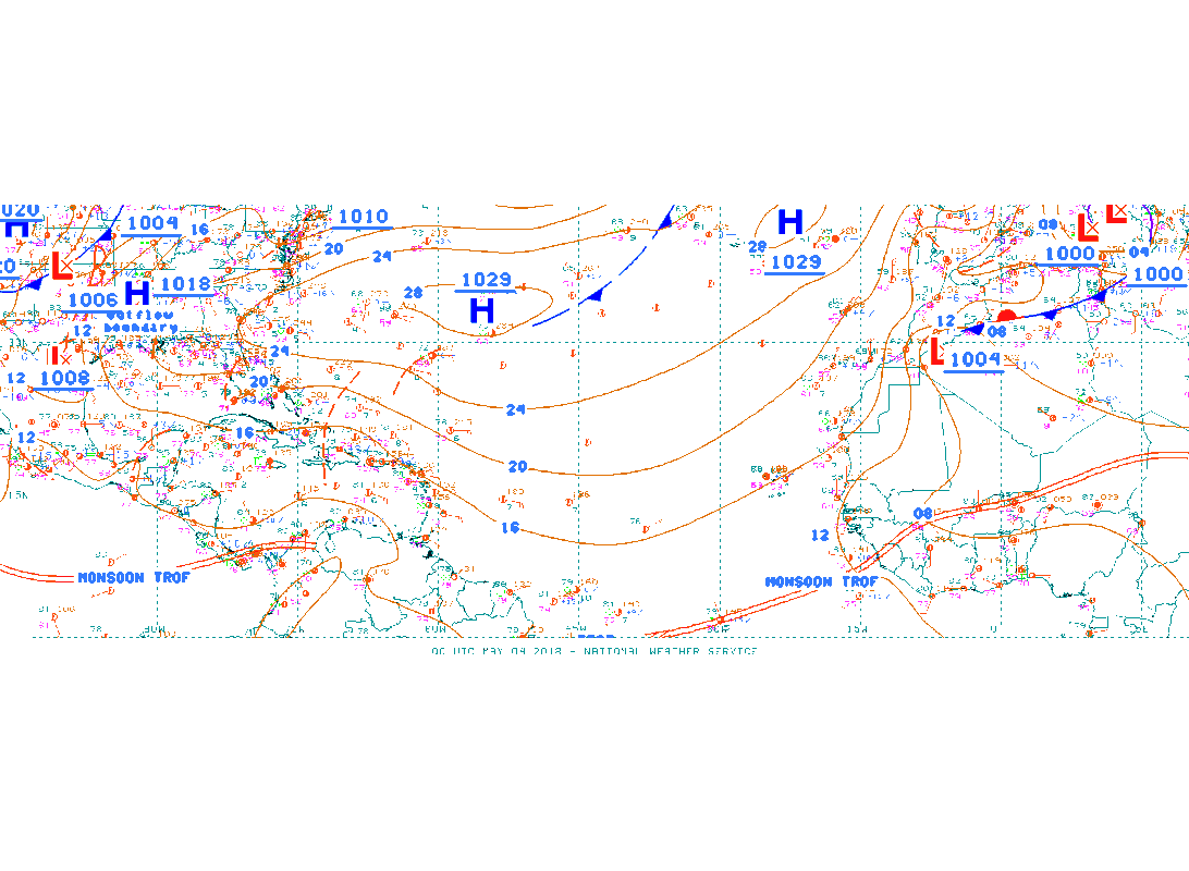
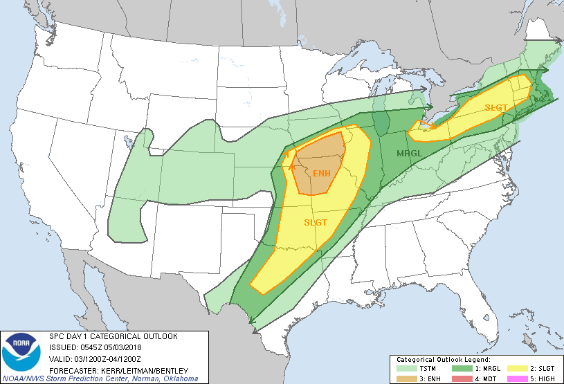
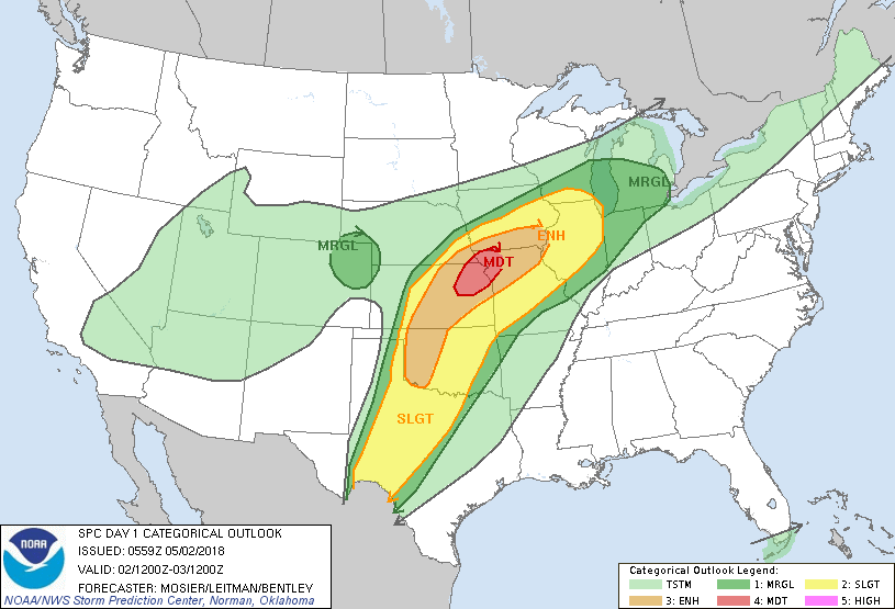
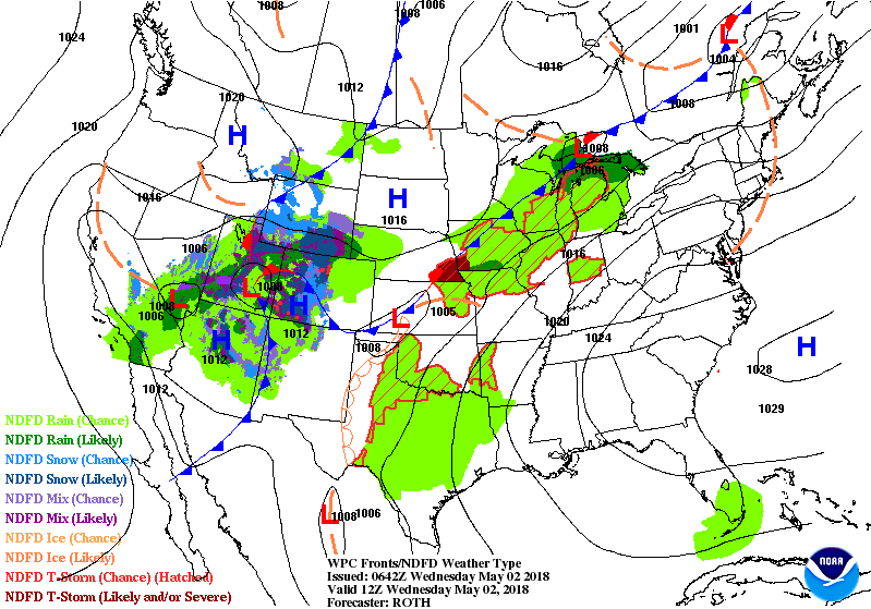
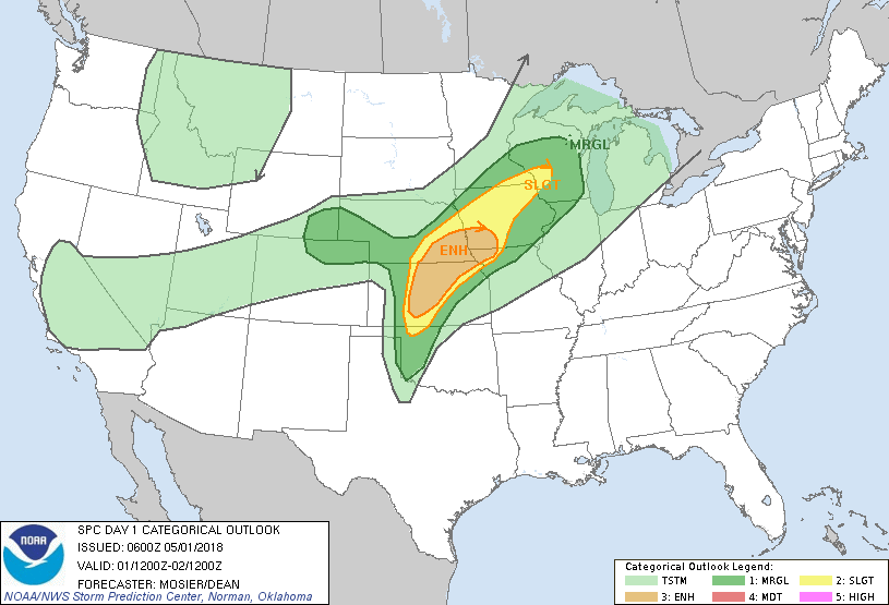
Satellite-radar shows moisture from Great Lakes to Southeast....moving north and this flow not likely to change into weekend. Heavy thunderstorms in So. Plains moves east to join this band over next couple. Showers in No. Rockies make it to Northeast early next week to continue an unusual spell of wet - unsettled weather. Below - today's risk of severe weather in dark green...yellow and tan. 
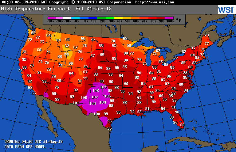
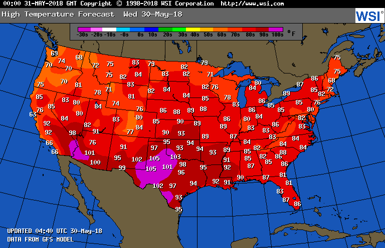
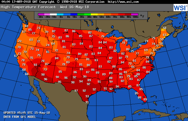
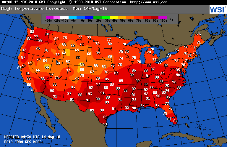
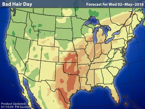
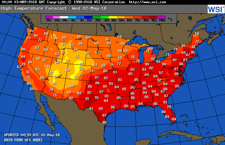
Below - temperatures for Friday. Heatwave in South Central. Followed by animated maps for the next couple. 
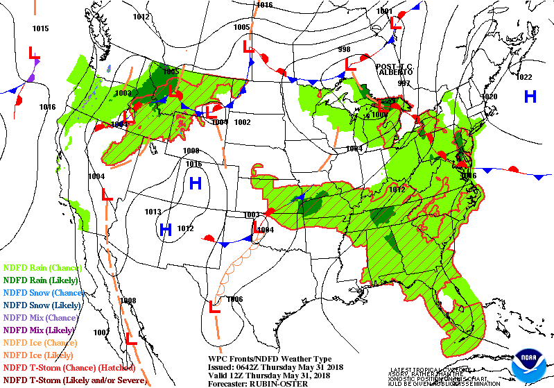
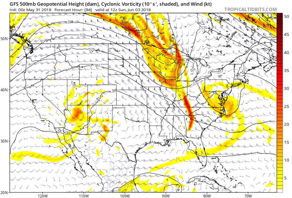
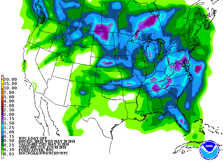
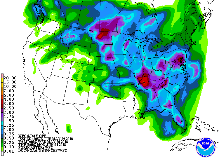
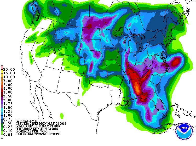
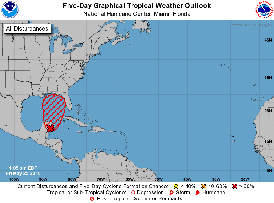
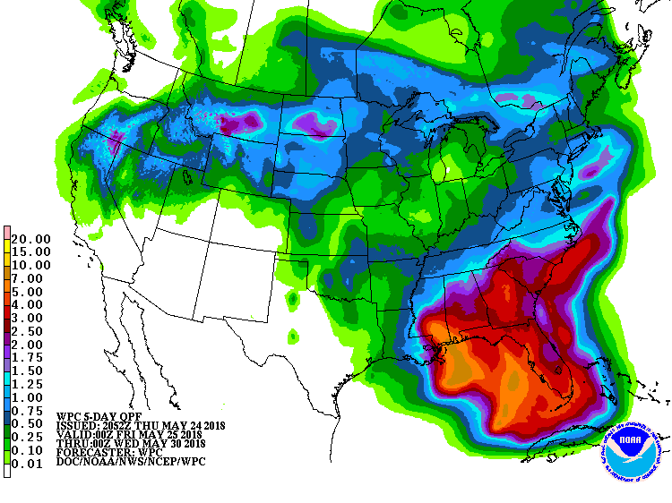
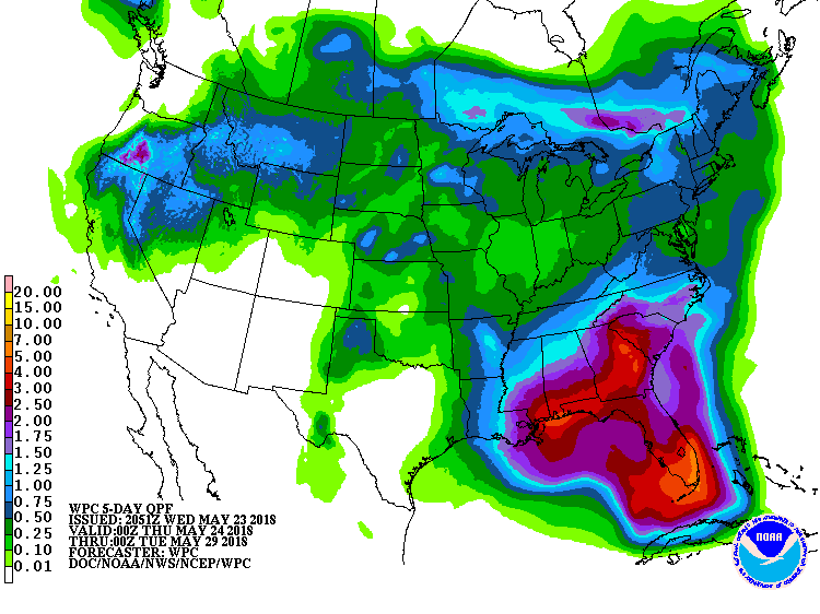
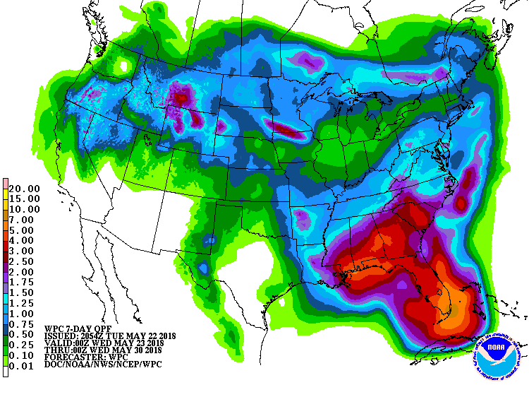
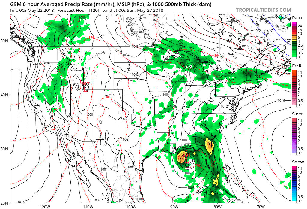
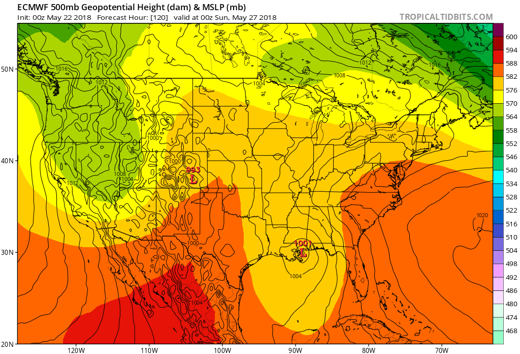
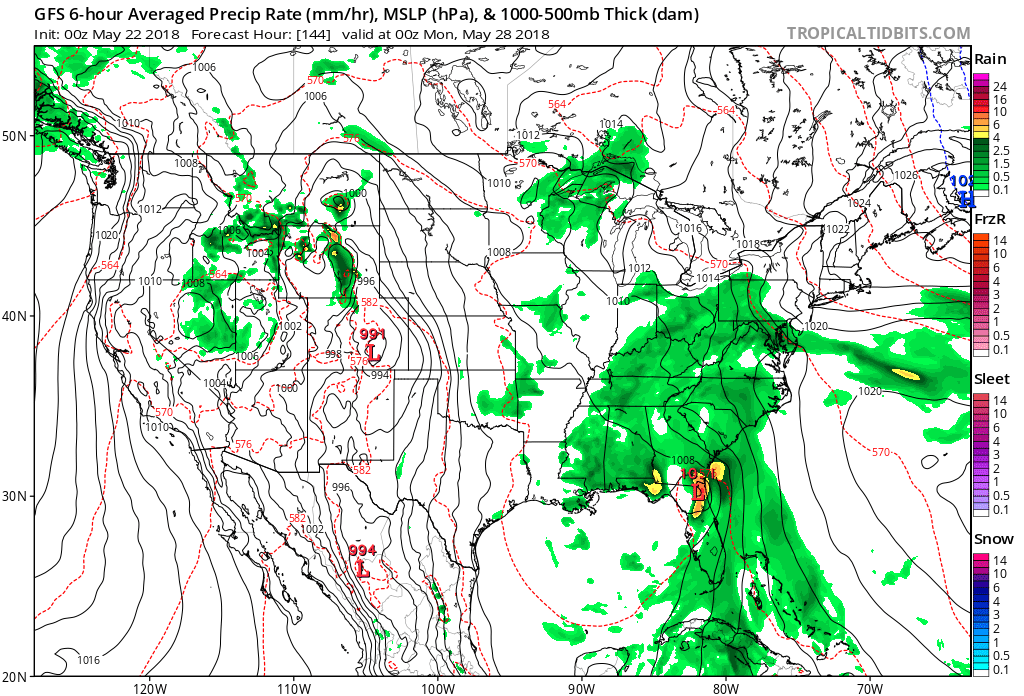
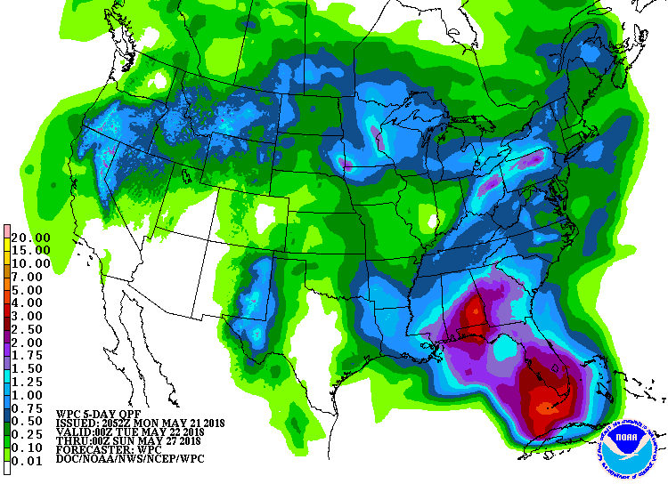
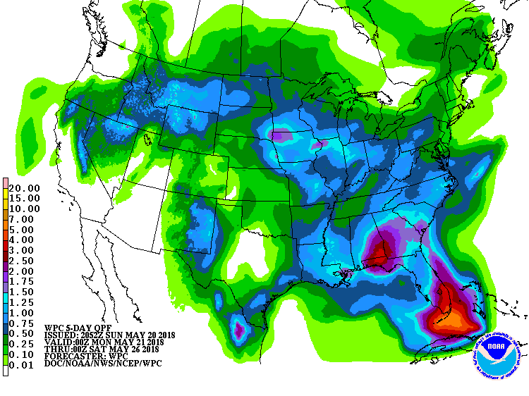
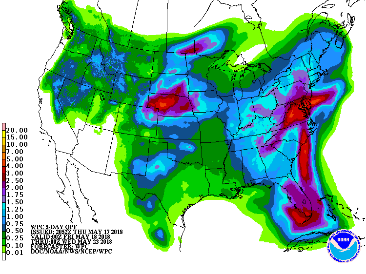
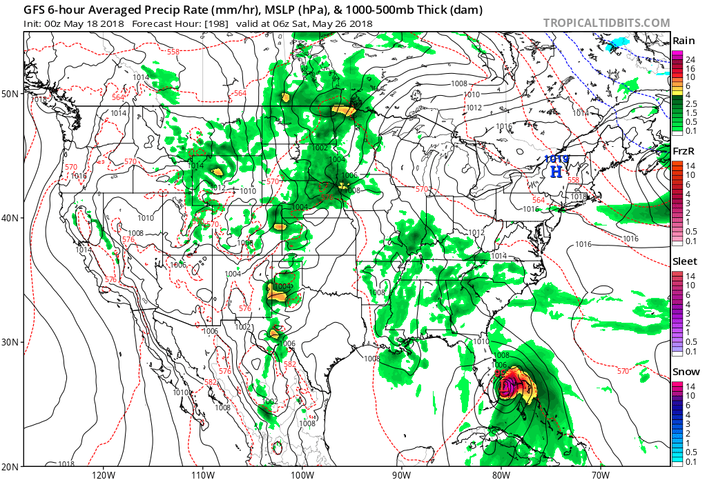
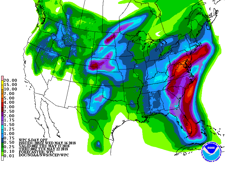
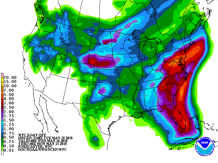
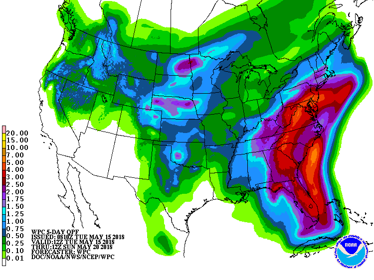
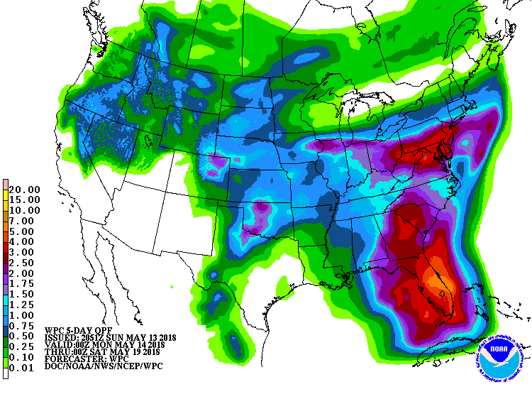
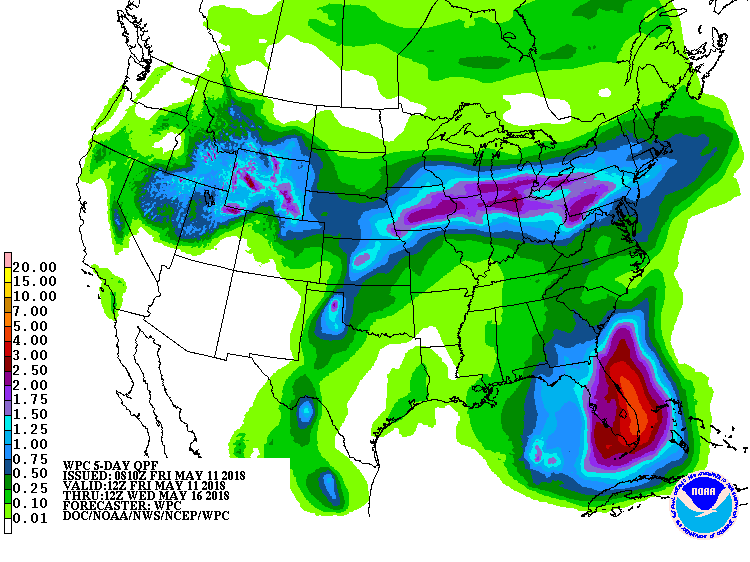
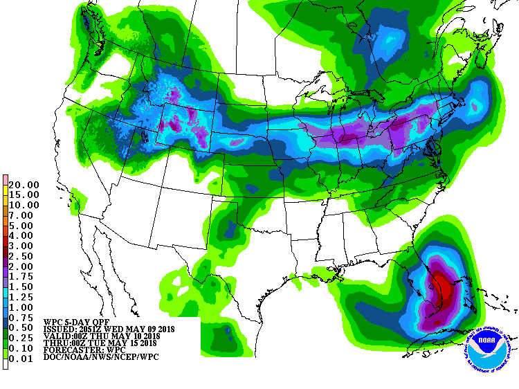
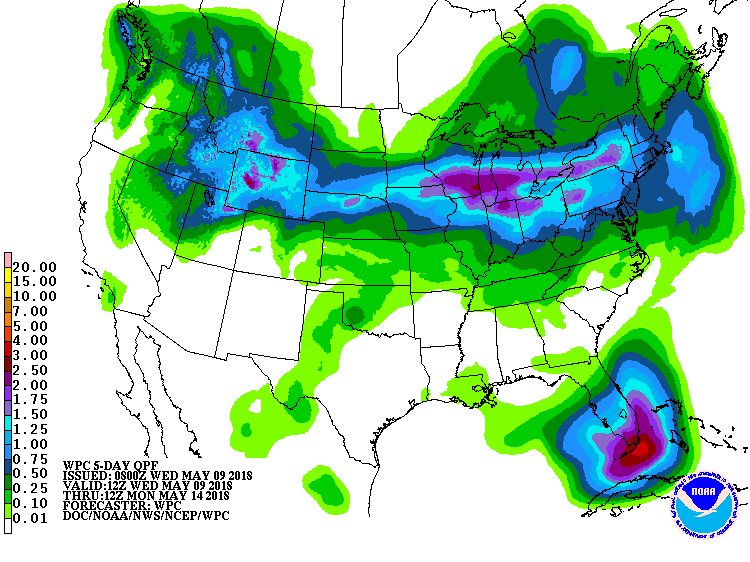
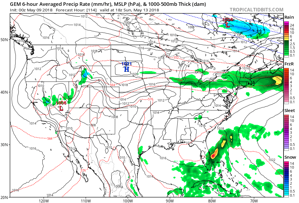
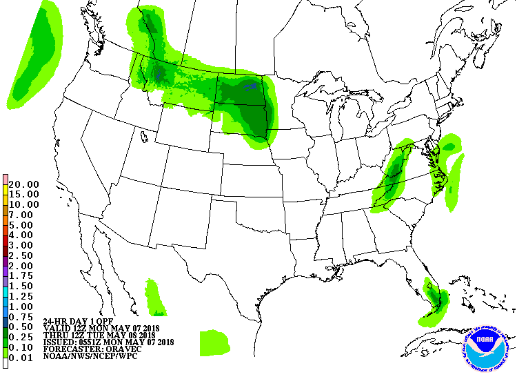
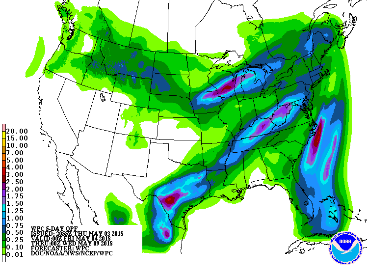
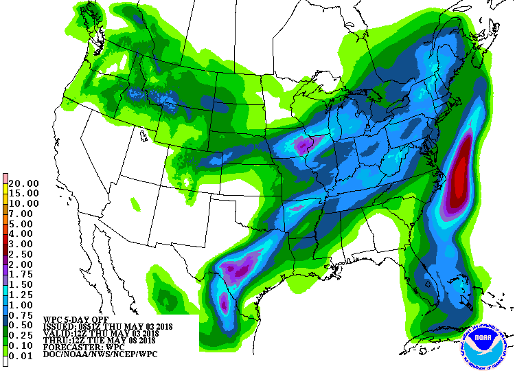
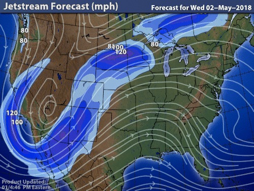
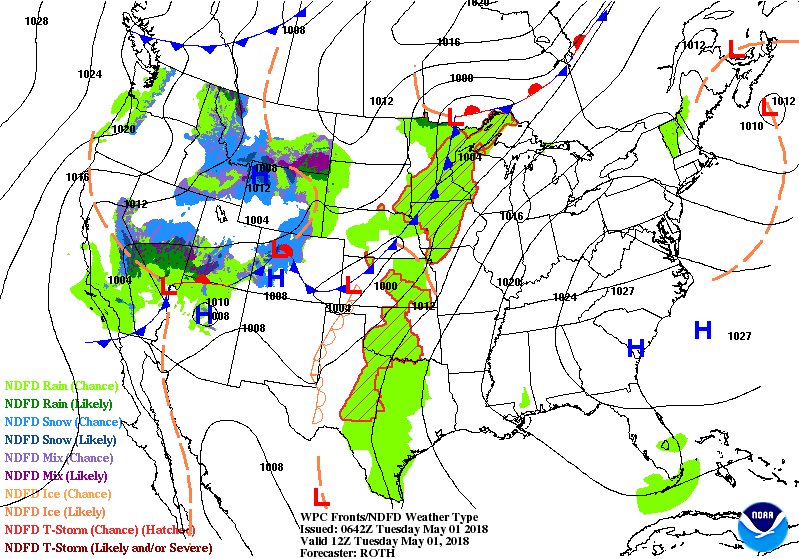
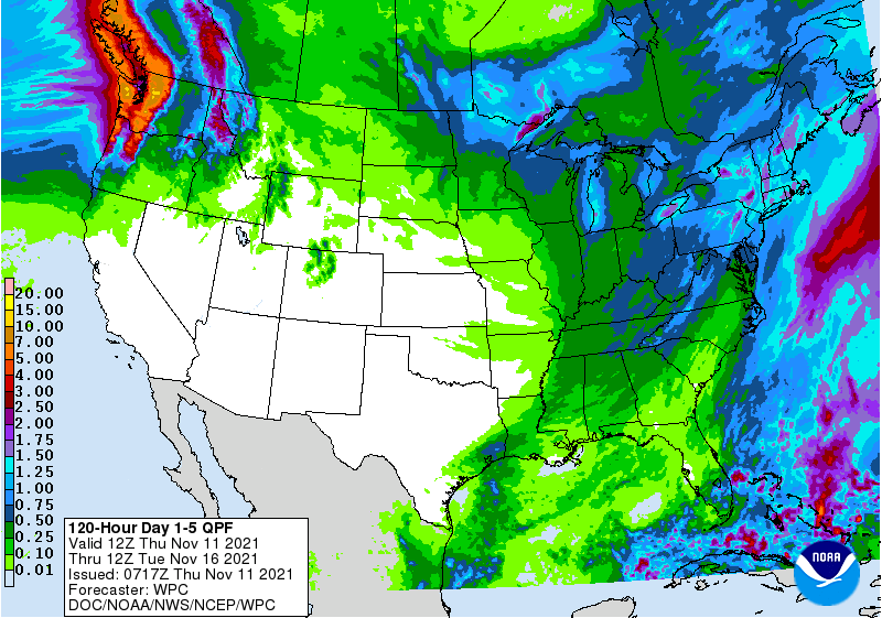
The upper air will produce a trof over the Northeast this weekend...which will cause a low off the Midatlantic with wet weather . Another trof over the Great Lakes will dive in to reform this trof next week with another storm off the Mid Atlantic. It all means cooler than normal and wetter than normal for the Northeast and Mid Atlantic. Below - upper air for Saturday...followed by amounts of rain for the next 5 days. Be safe.
0 Comments
Satellite above is from the new Goes 16 - showing global view from Pacific to Atlantic....will come in handy during this hurricane season. Below...satellite/radar combo showing Alberto remains in Kentucky and moving northward. Below - today's risk of severe weather in dark green and yellow followed by predicted high temperatures for this afternoon. Following maps show animated systems for the next 2 days followed by predicted rain through this weekend. Hard to say if the rainfall will verify over The Northeast this weekend as New England could stay north of the wet weather....will look at that tomorrow. Be safe.
Satellite + radar show Alberto moving across Alabama with a large plume of moisture covering the Eastern Half of The Nation. Add to that an active front in the Plains and you have a very cloudy - sometimes soggy pattern for much of the Eastern 2/3 of the Nation. Do not expect this to change much into this weekend. Below - track of remains of Alberto. He actually may head from Canada back south to mess things up for the Northeast this weekend. Below - today's threat of severe weather in dark green and yellow - followed by animated maps for the next 2 days. Lastly - rainfall predictions into Saturday morning. Be safe.
Above- satellite + radar shows front in Midwest moving east...moisture in SE moving north...add to that a tropical disturbance moving into the Gulf and lots of cloudy unsettled weather this weekend for the Eastern third of the Nation. Below - today's threat of severe weather in dark and green. Below - map showing tropical formation followed by map of the various tracks from computer models. This system will haunt the U.S. all of next week...so be prepared. Below - animated maps for the next 2 days followed by rainfall projections for the next 5 days which includes the holiday weekend. Have a nice and safe weekend....weather or not.
Stormy weather in The Plains heading east...will arrive on East Coast this weekend. Tropical disturbance south of Cuba - headed north with its moisture....all converging in the East this weekend. Northeast will see a front drop in from the North and stall. Showers and storms from Saturday late into Monday. Below - threat of severe weather today - in dark green and yellow. Below - animated maps for the next couple of days followed by expected rainfall for the next 5 days. While the holiday weekend will not feature heavy rain for Northeast....Sunday & Monday looked to be cloudy and cool with some rain or showers. Below - from the hurricane center...area they are watching and possible tracks. Currently too much sheer for this system to really form...but in time that could change and a tropical depression or storm could threaten the Gulf Coast. If they name it...it would be Alberto. Be safe.
Cool front moving off the East Coast will supress tropical moisture for rest of week. Front in No. Plains heads east and it will combine with tropical moisture to move north again and mess things up over Holiday weekend for East. Below - today's threat of severe weather -- dark green and yellow. Following maps show predictions of where a tropical system could form and it's possible track this weekend. Below- animated maps for the next 2 days and then projected rainfall for the next 5 days. Be safe.
Showers moving into Northeast today and tonight....not a big deal. Tropical moisture stream north thru Florida and Southeast. Can already see the makings of a disturbance south of Cuba. No matter where that goes..the stream of moisture will head north to affect the East this holiday weekend. Below - today's threat of severe weather in dark green. Below - hurricane center's outlook....which we agree with based on satellite pictures...and computer models. Below- different models take on tropical disturbance in Gulf. Most saying Saturday...GFS - Sunday. However...look at moisture streaming well north of the system. Below - rainfall expected through Saturday.....followed by animated maps for next 2 days. Be safe.
Looking at above satellite + radar you can see the stream of moisture moving north across Florida while showers and storms in Mississippi Valley more east. This will all continue over The East Tuesday into Wednesday. By late week - a tropical system will move into The Gulf. At the same time a front in Rockies approach the East Coast....not a winning combination for Memorial Day Weekend if you are in the East. Below - today's risk of severe weather - dark green and yellow. Below - animated maps for the next 2 days....followed by rainfall predictions for the next 5 days. Rainfall only goes out through Friday...so by the holiday weekend - it will expand north to cover New England.
Be safe. Satellite/radar looks like the same one from yesterday and the day before...but it isn't. Pattern not changing much through Sunday. Things will begin to change next week...for the better many places..others ..for worse. Below - today's risk of severe weather - dark green and yellow. Below - animated maps for the weekend followed by rainfall predictions for the next 7 days. Since the GFS Model is the only model that goes out for 15 days....it has been predicting a tropical system for Gulf for Memorial Day Weekend for over 2 weeks now. It has not backed off...and now the Euro is also seeing it. Hard to say where it will go...but below is the GFS prediction for Saturday of Memorial Day Weekend...showing either a tropical storm or hurricane for FLorida. We will be watching it and keeping you posted. Have a nice and safe weekend.
All of these maps look the same as Monday...simply...patterns haven't changed. Wet weather for The East right thru the weekend. Showers and storms in NW moving east. Southwest hot and dry. Below - today's risk of thunderstorms in green and yellow...shifts to Plains. Below- animated maps for next two days followed by rainfall for the next 7 days. A tropical like disturbance in Gulf will get absorbed by flow and head north only to enhance rainfall for the East. Over Memorial Day weekend...odds favor a significant tropical system in Gulf....it's path - too far out to call but will watch that. Be safe.
Ring of Fire......when a high near Bermuda sits and moisture moves clockwise around the high pumping moisture from the Gulf up across the East as you can see on satellite - radar pix above. This pattern will not change any time too soon. So best weather Northern Plains. Below...today's risk of severe weather in ark green. Below - animated maps for the next 2 days followed by amounts of rain for the next 5 days. Lastly....satellite of tropics....still a possible tropical disturbance in Gulf which will get absorbed by the flow and head north. Be safe.
Above....today's outlook for severe weather concentrated in Northeast. Yellow in slight risk....orange in an enhanced risk for areas from Poconos to Catskills...Berkshires and Conn. Below - satellite and radar show these storms already moving east from the Great Lakes. Wet weather continue for Florida due to a tropical like low there. Below- satellite of Atlantic basin showing 20% chance of something tropical in Gulf. Following that - animated maps for the next 2 days. Below - rainfall expected over the next 7 days....red indicated 3" or more.
Lastly - high temperatures expected for Wednesday. A LOW IN GULF PRODUCING WIDESPREAD - NEEDED RAIN FOR DROUGHT FLORIDA.....ALL WEEK LONG. SHOWERS AND STORMS FROM PLAINS EAST TO LAKES & OHIO VALLEY WILL CONTINUE TO MARCH EAST ALL WEEK LONG. HOT SOUTH - COOL NORTH. BELOW - TODAY'S RISK FOR SEVERE THUNDERSTORMS IN DARK GREEN AND YELLOW. tODAY'S HIGH TEMPERATURES PROJECTED TO BE NEAR RECORDS ACROSS THE SOUTH. MOST PLACES DARK RED - WILL BREAK RECORDS. BELOW - TROPICAL SATELLITE SHOWING A 30% CHANCE OF A TROPICAL SYSTEM FORMING IN GULF. BELOW - EXPECTED RAINFALL FOR NEXT 5 DAYS .....FLORIDA GETTING OVER 6" OF RAIN. BELOW - ANIMATED MAPS FOR NEXT 2 DAYS. BTW - THE GFS MODEL CONTINUES TO SHOW THE MAKINGS OF A HURRICANE IN THE GULF NEAR MEMORIAL DAY WEEKEND. VERY FAR OFF...WILL CLOSE IN ON THAT IF IT CONTINUES TO SHOW SUCH A TREND. BE SAFE.
Satellite + radar above does not tell the whole story. Stormy weather in Midwest works east by Saturday and will stretch east to west over much of the Nation. Very warm and humid to the south of boundary...cool and damp to north. This front will plague the Nation all of next week and the weather will be quite changeable and unsettled to stormy. Below - outlooks for severe weather today and Saturday. Notice on Saturday how the threat of severe weather extends west to east - yellow. Below - animated maps through the weekend followed by rainfall for the next 7 days. For nothing more than interest....The GFS Model has been showing a major hurricane threatening Florida for Memorial Day Weekend. First of all- it is the only model that goes out 15 days....so there are no other models to compare it with. There are times that this model does produce a fearless forecast and is correct...other times...it simply vanishes. So...not banking on this...but have a feeling that the model could be onto something. Below - it's forecast for Memorial Day Weekend. Have a nice and safe weekend.
Satellite & radar show cold front over Ohio with showers and storms moving east to the coast by tonight. Next system in Rockies heads east to mess things up along the east coast for the weekend. Below - today's risk of severe weather is dark green and yellow. Below - amounts of rainfall expected over next 7 days...most of which includes this weekend. Following - animated maps for the next 2 days. Be safe.
Above - Satellite/radar showing rain & storms Midwest - reaches East late Thursday...offshore Friday. Showers in Northwest - reaches Northeast Saturday and Sunday. If that 2nd front picks up some speed - things could improve during Mother's Day for Northeast. Best chance of that - New England. Below - today's risk of severe weather - dark green and yellow for Ohio Valley. Below - rainfall predictions for the next 7 days...which includes this weekend. UGH ! Below - animated maps for the next couple of days. Canadian Model for this Sunday - green indicates rain....so find your locations and you have a forecast by this model. Below - The GFS Model predicts for this Sunday. Looks like the best chance of rain for Mother's Day - over Florida...next best chance - Northeast. Be safe.
Showers and thunderstorms Northern Plains into Great Lakes...otherwise quiet much of the Nation. Below - threat of severe weather today in dark green...followed by amounts of rainfall next 24 hours. Above...weather systems for next 2 days. One front will move off the coast by Friday.....as the next low in the Rockies heads east. That system will move across the Northeast on Mother's Day. Thinking now is showers Northern New England early Sunday a.m. - showers for rest of New England during the day...but ending late day...and then moving into Mid Atlantic Sunday night. More updates through the week. Be safe.
Radar + Satellite show a front stalled along the East Coast...best chance of rain Carolinas. Lots of unsettled weather for Western third of Nation. Cool north - warm south. Below - chance of thunderstorms today - dark green - followed by rainfall over the next 24 hours. Below - tropical - like disturbance in Bahamas...which we were watching last week - being monitored by Hurricane Center. Lastly - animated maps for the next 2 days. Stay safe.
As front in Great Lakes moves east...severe weather is possible especially from NYS to Penn. today into tonight. Heavy rain and storms in Texas. A tropical wave in Bahamas looks to be taking on more organization...we will watch it. Below - today's risk for severe thunderstorms in dark green and yellow. Below - animated maps into the weekend followed by amounts of rainfall over the next 5 days. Below - tropical analysis showing tropical wave over Bahamas. May be too much sheer for anything to evolve from it...but will be monitored.
Have a safe weekend. Broken line of showers and storms from Great Lakes down to Texas will continue east - some of which will be severe again today. Meanwhile..a disturbance in The Bahamas needs to be watched. Below - today's risk of severe weather - yellow and brown - best chances. Below - animated maps for the next 2 days. The cold front in Central Plains will stall over Mid Atlantic this weekend and produce more wet weather there. Following animated maps - rainfall over next 5 days. Cooler weather will end the heat in Northeast and Mid Atlantic by the weekend...until then...stay cool...be safe.
Based on humidity - above maps shows your bad hair day....where orange is the worst.....green not bad. Below - satellite and radar ....showing showers and storms in Great Lakes working slowly east. Maps below show severe thunderstorm threat today...dark green to brown and even red.....followed by animated maps for next 2 days. Below - current upper air jet stream. Digging in the west ...where snow fell in higher elevations of Arizona yesterday. Heatwave for East. Be safe.
Radar and satellite above show low still off New England...so they have to wait one more day before getting warm. Elsewhere...summerlike with a break out of showers and storms for Plains...below - severe weather outlook for today...dark green to tan indicate best chances. Below - animated maps for the next 2 days...followed by amounts of rain over the next 5 days - then high temperatures for Wednesday....which indicate summer everywhere. Be safe.
|
We'll have daily weather discussions, talking about major systems on the horizon along with anything noteworthy that pops up on our radar.
Pat Pagano,
|