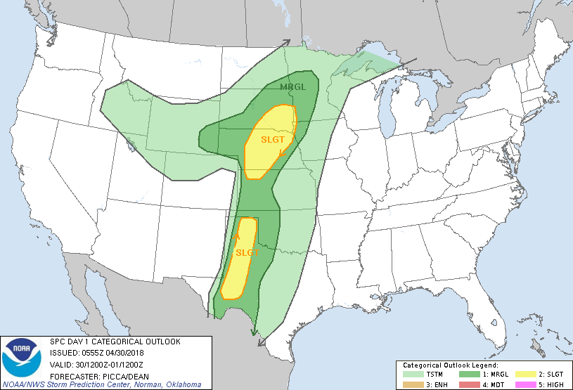
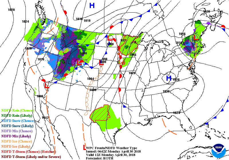
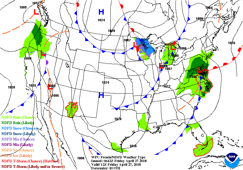
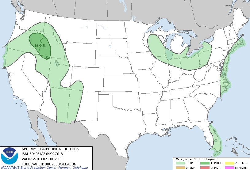
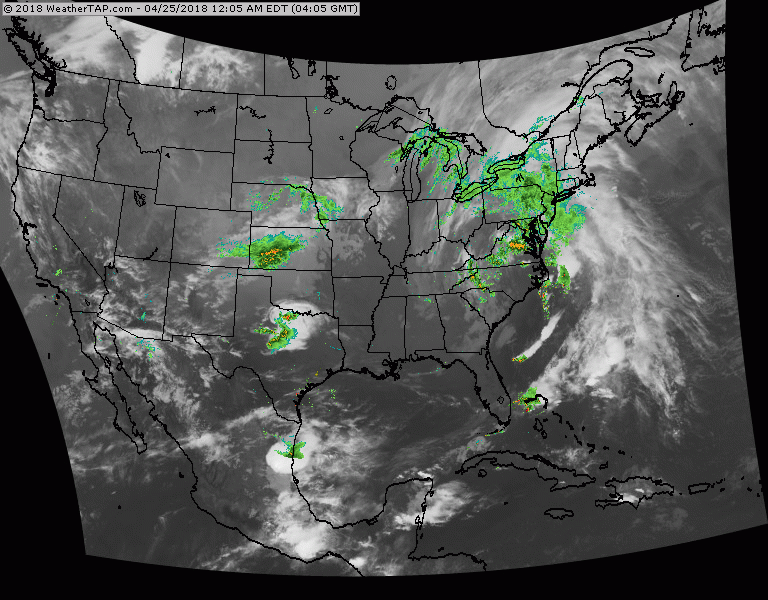
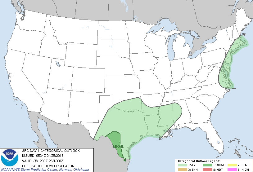
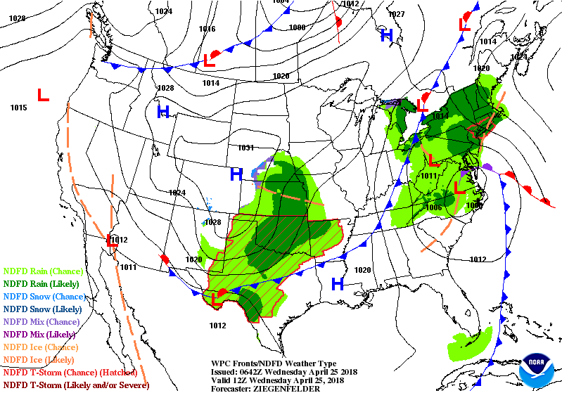
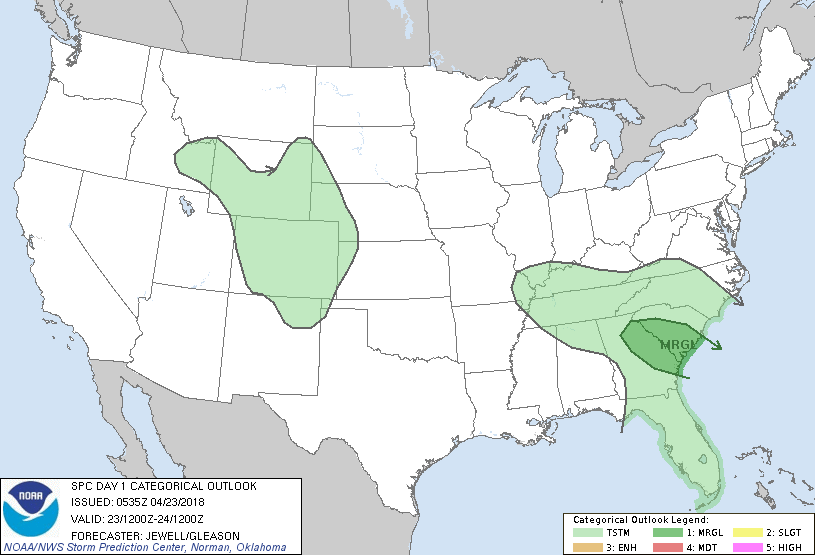
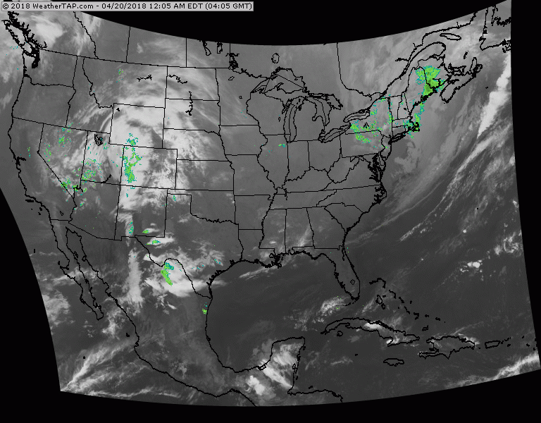
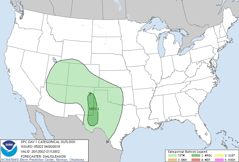
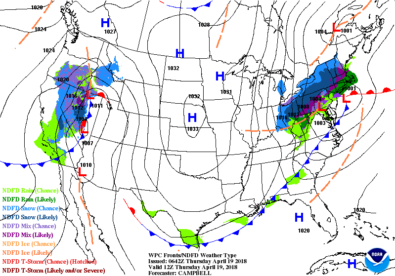
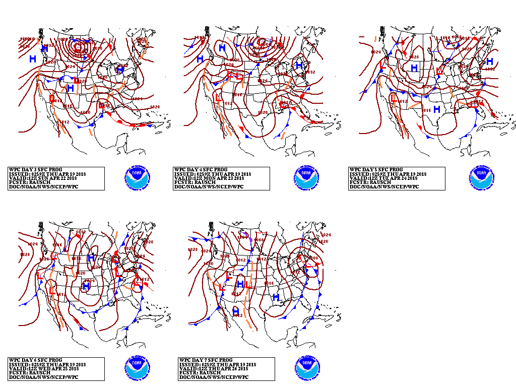
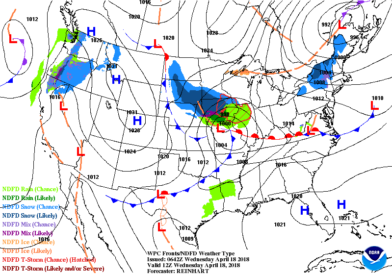
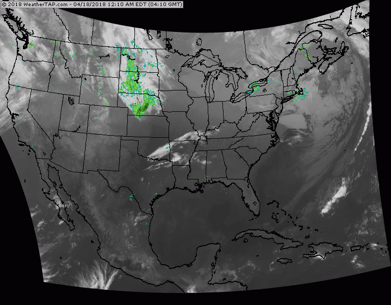
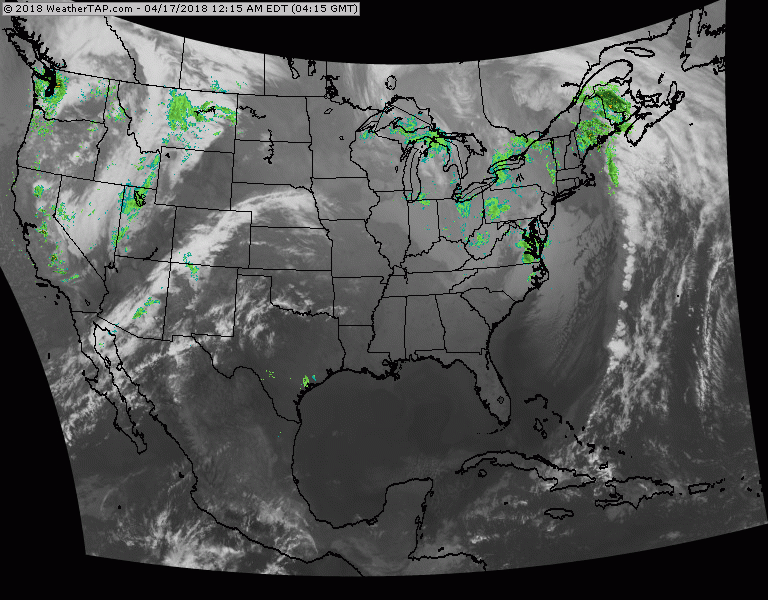
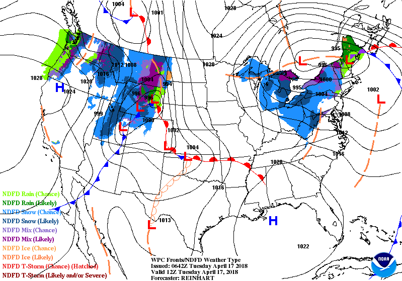
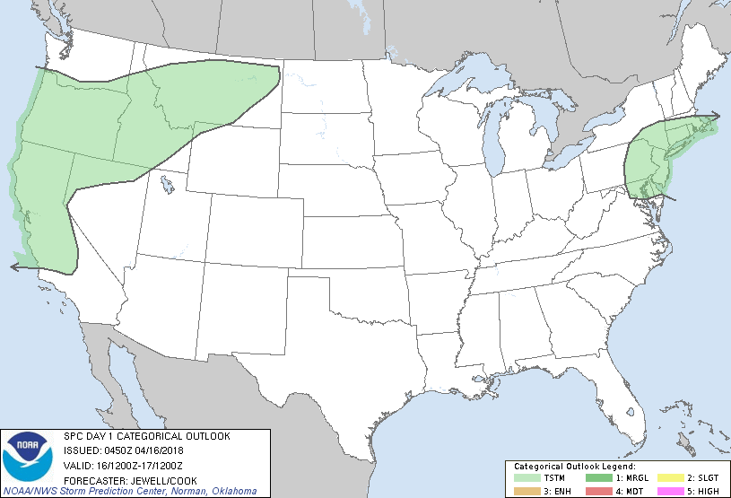
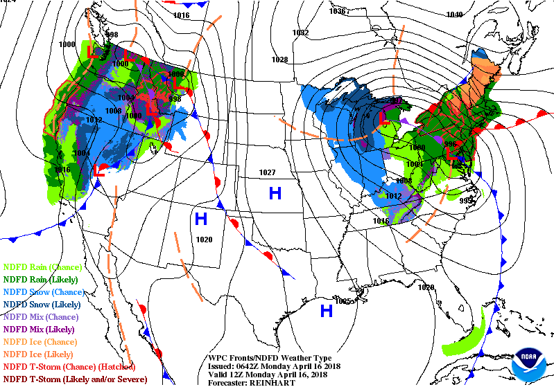
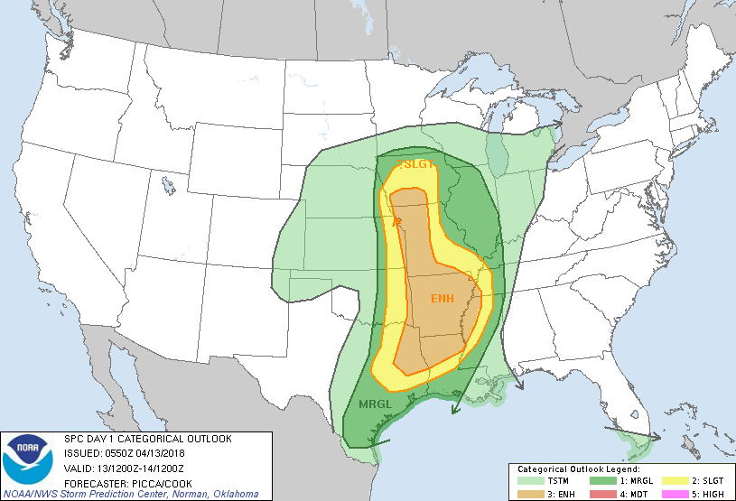
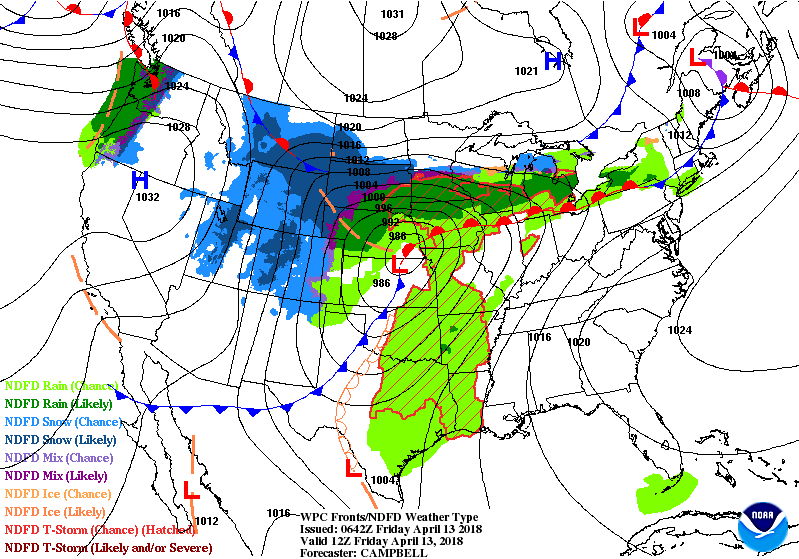
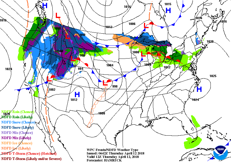
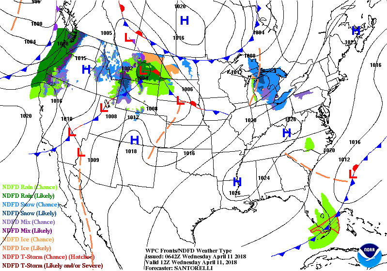
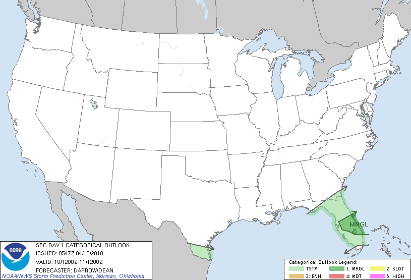
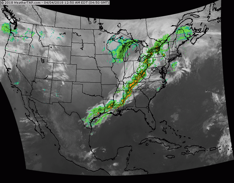
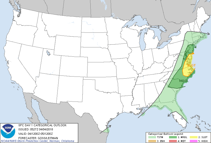
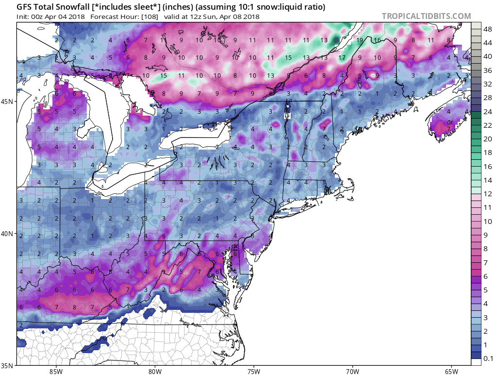
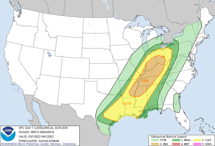
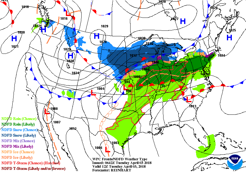
A storm on the surface and aloft over The Northeast producing unseasonably cool - windy weather with showers - and even snowshowers across New York STate. It will move out Tuesday...and warm weather will overspread much of the Nation. Showers and storms in Plains...some of which will be severe over the next few days. That front will weaken by the time it reaches the East by the weekend. Below - today's outlook for severe weather....yellow and tan denoting best chance . 
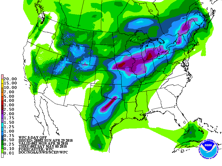
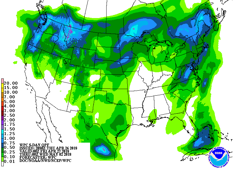
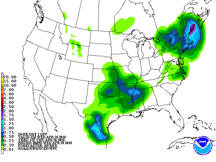
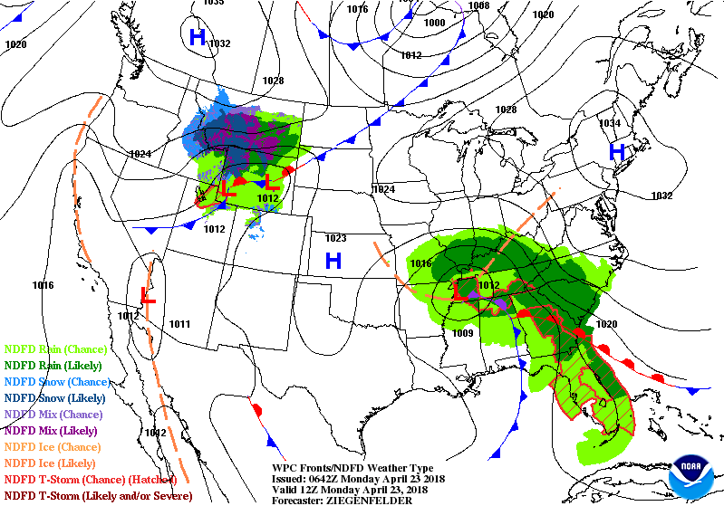
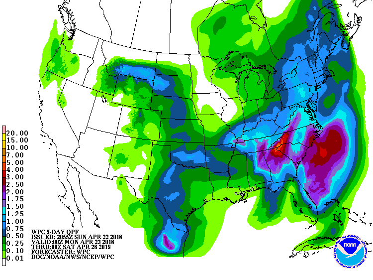
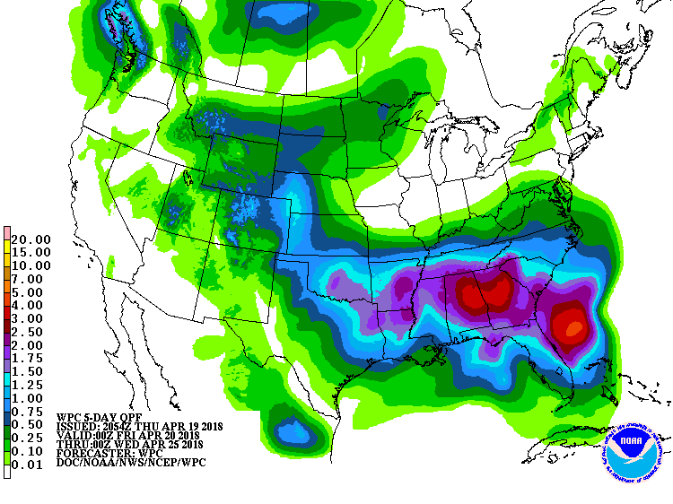
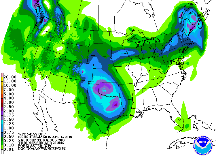
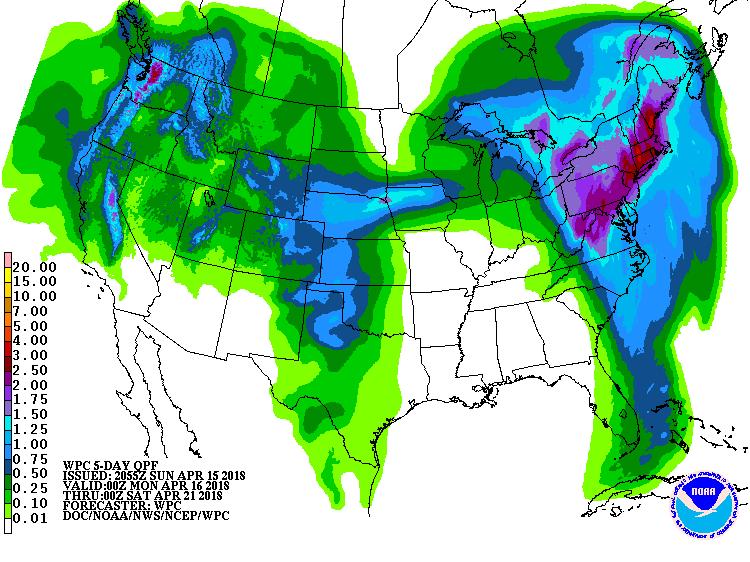
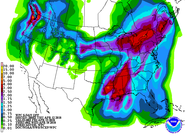
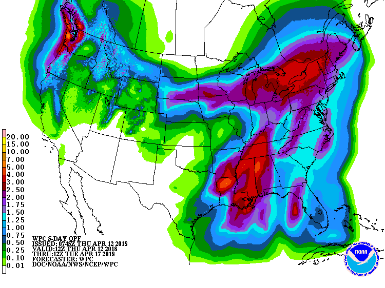
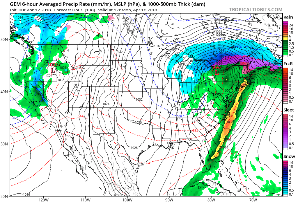
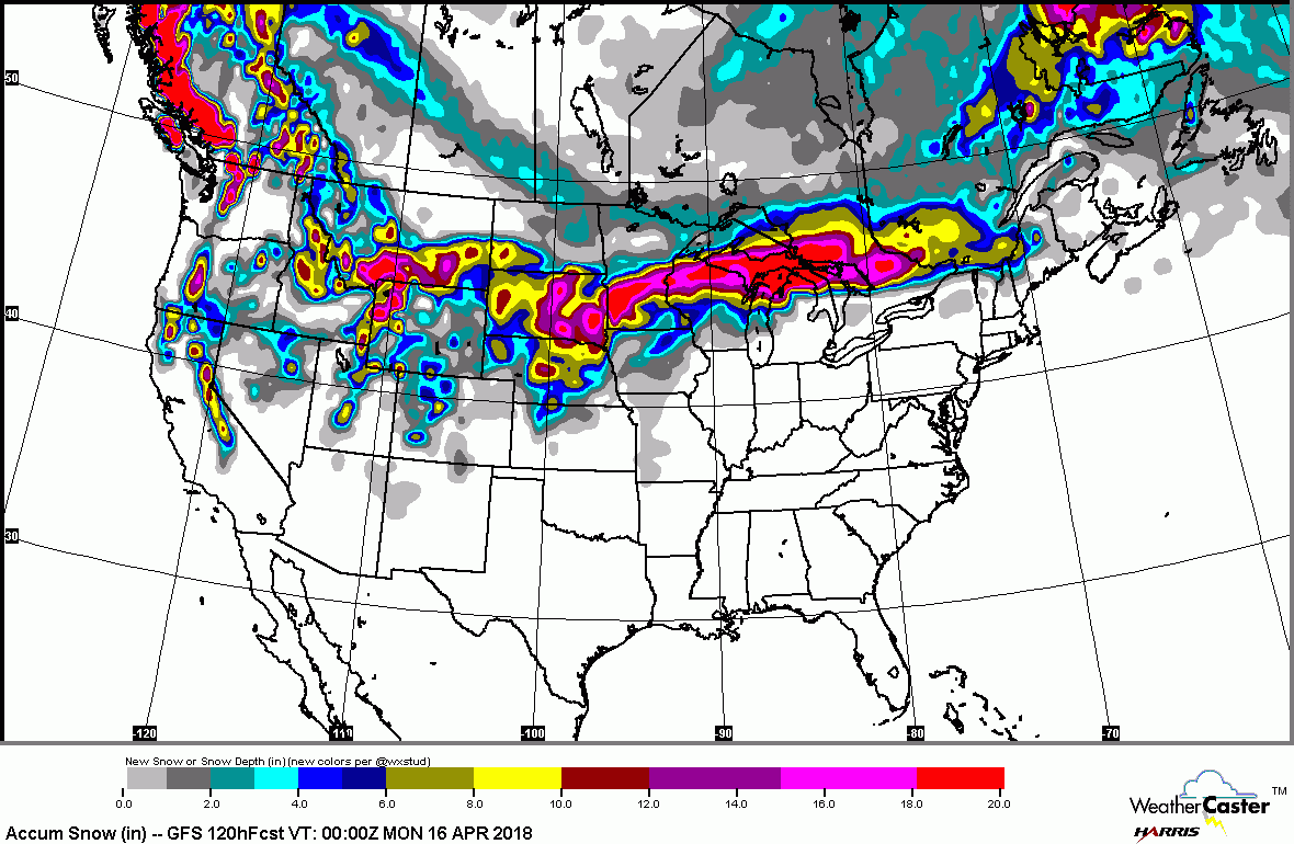
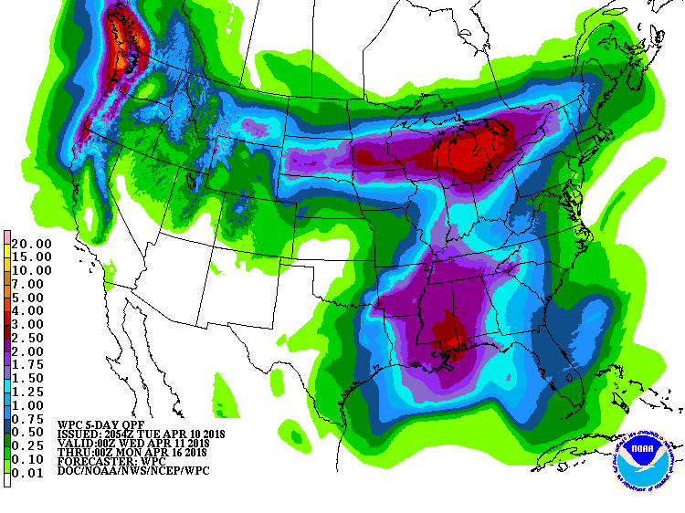
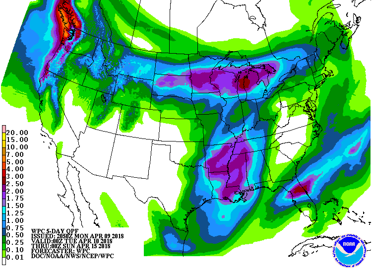
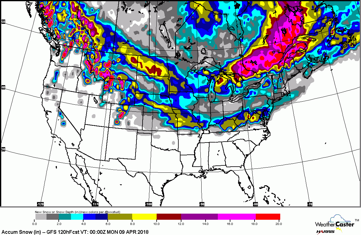
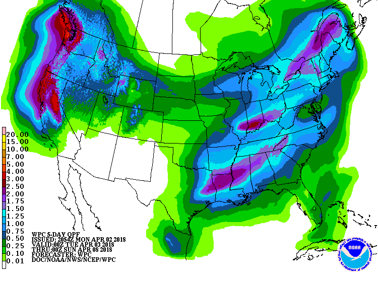
Below - rainfall expected over the next 5 days....followed by animated maps for the next 2 days. 
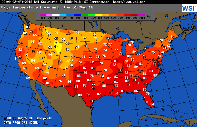
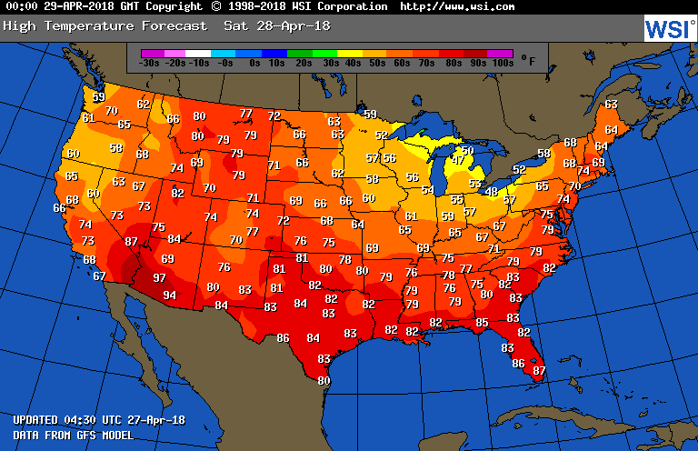
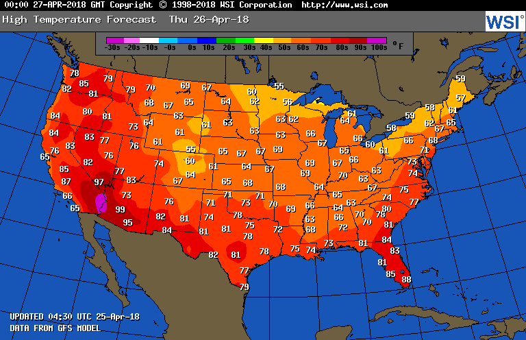
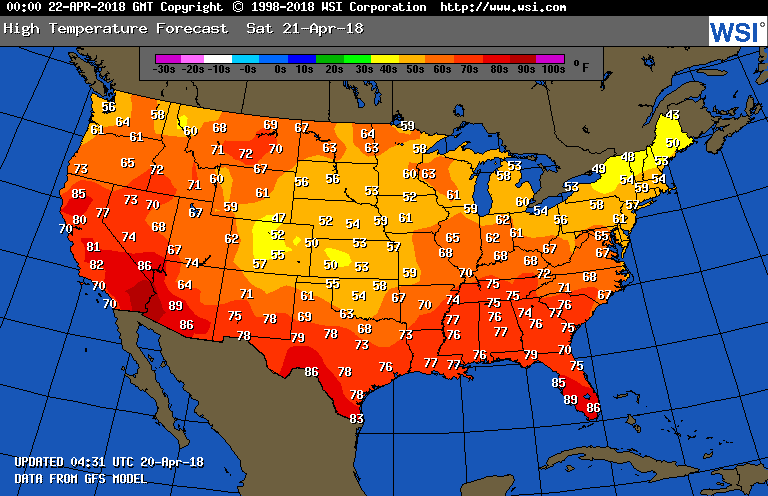
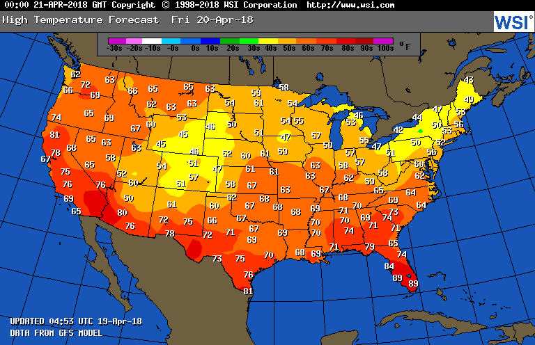
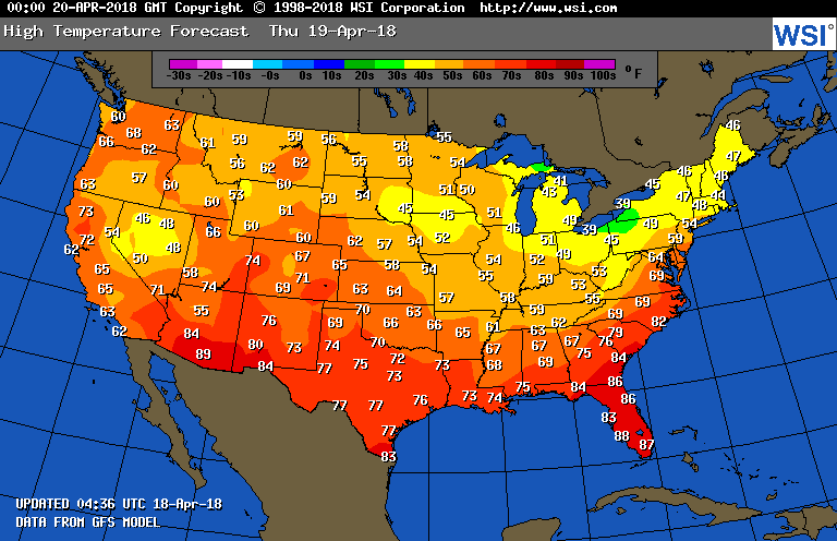
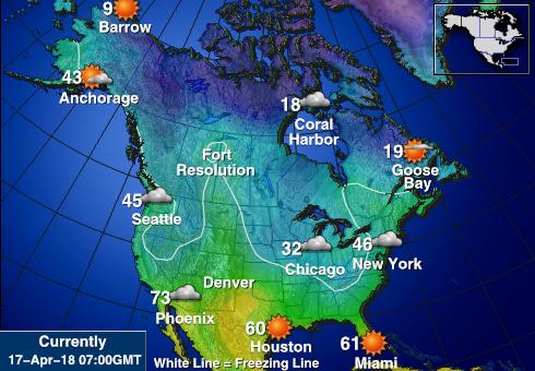
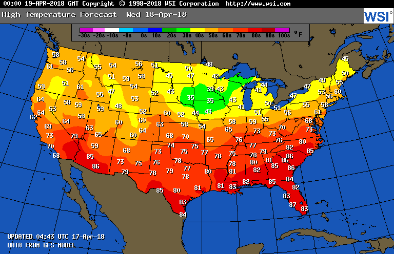
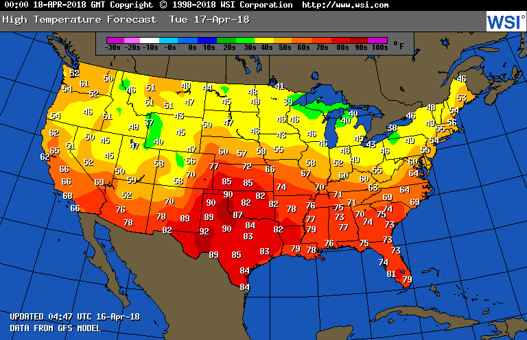
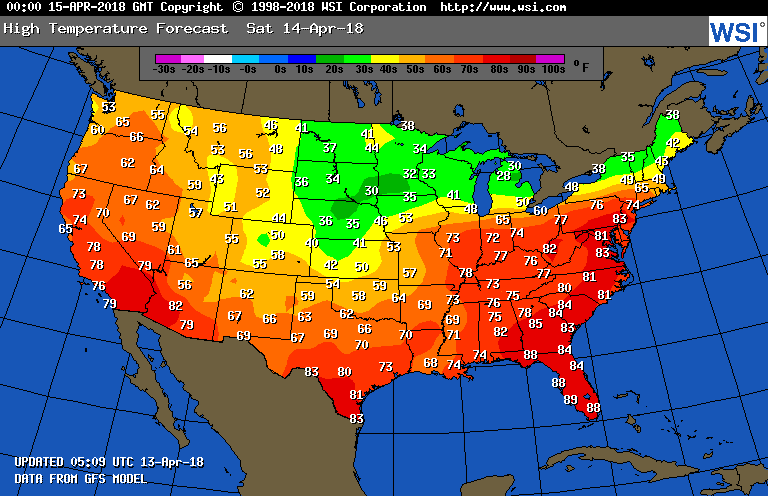
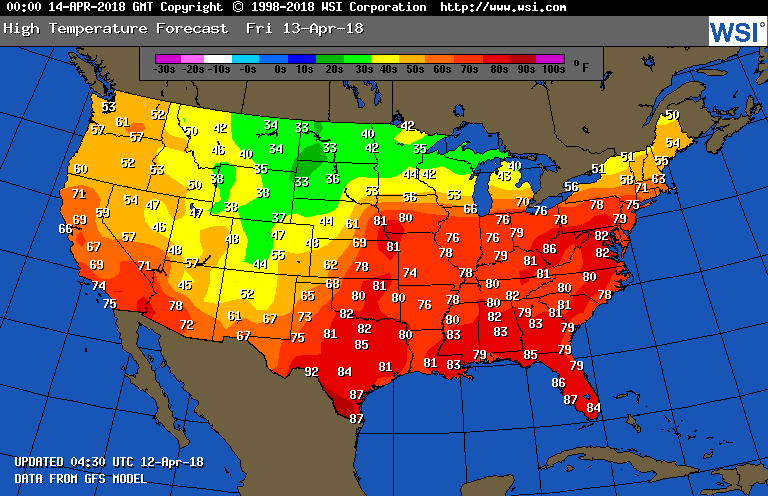
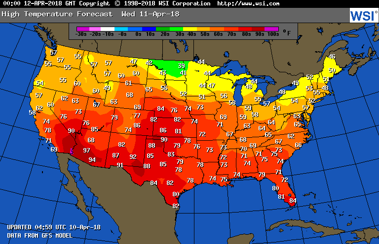
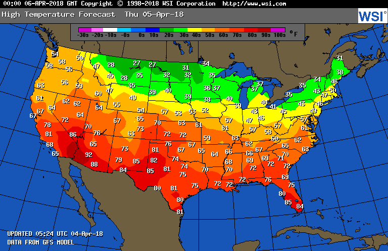
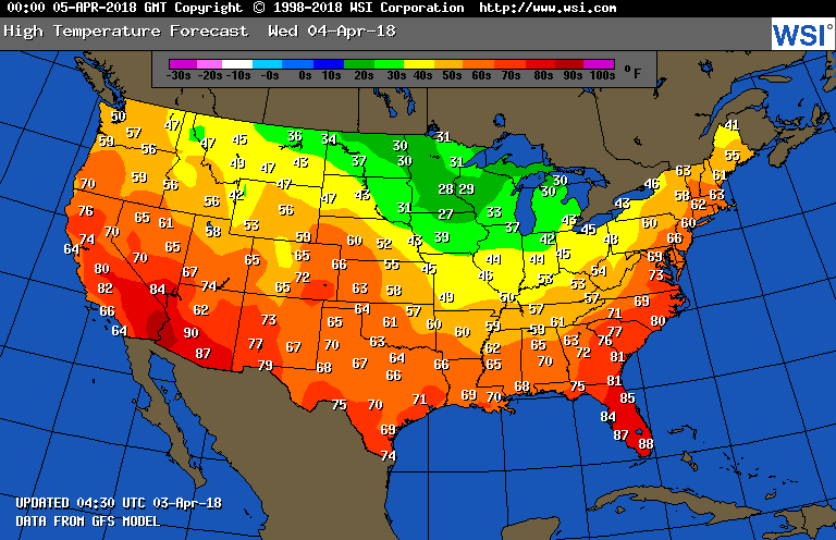
Below - high temperatures expected Tuesday.....finally most of the Nation sharing in spring. Be safe.
0 Comments
Above....animated maps for the next 2 days showing cold front in east with cool air...lots of wet wet NW>.
Rain over MidAtlantic heads across Northeast today. Showers over Great Lakes and Upper Midwest will bring waves of cooler air into Northeast this weekend...and even some snow...yes...snow...over higher elevations Sunday into Monday for Northeast. Below - chance of thunderstorms today - in green. Below- animated maps for the weekend - followed by amounts of rain for next 5 days...then high temperatures for your Saturday. While the pattern will try to change to warmer weather next week...the Northeast could slip back from time to time with cool temps. Have a nice - safe weekend.
Satellite + Radar shows wet system in the East....not pulling out until Thursday. Another area of showers in Plains...affects the East Coast Friday into Saturday. Below - chances for thunderstorms today - in green. Below - amount of rain for the next 24 hours....followed by animated maps for the next 2 days. Below - high temperatures expected for Thursday. Be safe.
Satellite/radar showing a spring storm in Gulf States with rain and storms. It will spread north to affect the East Coast Tuesday and Wednesday. Front in Rockies will reach the east by end of the week. Below - today's chance of severe weather.....darkest green have best chance. Below- animated maps for the next 2 days followed by rainfall projections for the next 5 days....heaviest for the southeast. Below - high temperatures expected for Tuesday......now that's more like it. Be safe.
Left over rain and snowshowers in the Northeast and windy there. Storm in Rockies will be fed by moisture from Pacific and then Gulf...so lots of rain and storms across the south this weekend. That storm will turn up the coast next week reaching New England by Wednesday. Below - severe risk of thunderstorms today - in green. Below - animated maps for the weekend...tracking that southern storm. Map following...showing rainfall for the next 5 days....clearly indicating the heavy rains for the south. Below- high temperatures projected for Saturday. Enjoy your weekend...be safe.
Satellite & radar show rain and wet snow for the Northeast today - higher elevations could pick up 1"-3". New storm west coast takes southern track this weekend and then up coast by late next week. Below - animated maps for next 2 days. Below- high temperatures expected for Friday....as it finally begins to warm up. Following that...maps for the next week. The next storm moves across the south and up to the Northeast by Thursday of next week.
Be safe. Above- animated maps for the next couple of days showing snow in Midwest headed for Northern New England. Below - satellite and radar showing that storm -central Plains. Below - rainfall expected over the next 5 days followed by high temps expected on Thursday. Be safe.
Above - snapshot of N.America today. Notice how it's cold for 75% of the continent. Below - today's satellite/radar showing storms in Eastern Canada and west coast. Below- animated maps for the next 2 days followed by amounts of rainfall for the next 5 days. Below- map showing high temperatures for Wednesday. While still on the cool side...longer range suggesting and turn to drier weather and with that will come milder. Be patient. Be safe.
Heavy rains hitting the East with thunderstorms and strong winds...snow from Great Lakes to Upper Midwest. New storm in the West coming east during the week. Below - chance of thunderstorms in green. Above. upper air for Monday - showing trof over Central U.S. Southerly flow ahead of it pumping up tons of moisture from Gulf of Mexico...net result will be 1"-3" of rain in Northeast. Below - chart showing rainfall amounts through next 5 days. Below - temperatures for Tuesday......unseasonably cool for Northern third. Animate maps for next 2 days will follow. Be safe.
Above...map showing current weather warnings out. Notice the orange...that is Blizzard Warnings. This storm will impact much of The U.S. with many forms of severe weather from blizzards to ice in New England to severe thunderstorms and tornadoes in the south. Below..latest satellite and radar showing the storm organizing in Rockies. Below - today's severe outlook - dark green..yellow - tan - widespread outbreak possible. Following that map - expected snowfall over next 5 days. Below - animated maps for the weekend followed by rainfall for the next 5 days. Lastly...a look at high temperatures for Saturday. You can see the contrast in the Plains...one of the reasons for such a large storm. Be safe.
Above....snowfall expected over the next 5 days....quite remarkable for mid April. Below - latest satellite and radar showing storminess over the Rockies...wet over The Great Lakes but weakening. Below - temperatures expected on Friday.....followed by amount of rainfall over the 5 days. Below = animated maps for the next 2 days followed by Canadian model forecast for this coming MOnday which shows the big winter storm from the west over the Great Lakes with wind and rain for the East. Yellow indicated heavy rain and thunderstorms. be safe.
Maps above for the next couple of days show a major late winter storm for Northern Rockies and No. Plains. Many places will get blizzard conditions by Friday with snowfall being measured in feet. Meanwhile..same storm will carry heavy rain and thunderstorms east across Ohio Valley this weekend and into East early next week. Below...current radar and satellite showing that storm organizing out west, Below....expected snowfall over the next 5 days. Still not certain who will get the heaviest snow in the Plains...but lots of it possible. Following that..amounts of rainfall for the next 5 days. Finally - temperatures expected Thursday. Enjoy. Be safe.
A touch of rain and wet snow moves across the Northeast....no big deal...with showers and storms in the southeast which may be severe. New system moving into west coast could bring a late winter storm to Northern Rockies and Plains by end of the week. Below - today's risk of severe weather in dark green and yellow. Below - animated maps for the next 2 days....followed by high temperatures for Wednesday....where you will notice a very big warm up for most of the Nation...about time. That is followed by rainfall for the next 5 days across the Nation. Be safe.
Cold front moving through Appalachians. Ahead of it...mild..showers..thunderstorms and winds to 50 mph....today...behind it..back to winter. Snow in Great Lakes. New system in Northwest heads to Northeast by Friday. Below- today's threat of severe weather in dark green and yellow. Below- animated maps for the next 2 days....followed by national snowfall forecast for the next 5 days......quite impressive for this time of year. A sneaky storm along the east coast this weekend could produce more snow from Mid Atlantic to Northeast. Below -....these are the snow predictions from the models in this order.....GFS - Canadian - Euro. Read them and weep. The Euro will not be copied....but it's similar to the 2 above. Finally - temps. tomorrow. Enjoy spring...wherever it is.
Unusual weather pattern will continue with cold air from time to time and waves of storms that will produce anything from wintry mix to severe thunderstorms. Severe outbreak possible today in Ohio Valley and south. Snow in Northern Plains. Below - today's risk of severe weather...followed by today's wind chill effects. Below - animated maps for the next 2 days....followed by amounts of rain next 5 days. Below- map showing high temperatures for Wednesday. Ahead of the storm and front - very mild...behind it..very chilly. Do not expect this pattern to change until at least mid month. Be safe.
|
We'll have daily weather discussions, talking about major systems on the horizon along with anything noteworthy that pops up on our radar.
Pat Pagano,
|