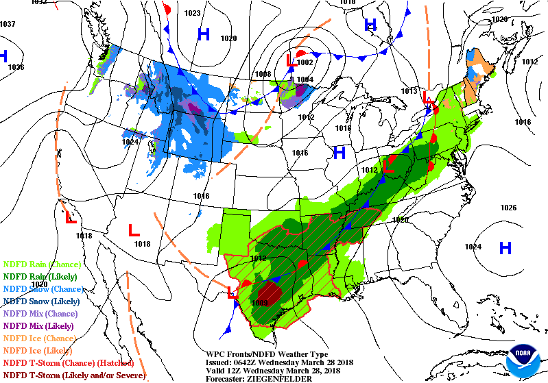
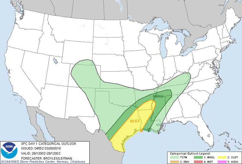
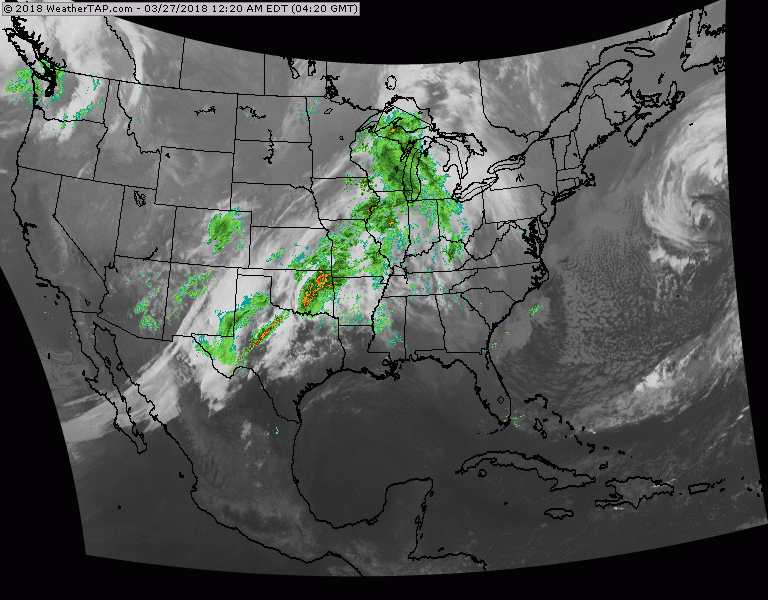
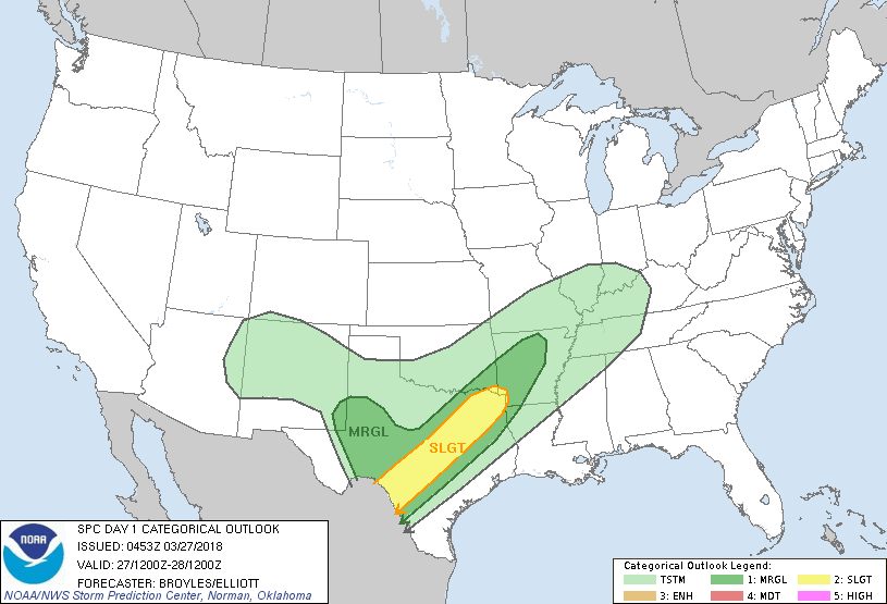
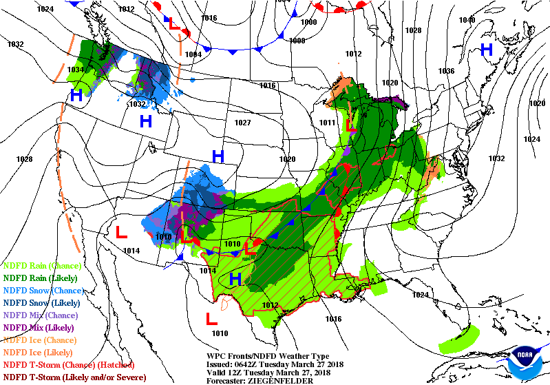
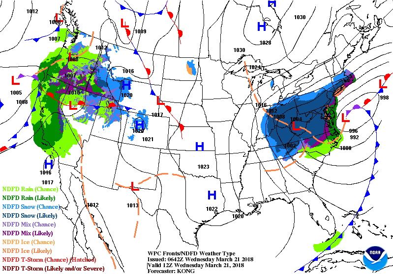
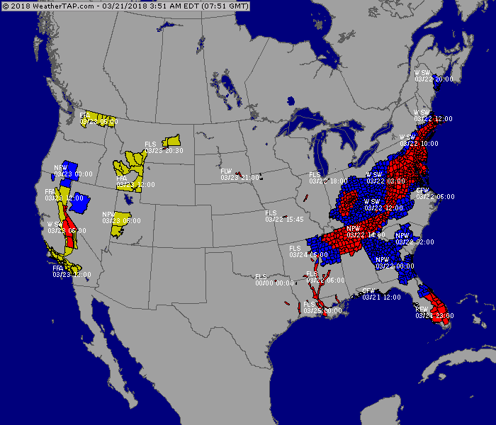
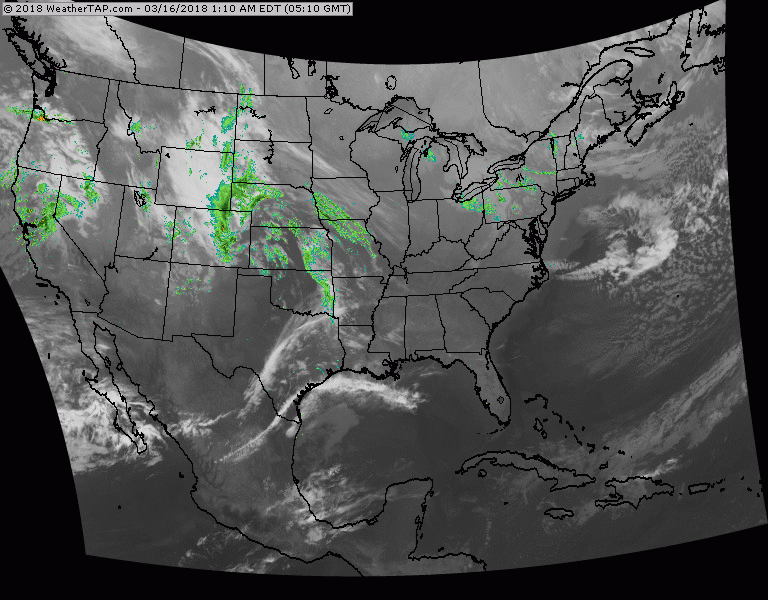
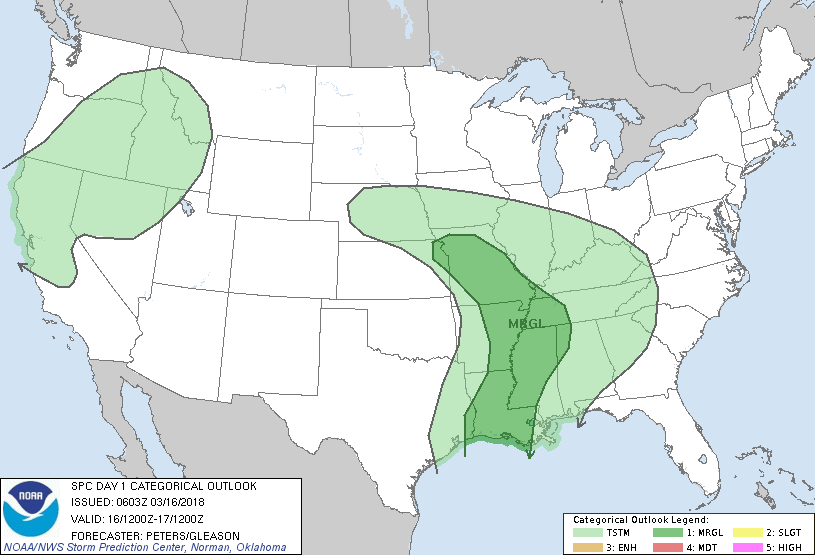
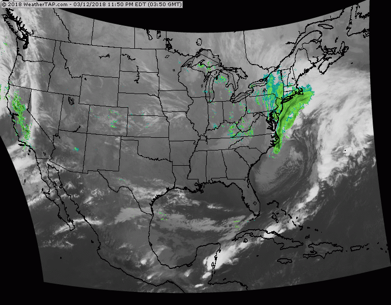
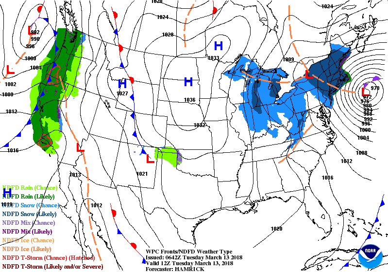
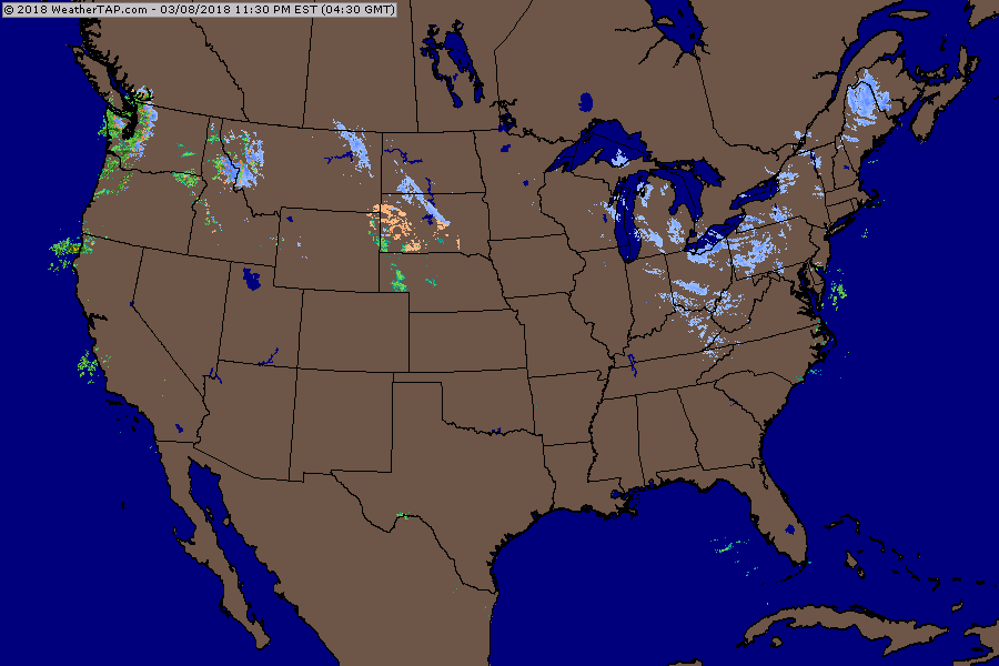
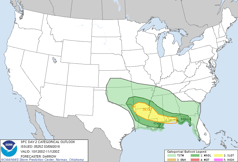
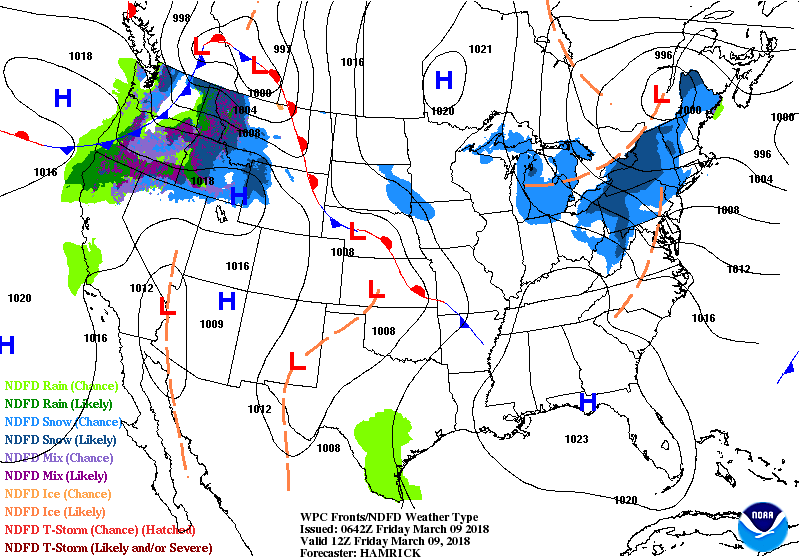
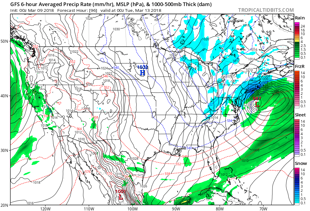
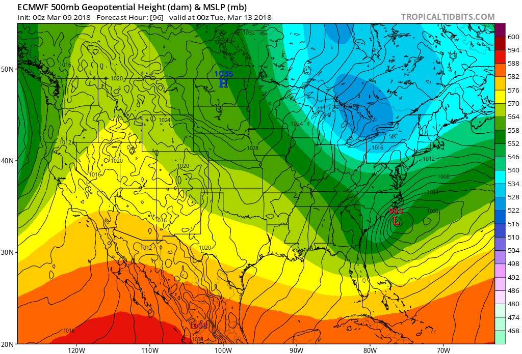
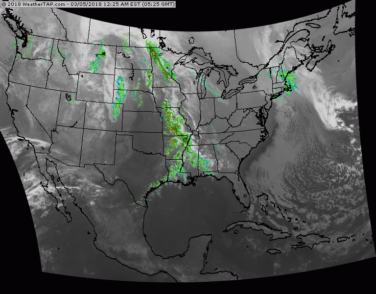
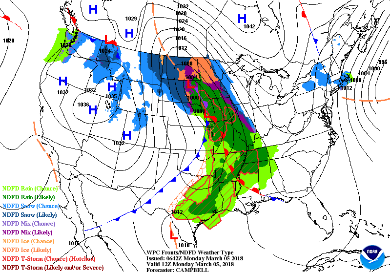
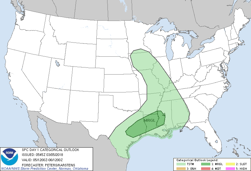
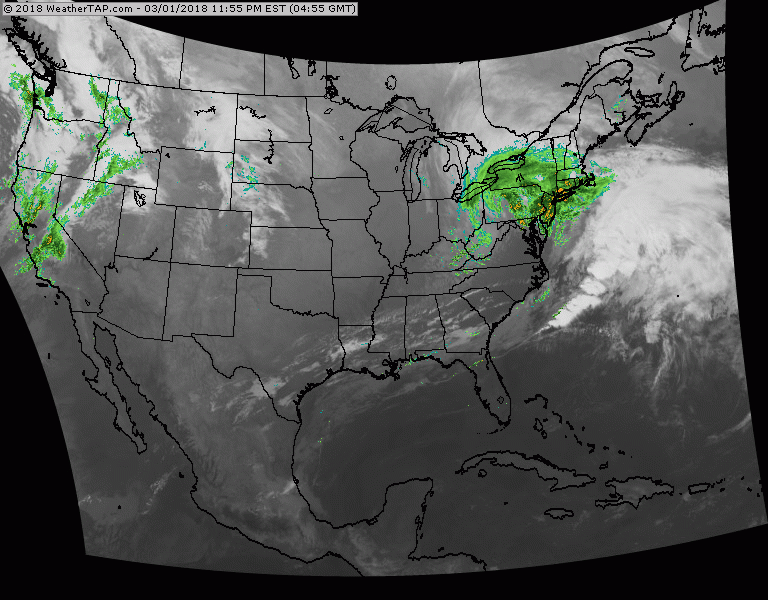
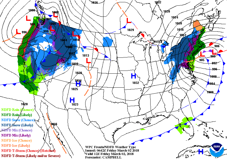
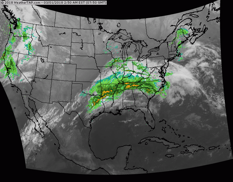
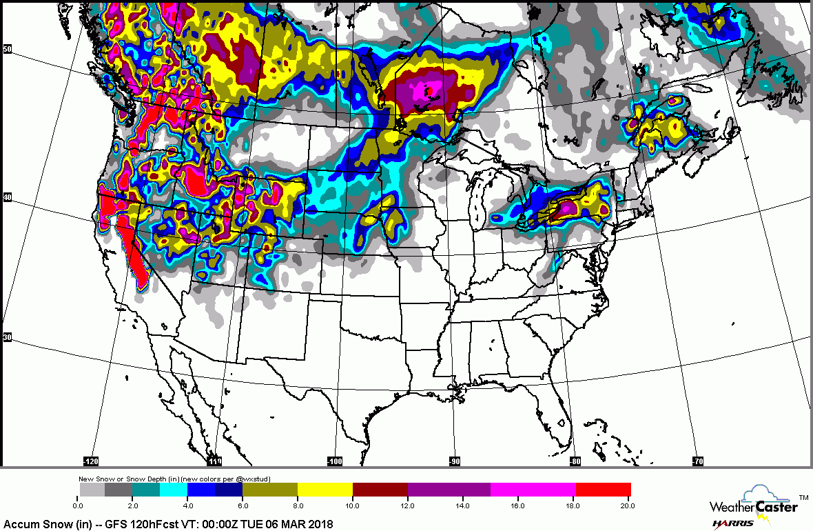
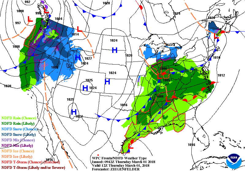
Animated maps above show how there will be one front after another moving across the Nation to keep the weather unsettled. Below - radar and satellite picture followed by threat of severe weather today highlighted in dark green and yellow.

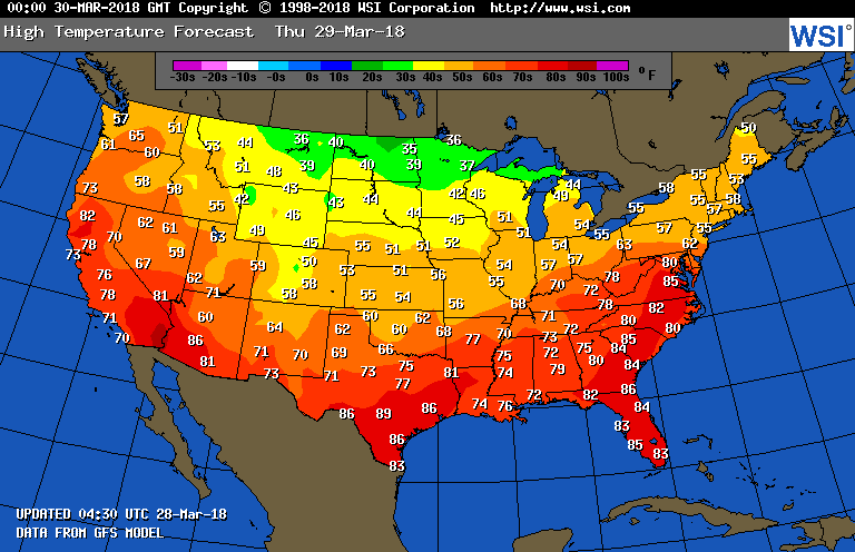
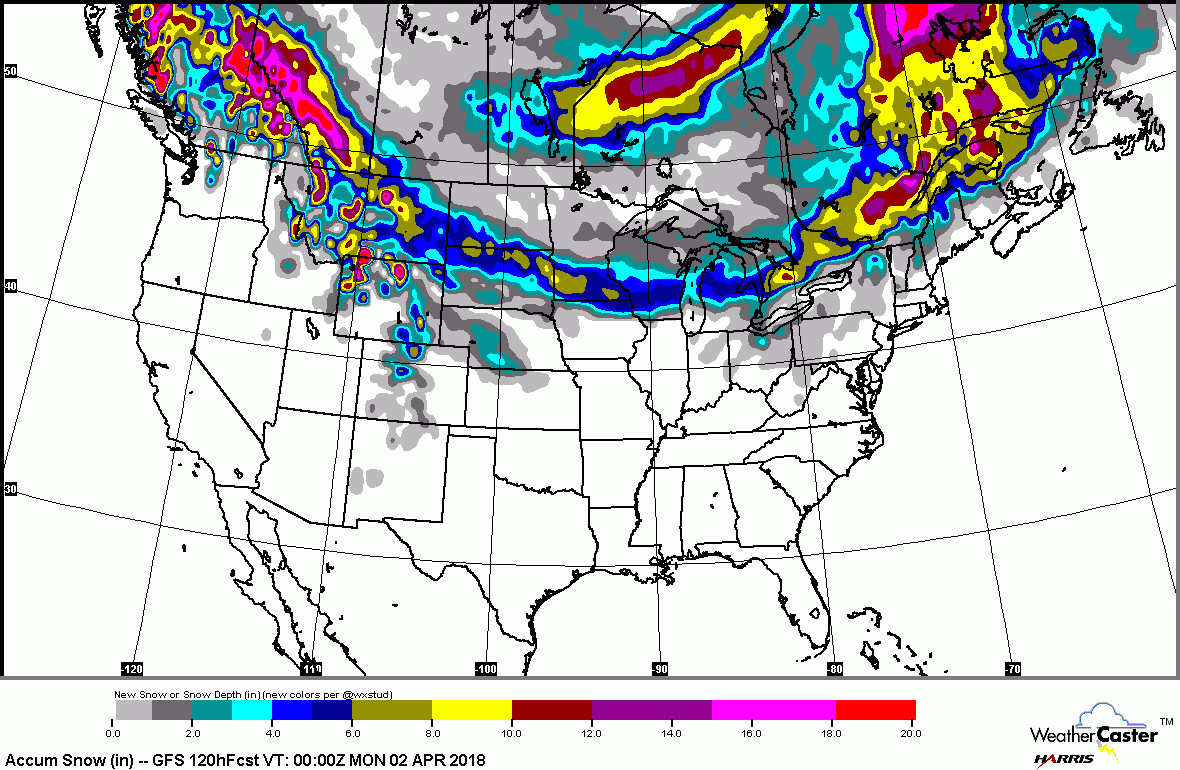
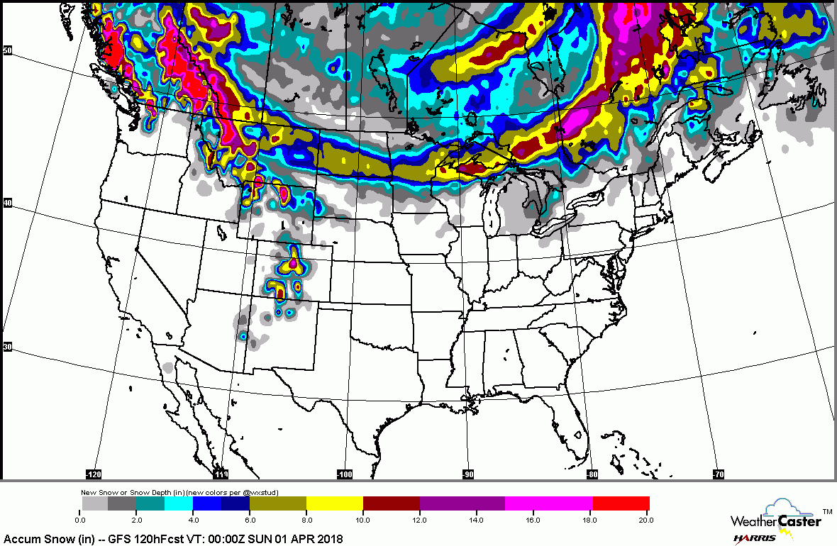
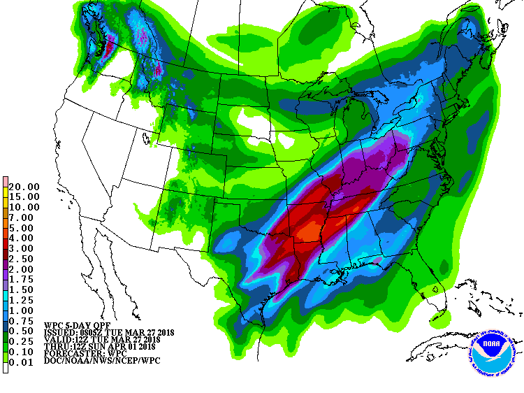
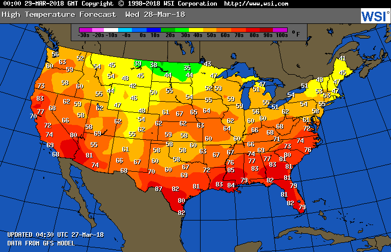
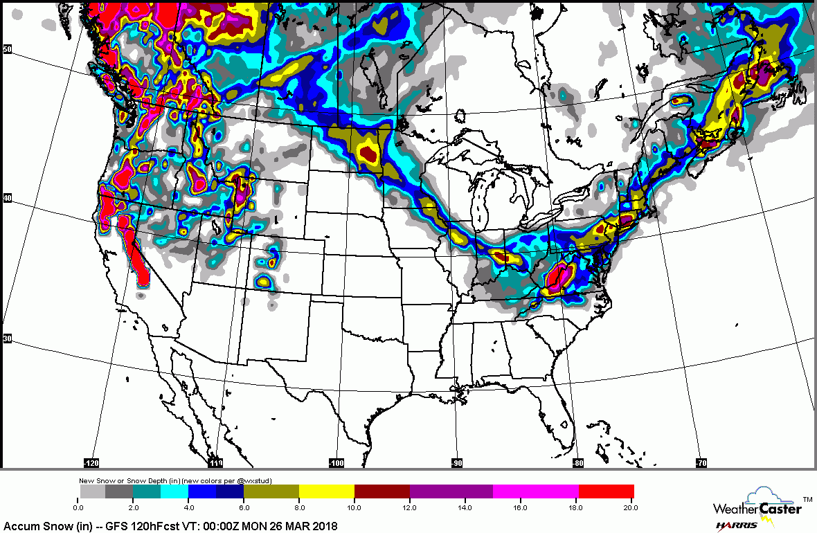
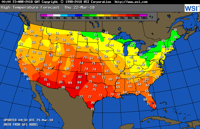
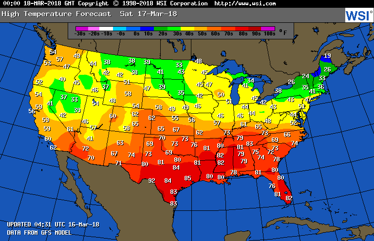
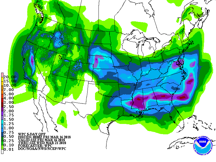
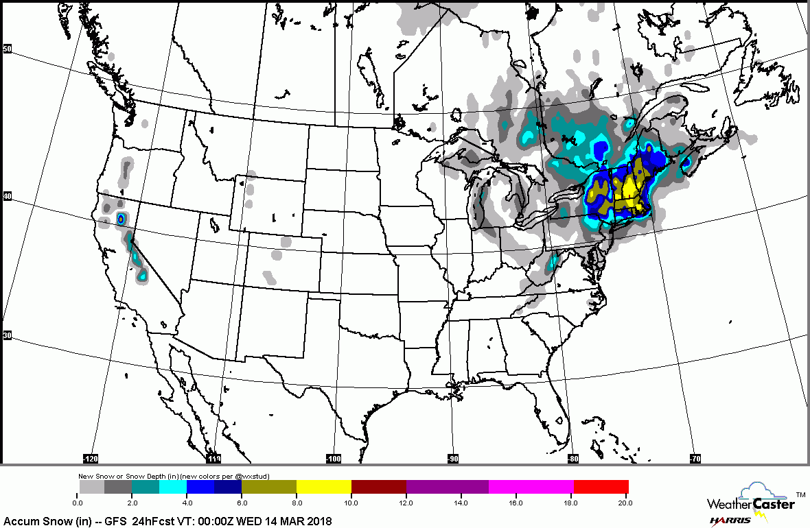
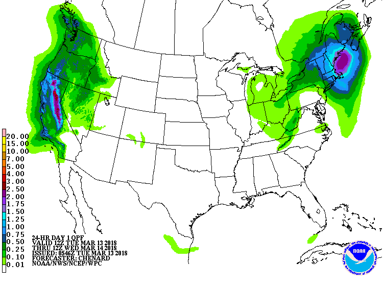
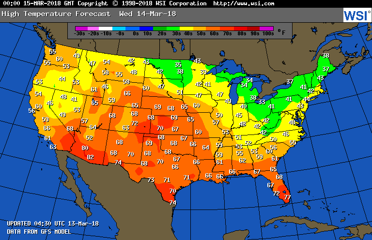
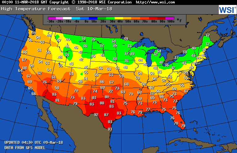
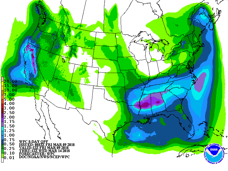
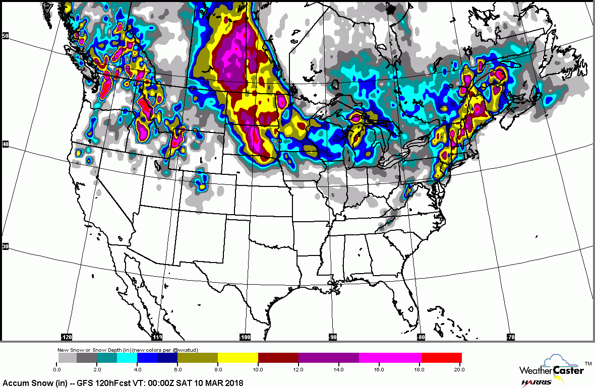
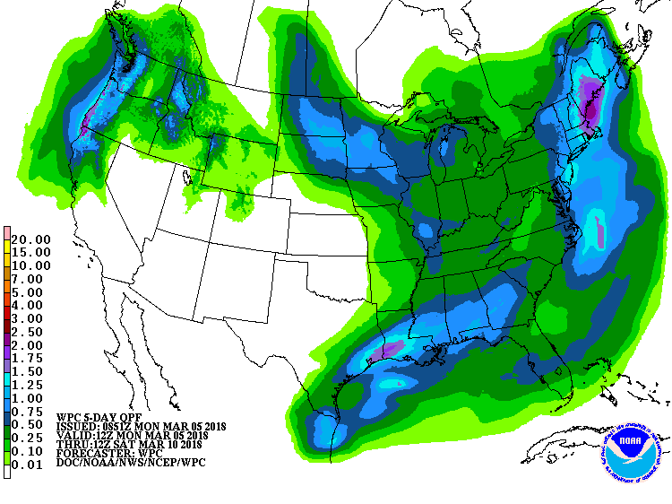
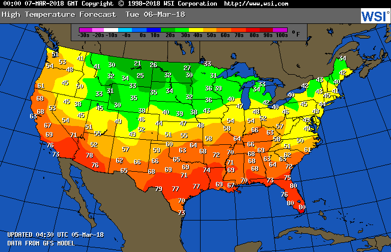
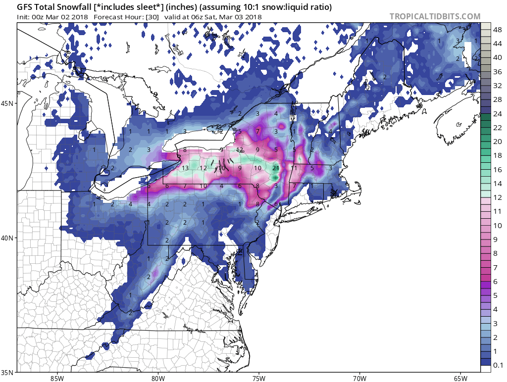
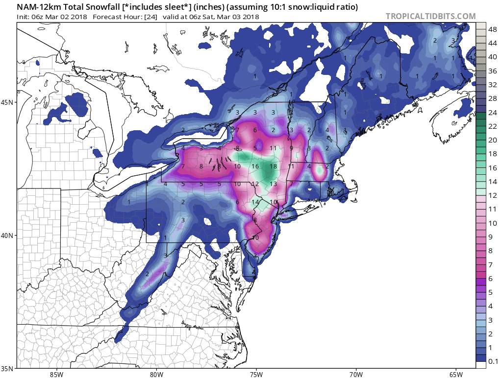
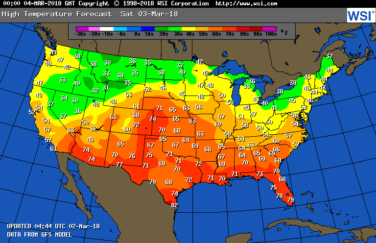
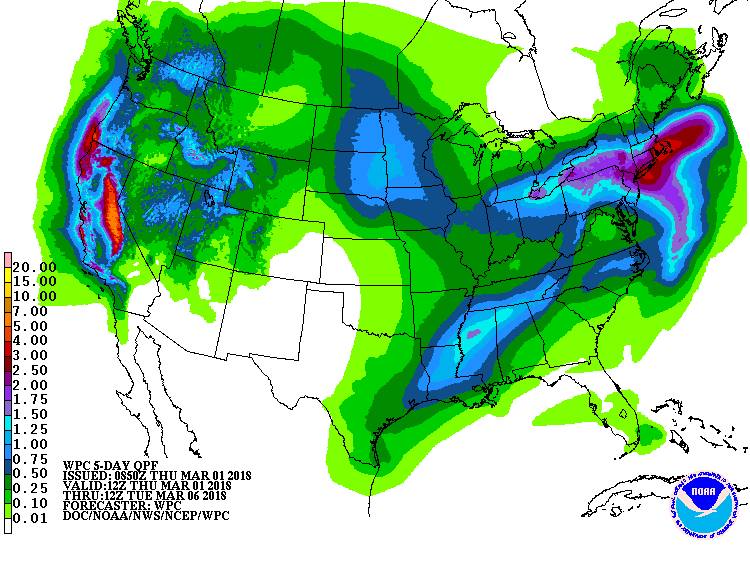
Below- high temperatures expected for Thursday followed by snowfall for the next 5 days. On a side note...several parameters indicate that there could still be another blast of winter before the mid part of April...so keep the coat handy. Be safe.


 RSS Feed
