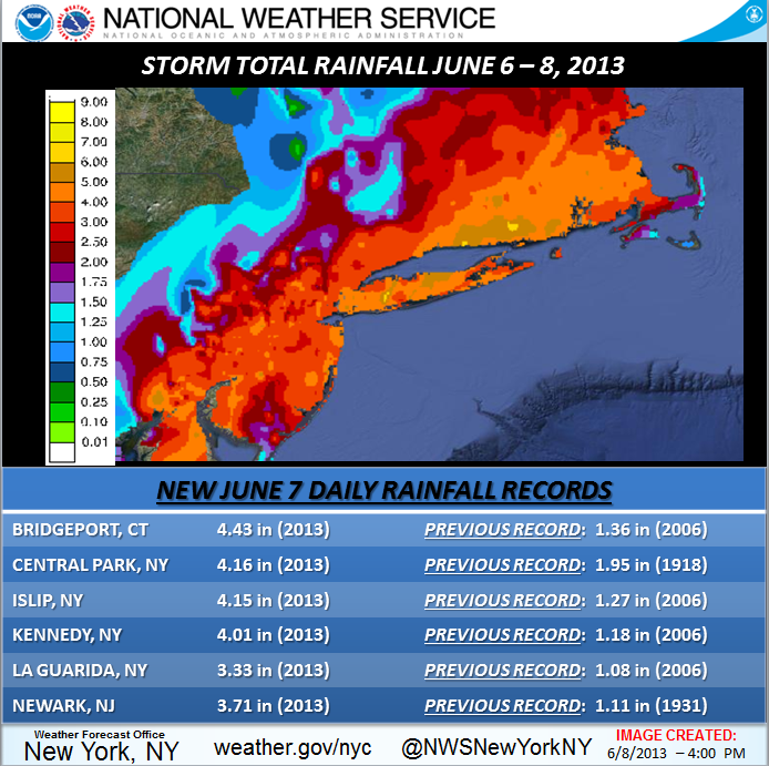
Andrea moves on and is now a thing of the past... It leaves its mark though in the record books. Most of the local airports in the tri-state area saw single-day rainfall amounts 2 inches or greater than the previous records as illustrated by this table...
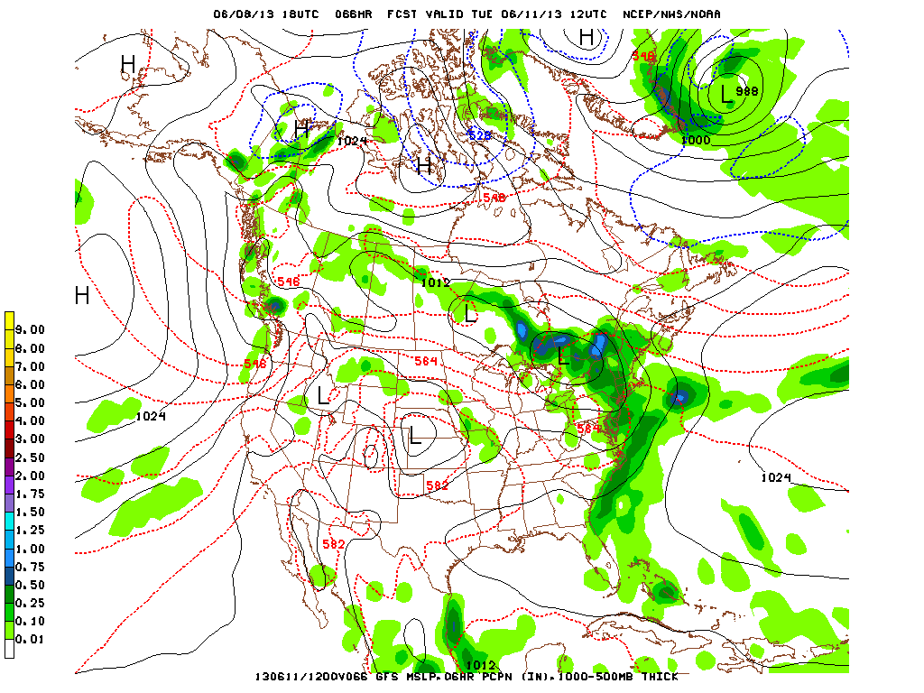
As for the remainder of our weekend, High Pressure will build into the Northeast through Sunday but stay for only a brief period. Once High Pressure pushes out to the east, the next low pressure system will begin to interact with the eastern seaboard. A warm front lifts from the south and rain showers will fall. Monday night into Tuesday morning, the Low will be centered just north of the great lakes and the cold front associated with the pressure system will move towards New York City. Heavier precipitation and thunderstorms are possible with this part of the system as illustrated in this image of the GFS run for 12UTC on this upcoming Tuesday, June 11.
Enjoy your Sunday as there will be more sun than Saturday had, and temperatures will just reach into the lower 80's across much of the Mid-Atlantic Region.

 RSS Feed
