Already the month of June is in the top 5 as far as wettest in many cities in the East. The next storm...now in Nebraska will head east and become a compact powerhouse off the NJ coast Thursday night. Estimated rainfall will be between 3-5" from Pa....east and north. To complicate this situation....a moderate risk of severe wx and tornadoes across the Mid Atlantic. Euro is still slower but in the same camp as rest of models. Last run of GFS wants to slow system down and keep rain going especially over New England right into Friday. Don't think it will slow that much....but some wetness still likely Friday. Saturday looks good...but more humid weather with showers and t- storms come back into the pix late Sunday and early next week.
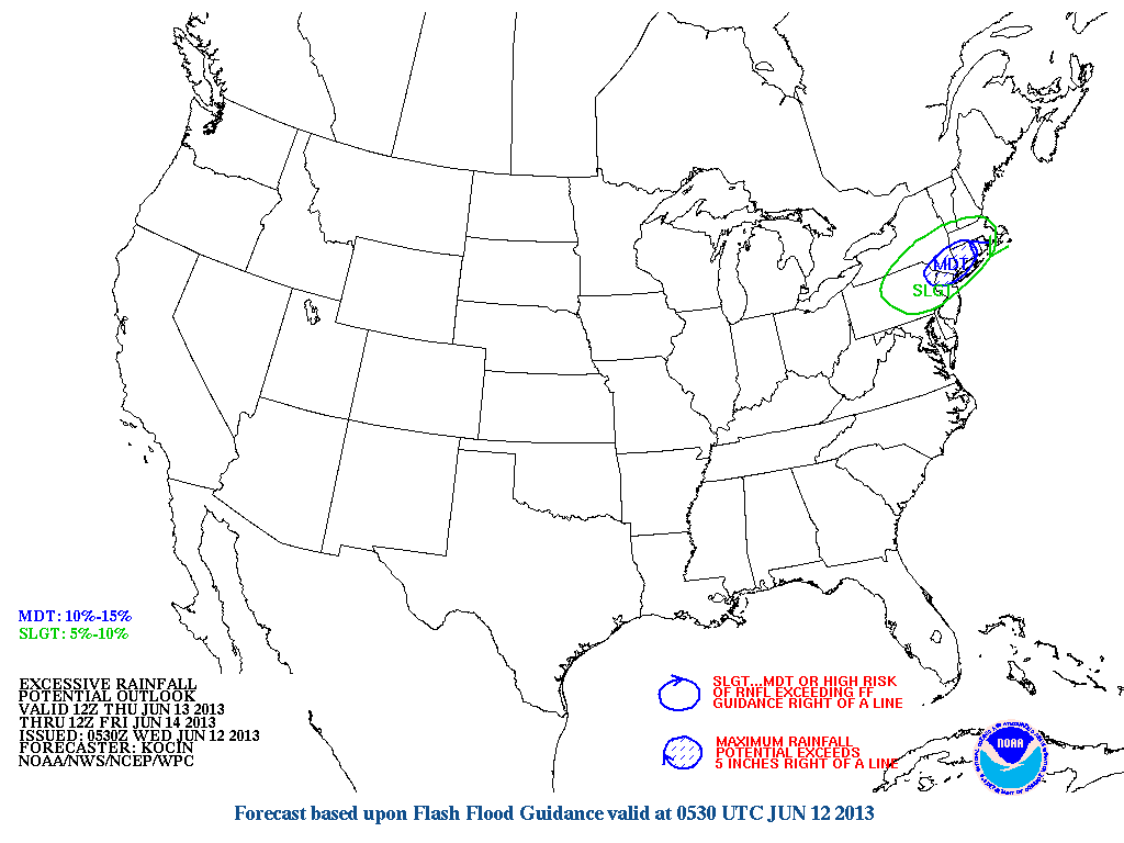
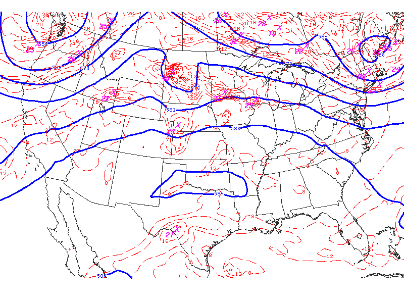
Below......a map depicting excessive rainfall for the Northeast.
Below......a map depicting excessive rainfall for the Northeast.
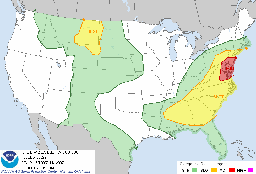
Here is the outlook for severe weather Thursday...Thursday nite....
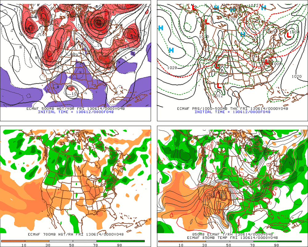
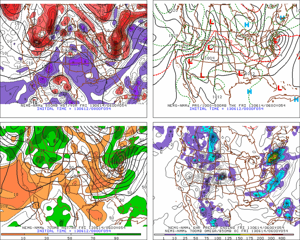
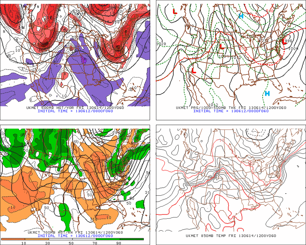
Below you will see Nam, UK Met, Navy, Euro. All depicting a compact intense system....with those timing differences.
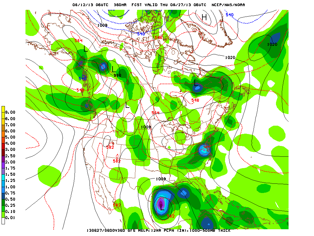
How about the GFS wanting to form another tropical system in Gulf by end of month ? Watch it.....it's been doing a good job of this stuff.
Below.. 500 mb flow overlayed. You can easily see the set up already forming for a big event in the East.

 RSS Feed
