Metro Weather Inc. Services
Like us, follow us, link to us, contact us!
  • Home
    • Daily Weather Discussion
  • Weather Prepared for You
    • Film and TV Production
    • Radio & Television
    • Government and Industry
    • Forensic Services >
      • Weather Record Request Form
    • Metro Morning Monitor
  • About Metro Weather
    • Senior Staff
  • Your Weather Images
  • Contact Us

A March-like Pattern

2/15/2018

0 Comments

 
Picture
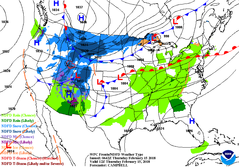
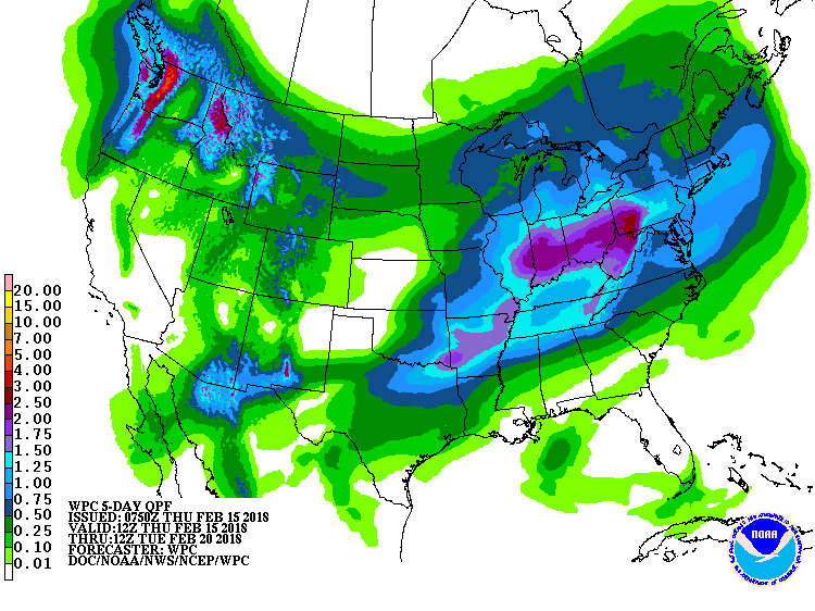
Waves of rain from The SOuthwest to East Coast into Friday. Very mild...lots of record highs will be broken today. System in No. Rockies will head southeast and could produce some snow for Mid Atlantic and Northeast this weekend. Back to mild weather thereafter.  Below - animated maps for the next 2 days...followed by amounts of rain for next 5 days.
Picture
Picture
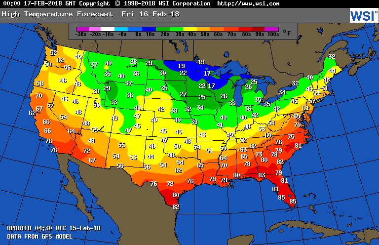
Below - look at high temperatures for Friday.
Picture
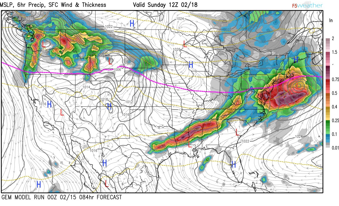
Below - closeup for Northeast this weekend. Models showing storm off Mid Atlantic - Saturday nite. Blue is snow - green is rain. The models are GFS/CANADIAN/GERMAN/EURO.  Take your pick.  Be safe.
0 Comments


Leave a Reply.

    Genesis of a Tornado
    We'll have daily weather discussions, talking about major systems on the horizon along with anything noteworthy that pops up on our radar.

    Pat Pagano,
    Mike Merin

    Follow us on Twitter and like us on Facebook to get updates whenever we post a new entry!

    RSS Feed

Powered by Create your own unique website with customizable templates.