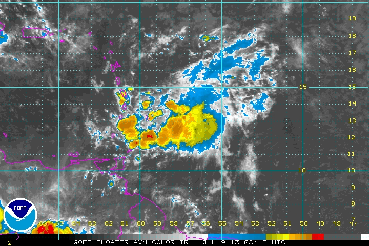
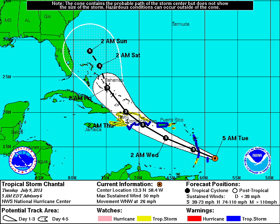
Starting with Chantal....50 mph winds moving west quickly. Satellite pix this a.m. does not show a well organized system....and as it heads across Hispanola it could only get worse. In any event....you'll see the Hurricane Center track and then a map showing all of the computer models......which for the most part are in good agreement.
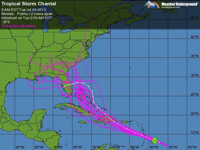
The Canadian Model seems the most agressive.....but we have seen in the past that it overdoes tropical systems. The pattern along the Eastern Seaboard nevertheless is not a good one...and would not discourage tropical trouble.....but I do think that will change by month's end.
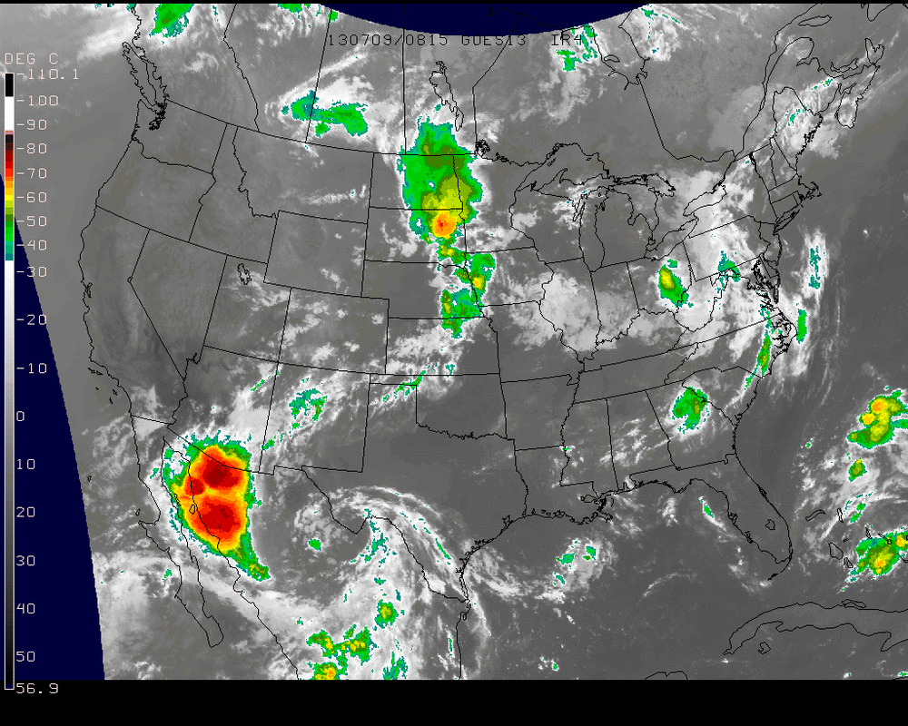
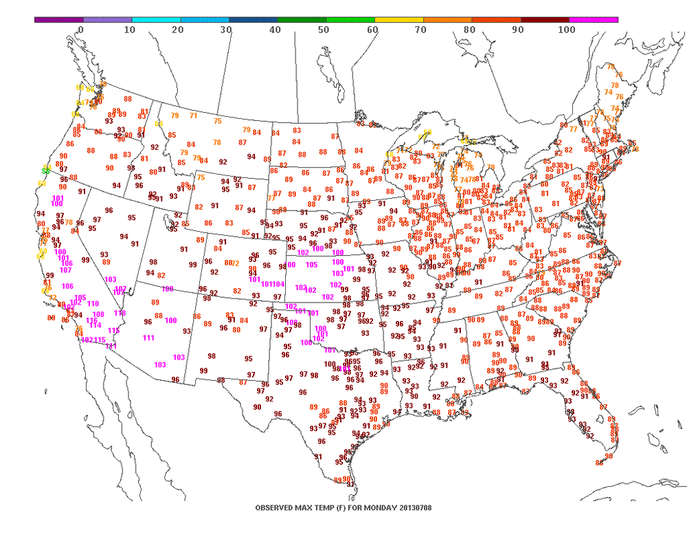
National satellite shows the cold front in the Plains which is expected to stall just off the East Coast this weekend. Models want to keep showers going across The Northeast....and while that may be true...the coverage should be spotty and nothing more than we have seen so far. Yesterday's max temps were still uniformly warm Nation-wide...with the cooler temps confined to Northern States.....a place I'm headed to tomorrow. Mike Merin - Joe Leonardi will be posting ....until next week...be safe..later.

 RSS Feed
