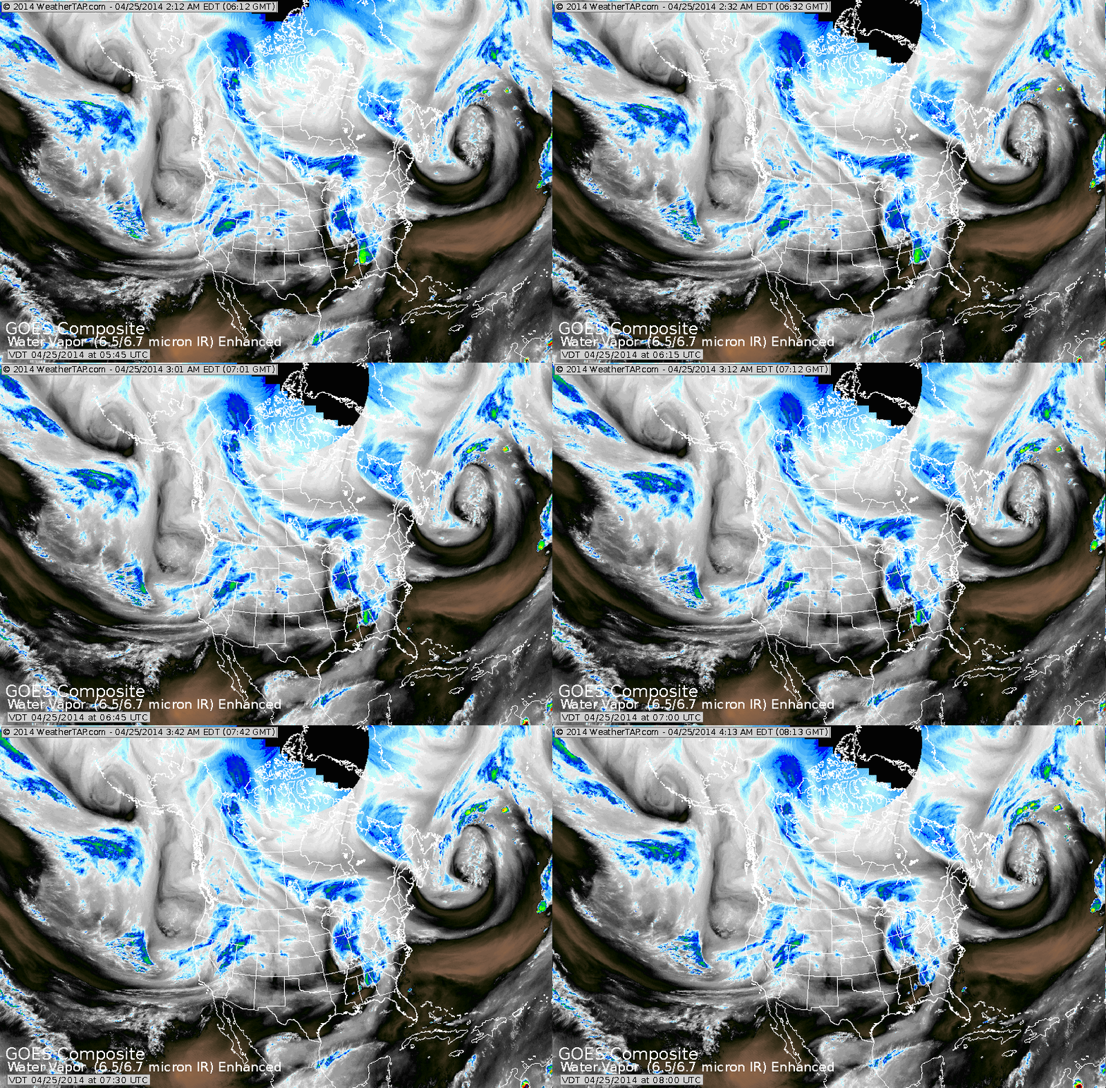
Above...Blue patch over Great Lakes is a small system that will bring a keep dose of moderate rain to Northeast tonight into Saturday. Some places in No. New England will see some flurries by Sunday. A more potent system is taking shape now over The West, This will be a major
spring storm as it moves slowly east. Heavy snows will fall from Rockies into upper Midwest next week.....while severe weather threatens the mid south,
spring storm as it moves slowly east. Heavy snows will fall from Rockies into upper Midwest next week.....while severe weather threatens the mid south,
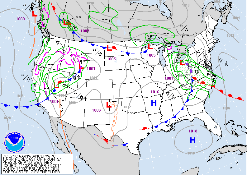
Above...today's map. System moving out of Ohio won't bring needed rain to Northeast until tnte...so FIRE DANGER is high there today. West system is moving into Rockies.
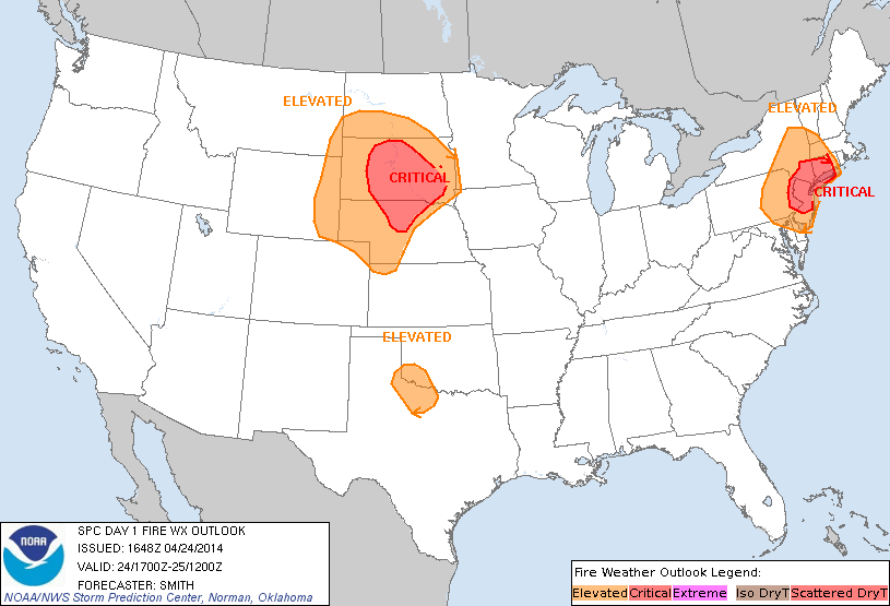
Above....FIRE DANGER map for today,
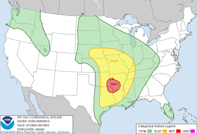
Above.....yellow indicates potential for severe weather on Saturday. Click on picture to enlarge. Below....severe potential for Sunday,,,,with red indicating moderate risk,
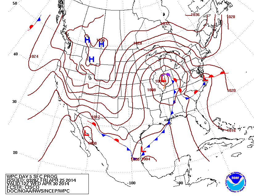
Above...this is what the map should look like Wednesday,,,,spring storm in Illinois.
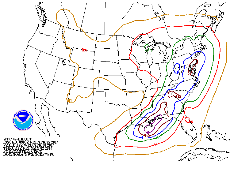
Above...map shows amounts of rain for mid next week. Blue = 1"...Brown over 1"... Until then...be safe...enjoy your weekend.

 RSS Feed
