Metro Weather Inc. Services
Like us, follow us, link to us, contact us!
  • Home
    • Daily Weather Discussion
  • Weather Prepared for You
    • Film and TV Production
    • Radio & Television
    • Government and Industry
    • Forensic Services >
      • Weather Record Request Form
    • Metro Morning Monitor
  • About Metro Weather
    • Senior Staff
  • Your Weather Images
  • Contact Us

A Gully-Washer Heads East.....

5/4/2017

0 Comments

 
Picture
Satellite/radar shows the next storm in Mid Mississippi Valley...lots of rain..thunderstorms headed eastbound for East Coast Friday....and beyond.Below....weather map for today.
Picture
Below - today's severe threat - highlighted in green - only marginal but still possible.
Picture
​Amounts of rainfall expected on Friday. Many places will receive over 2" of rain in Northeast.
Picture
Since the storm above will stall over the Northeast this weekend....temperatures during the day will be unseasonably chilly. Below- high temperatures for this Sunday.....grab the coats. 
Picture
Below - GFS models for Saturday and Sunday. Green indicates rain or showers. Plan accordingly. Be safe.
Picture
Picture
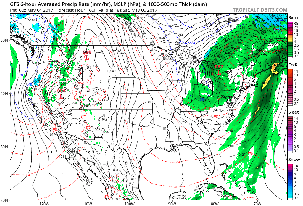
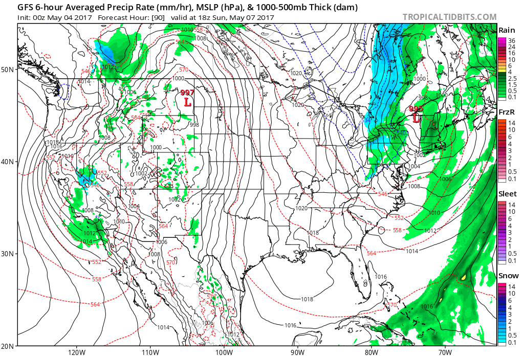
BTW - any blue on maps indicate snow......yes.....snow.
0 Comments


Leave a Reply.

    Genesis of a Tornado
    We'll have daily weather discussions, talking about major systems on the horizon along with anything noteworthy that pops up on our radar.

    Pat Pagano,
    Mike Merin

    Follow us on Twitter and like us on Facebook to get updates whenever we post a new entry!

    RSS Feed

Powered by Create your own unique website with customizable templates.