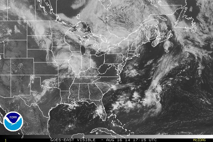
Rain showers ahead of a frontal boundary are moving southeast through the Great Lakes today while the Northeast enjoys a dry day and awaits said line of rain showers by tonight and into Sunday. Low pressure is building near the Midwest and is bringing a plethora of rain from Illinois into western Kentucky.
Both signatures can be seen below in the visible imagery for this early afternoon.
Both signatures can be seen below in the visible imagery for this early afternoon.
Further west, upper atmospheric disturbances will move into the upper Midwest as the weekend progresses into Sunday flaring up showers & thunderstorms before the conditions dry out into Monday.
The trough built by this energy will be a rain producer into the midweek as it pushes east across the northern states. High pressure will shift towards the Gulf Coast preventing plenty of the moisture from reaching into the region.
- JL
The trough built by this energy will be a rain producer into the midweek as it pushes east across the northern states. High pressure will shift towards the Gulf Coast preventing plenty of the moisture from reaching into the region.
- JL

 RSS Feed
